
Isolated severe thunderstorms are developing over the Trans-Pecos this afternoon. The strongest may produce very large hail as they slowly move east/northeast through the evening hours. A brief tornado cannot be ruled out, although that threat is very low. If storms grow upscale into a small cluster or squall line we’d also have to deal with a localized damaging wind threat.
A larger area of showers and thunderstorms are moving southeast across Far Southeast Texas extending west along an outflow boundary into Southeast Texas and the Coastal Plains. This activity may briefly produce gusty winds and heavy rainfall. Isolated street flooding is probable. Just what you wanted to deal with for the Friday drive home…
You can keep track of the rain in your area using our free HD interactive weather radar here on our website. Better yet, click on our mobile app banner at the top of this page and use our radar in that!
Click image for full-screen version
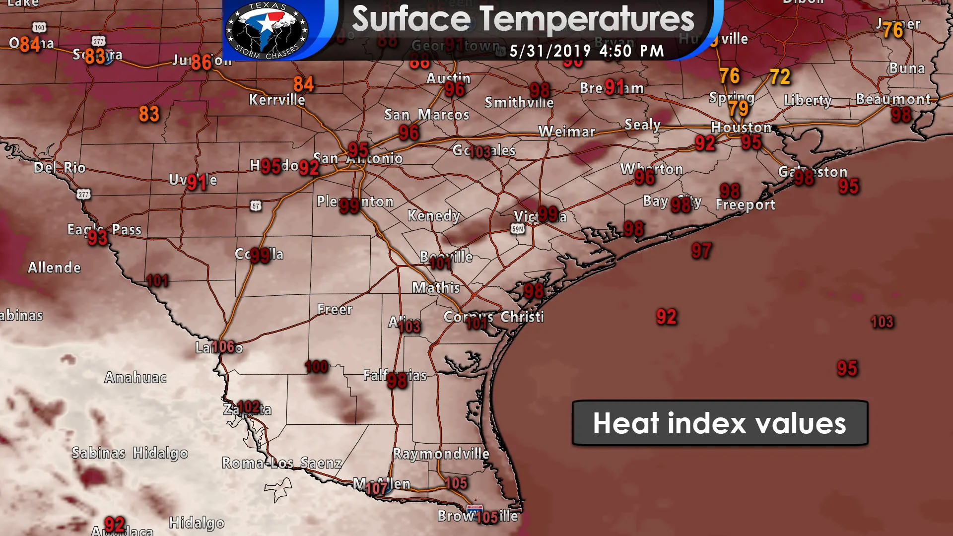
Meanwhile – those in South Texas, the Coastal Bend, and in the Rio Grande Valley have been ‘enjoying’ heat index temperatures between 100 and 110 degrees this afternoon. Summer is definitely around the corner, but we’ll be dealing with increased precipitation chances next week. Those higher rain chances should help knock down some of these obnoxious heat index values.


0 Comments