
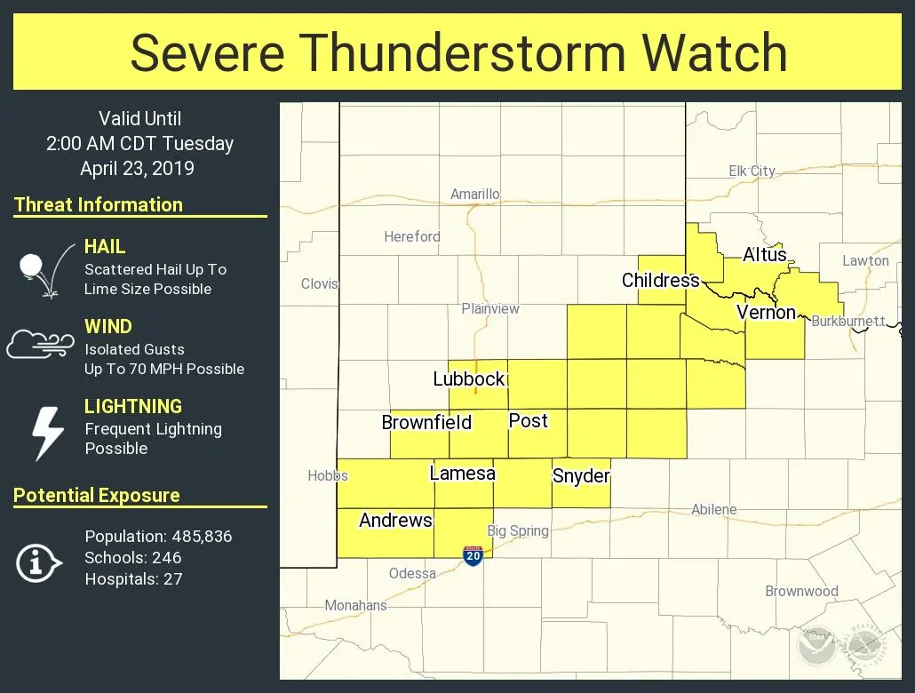
A severe thunderstorm watch is now in effect through 2 AM for portions of West Texas and Northwest Texas. This includes Andrews, Lamesa, Brownfield, Lubbock, Post, Snyder, Childress, and Vernon. The strongest storms may produce hail slightly larger than the size of a golfball along with localized damaging winds up to 70 MPH. We’ll also have to monitor for localized heavy rain and isolated flash flooding.
Isolated thunderstorms have begun developing in the proximity of a stationary cool front located from near El Paso to Lamesa to Snyder. Showers and a few storms are underway north of the front in the Texas Panhandle and West Texas. However, our most likely corridor for a few severe storms this evening will be near that front. We’ll probably see a few rounds of isolated to scattered storms through the evening hours. They’ll generally move east/northeast. We could see a cluster of storms organize late tonight and move northeast toward Childress and Vernon.
Those farther east in places like the Big Country, Concho Valley, North Texas, and Central Texas will have to wait until tomorrow and Wednesday for higher storm chances. That’ll include a few severe storms capable of producing hail, localized damaging winds, and an increased flooding threat (especially by Wednesday).
You can keep tabs on the ongoing storms with our free HD interactive weather radar here.


0 Comments