
It’s been an eventful 14 hours across the eastern two-thirds of Texas. The light is at the end of the tunnel, but we need to get the storms out of East Texas first. We expect that’ll happen by 5 PM. Until then we’ll need to watch for damaging wind, large hail, and the potential of a tornado. I do believe the highest tornado threat is shifting east into Lousiana, but the tornado threat itself won’t completely end until the storms move east of Texas.
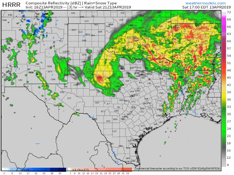
18Z HRRR Simulated Weather Radar for the remainder of the day and into early Sunday morning.
A line of severe storms extends from Kilgore to Garrison to Avalla to Livingston. More isolated storms are firing up ahead of the line from near Hemphill to Beaumont, with the broken line itself back toward Conroe to Richmond. It’ll be the storms ahead of the line that we’ll have to watch for in terms of the highest tornado potential. That threat should be becoming to an end by 5PM. Storms farther south/southwest near Houston could produce hail and gusty winds, but the tornado threat is comparatively lower (not zero). That activity will likewise move east/northeast into Louisiana by the late afternoon as well.
Showers and a few storms will continue across Texoma, North Texas, and Northeast Texas through the evening hours. Gusty non-thunderstorm winds are also expected. That activity will not be severe. Some minor flooding of low-lying areas will be possible. All precipitation will move out overnight. That’ll end this event and give us a few days of calmer weather before our next severe weather threat arrives on Wednesday.


0 Comments