
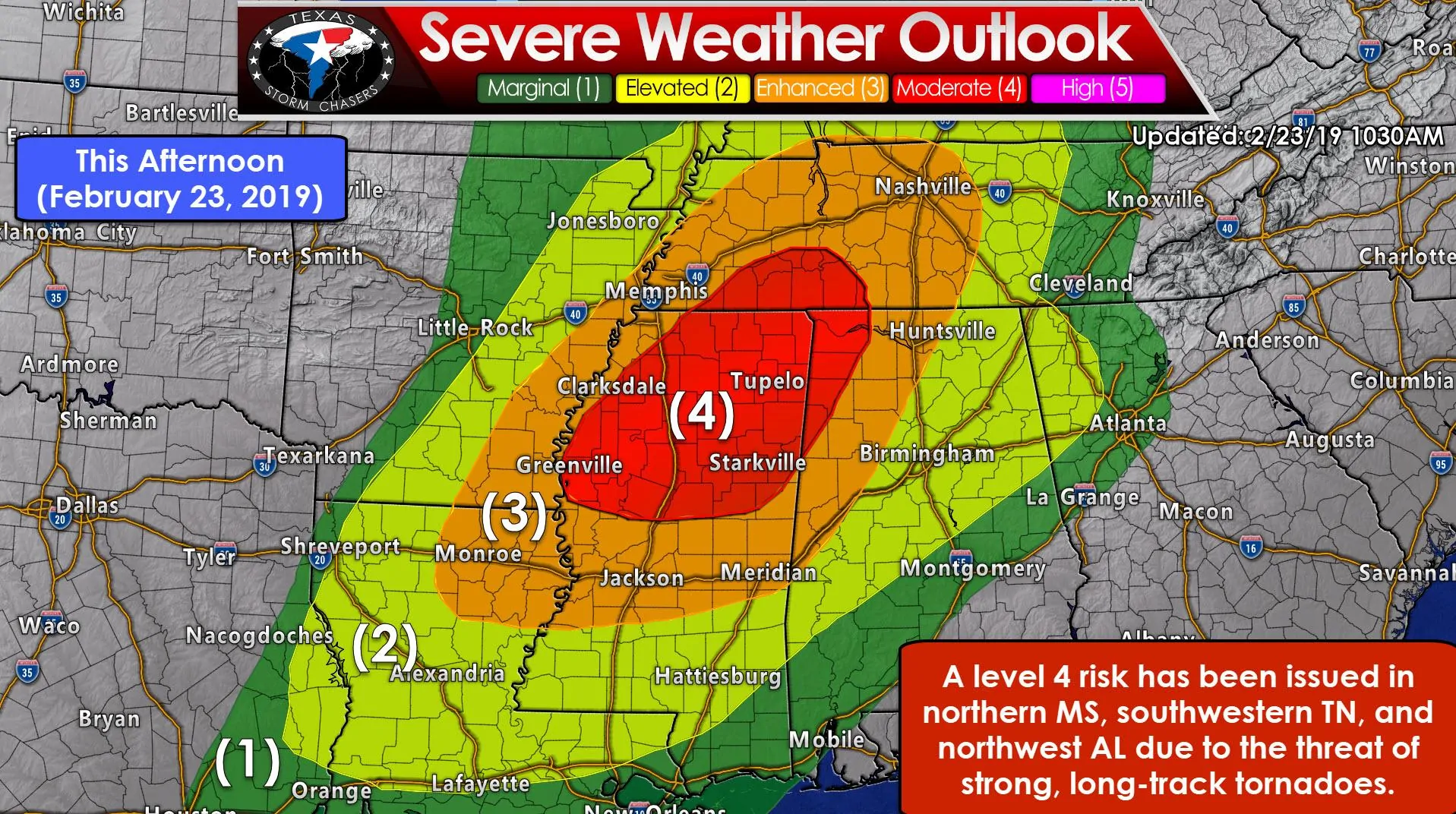
A significant severe weather event is anticipated to unfold today across ‘Dixie Alley’. The Storm Prediction Center has placed a level 4 risk of severe weather across northern Mississippi, southwestern Tennessee, and northwestern Alabama. A level 3 risk includes eastern Arkansas, northeastern Lousiana, western Alabama, and about the western half of Tennessee. Those higher-end risk levels are in place due to the threat of widespread damaging wind gusts up to 80 MPH and the potential of strong, long-track tornadoes. Specifically, the level 4 risk is where confidence is highest in the probability of multiple significant (EF2+) tornadoes.
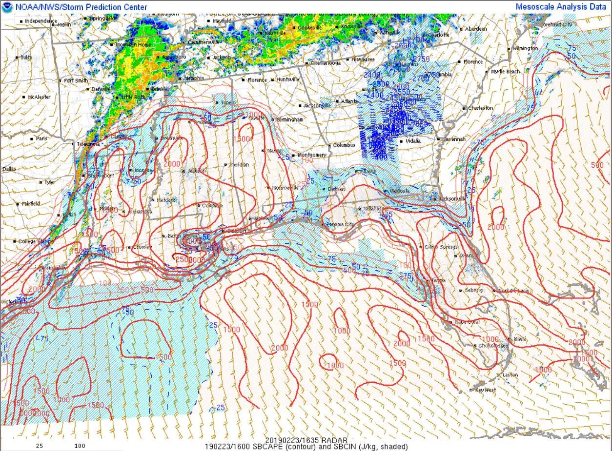
Instability values over central Mississippi into western Alabama have already risen to 2,000 J/Kg. Those values are fairly high considering models two days ago were indicating instability values would struggle to rise above 1,000 J/Kg. The northern delineation of that instability axis is where a warm front is located. That warm front will continue lifting north as strong southerly winds at the surface continue. Wind speeds quickly increase with height and wind profiles are quite supportive of organized thunderstorms, including intense supercell thunderstorms.
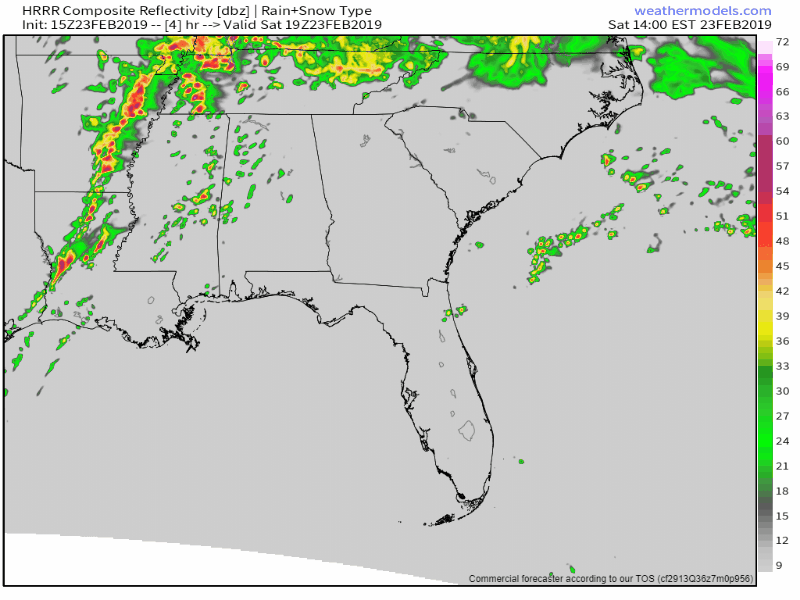
15Z HRRR Simulated Radar for the Southeastern United States today from 1 PM to Midnight.
The High-Resolution Rapid Refresh (HRRR) model has a broken line of thunderstorms moving east across Missippi and Tennesee this afternoon and early evening. Those storms will likely be moving at 55 to 65 MPH! They’ll slowly weaken as they outrun the instability axis east of Interstate 65, but could continue producing strong winds and isolated tornadoes into the late evening hours across Tennesee and Alabama. Notice that this model is indicating that storms may remain semi-discrete versus in a solid line. That would increase the tornado threat, with some of those supercells capable of producing long-track tornadoes.
Today has the makings of a dangerous severe weather day given the fast storm motions and significant risk of tornadoes. If you have friends or family out in the aforementioned regions you may want to shoot them a message to ensure they’re staying weather aware today. Jason, Chelsea, and Adam left D/FW early this morning and are making their way toward the risk zone. Assuming their chase strategy is successful we’ll likely have some content to share with y’all later on today.


0 Comments