
As has become customary for the last several days we’re starting off the day with dense fog. Visibilities should improve by mid-morning as surface temperatures start warming and we see the temperature/dewpoint depression increase. Warm weather fans should take the time to cherish the weather. Winter and the associated northerly winds of doom return with a vengeance on Thursday and Friday.
Risk of strong thunderstorms Wednesday Night
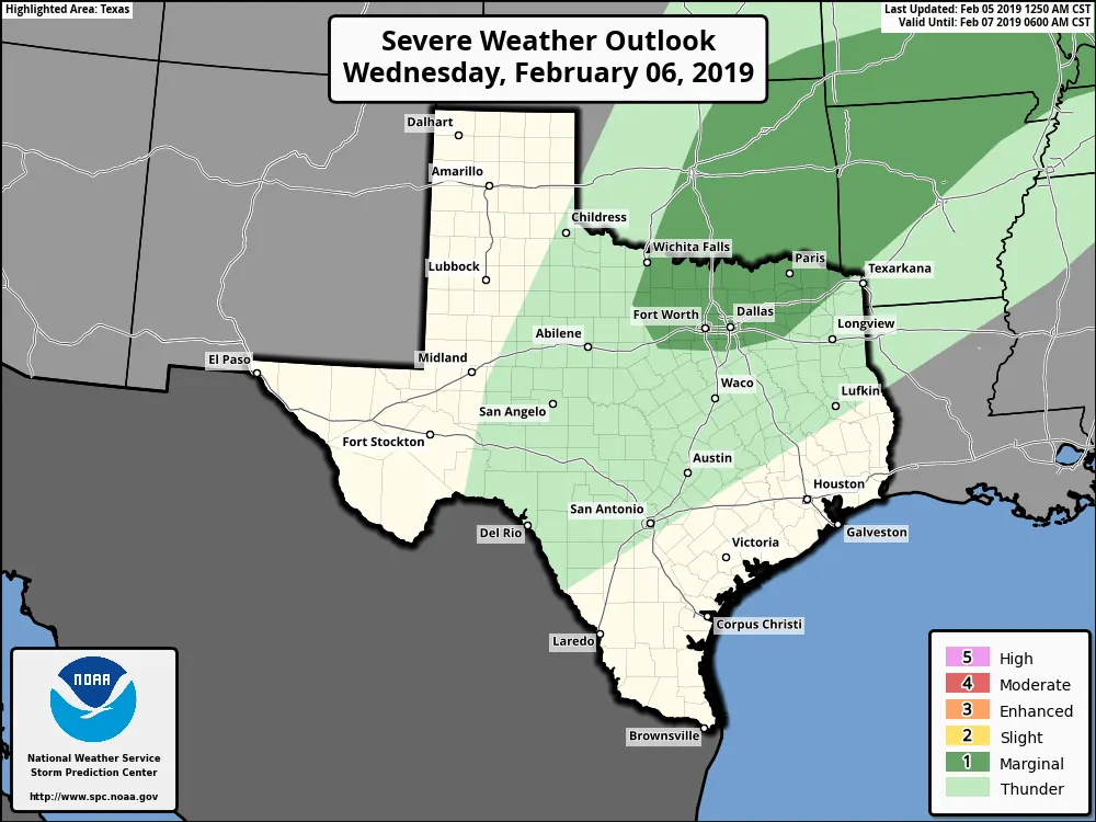
The Storm Prediction Center has encompassed much of North Texas and Texoma in a level one risk of severe weather tomorrow night. Those in the D/FW Metroplex up to Oklahoma City and east toward Texarkana are included.
Uncertainties that could preclude more of a severe weather threat include the speed of the cold front and time of day (or night in this case). The cold front is going to be blasting south while storms would be moving to the east/northeast. That storm motion would result in the cold front undercutting storms fairly quickly – thus reducing the threat of damaging wind gusts and tornadoes. Even without that limiting factor, the threat for tornadoes is very low.
Stronger storms tomorrow night could produce hail and localized wind gusts up to 50 MPH. A capping inversion, the time of day (night in this case), and general timing disadvantages look to prevent a higher threat of severe weather at this time. Scattered showers and storms will be possible in proximity to the cold front as it moves south Wednesday night and on Thursday.
Northerly winds of doom bring a return to winter temperatures
This front is not going to be particularly kind in the wind chill department. One will know the front has arrived when temperatures plummet from the 60s and 70s down into the 40s. Temperatures will continue falling into the 30s north of Interstate 10 with wind chills even lower on Thursday.
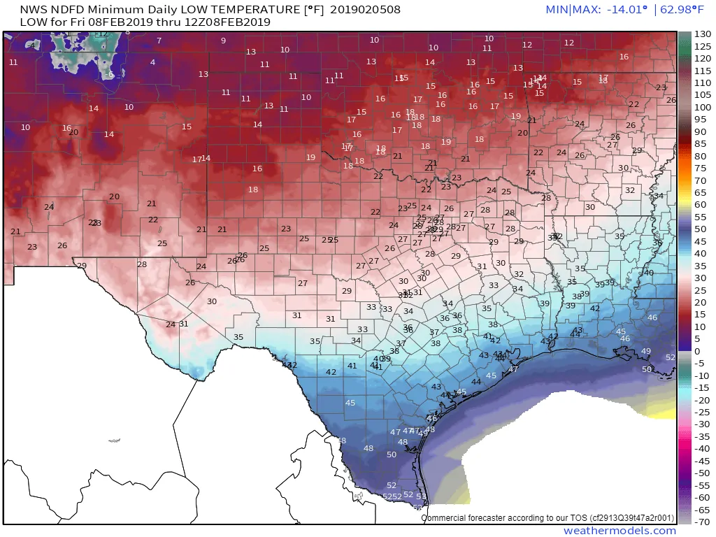
Friday morning’s low temperature forecast. Wind chill values will be about 5 to 15 degrees lower.
Friday morning will be cold with temperatures approaching the single digits in the Texas Panhandle. Temperatures will fall into the 20s Thursday night into Friday morning along and north of Interstate 20. Wind chill values could make it down into the teens. It won’t be as cold farther to the south, but cooler air will continue filtering south on Friday with folks down south being colder Saturday morning.
Friday and Saturday will feature high temperatures much closer to where they should be for February with 30s, 40s, and 50s. We’ll see conditions start moderating on Sunday as a 60s start pushing back north. Another cold front is expected around Tuesday of next week. So far there are no signs of winter mischief on the horizon.


0 Comments