
A winter storm watch has been issued for the eastern Big Country, eastern Concho Valley, and western North Texas. This watch runs along/east of a Haskell, Abilene, Eden, Brady, to Brownwood
line. The eastern delineation runs from Decatur to Weatherford to Granbury to Glen Rose. The primary timeframe for potential accumulating winter precipitation will be from late Tuesday night through much of Wednesday.
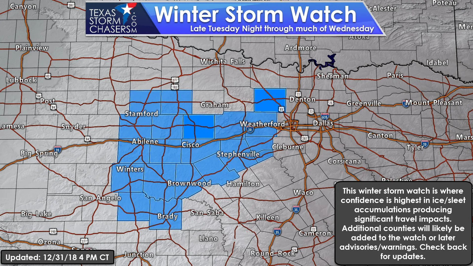
Temperatures may rise above freezing Wednesday evening as warm air advection kicks in. However, significant accumulations of freezing rain and/or sleet are expected to occur before temperatures rise above freezing on Wednesday. One tenth to one-quarter inch of ice accumulation is anticipated, but locally higher amounts may occur. With temperatures in the 20s across the watch zone, there is a high probability of hazardous road conditions on Wednesday.
Additional counties across Texoma, North Texas, and the Hill Country may need to be added to this watch and/or advisories in later updates. The eastern edge of whatever winter weather we eventually may have will be determined by the surface freezing line. It is possible that ends up farther east than this watch zone and into the D/FW Metroplex. However, impacts would likely be less widespread compared to locations farther to the west. Check back for forecast updates over the coming two days. I’ll have a detailed forecast update posted sometime this evening. Remember that winter weather is difficult to forecast in Texas outside of twenty-four hours. Changes to the forecast are all but guaranteed.
Good note from @NWSFortWorth regarding winter forecasts for Wednesday & Thursday. "We advise individuals to NOT get locked into these forecast accumulations (and focus on impacts as noted above) as there is still the potential for some variability in time and space." #txwx
— Texas Storm Chasers (@TxStormChasers) December 31, 2018


0 Comments