
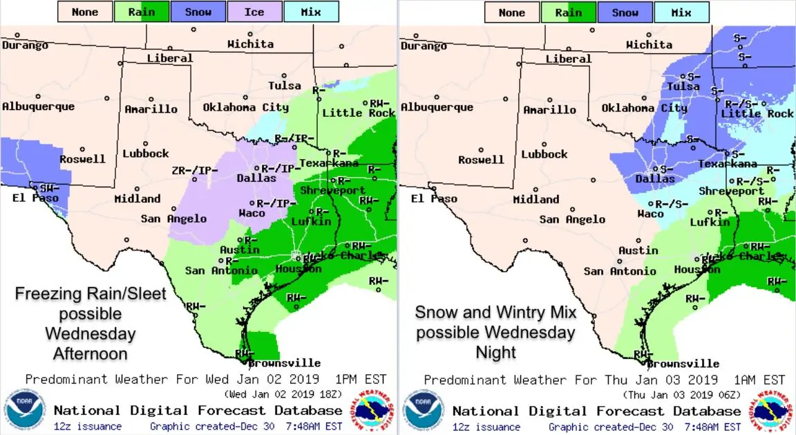
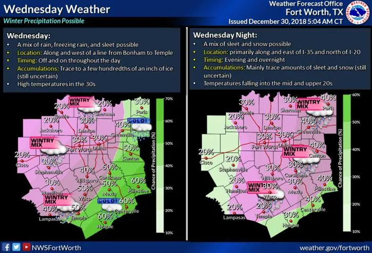
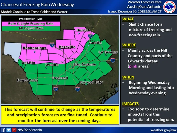
Something to watch over the next couple of days, especially with folks still traveling for the holidays, will be the chance for wintry weather across portions of north, central and northeast Texas Wednesday into Wednesday night. At this time, on and off periods of light snow are expected Monday through Wednesday across portions of the panhandle region. With only very light accumulations expected, travel across this region should not see any major impacts from wintry weather over the next several days. However, parts of north and central Texas including the DFW metroplex and down into the Hill Country/Edwards Plateau region could see some impacts. By Wednesday, with the arrival of another upper level system over southern Arizona and New Mexico, we’ll see chances for wintry precipitation shift east into parts of central, north central and northeast Texas. The current forecast calls for wintry precip mainly in the form of rain, freezing rain and sleet to begin early Wednesday, with a changeover to a mix of sleet and snow or all snow by Wednesday night. It’s still too early to determine the exact details…some of the medium range forecast models are still keeping north and central Texas cold and dry…but it’s something we’ll be monitoring over the coming days. If you are someone planning to travel anywhere across central, north or northeast Texas Wednesday, Wednesday night or even early Thursday, you’ll want to monitor the forecast carefully and have a plan B if it turns out that we do see accumulating ice or snow creating travel disruptions. Be sure to check back with us as we post updates once the forecast begins to refine over the next 24 to 48 hours.


0 Comments