
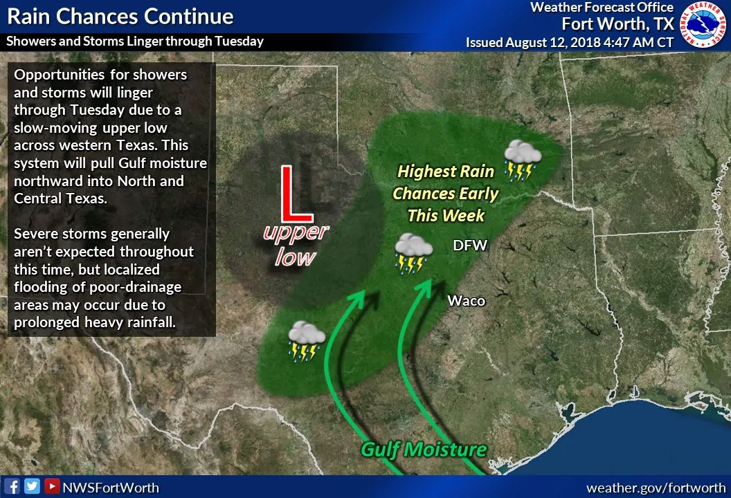
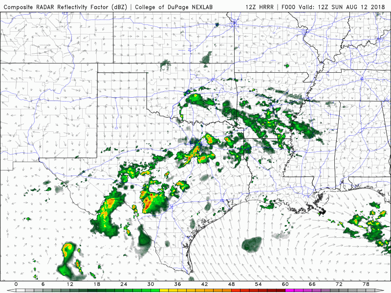
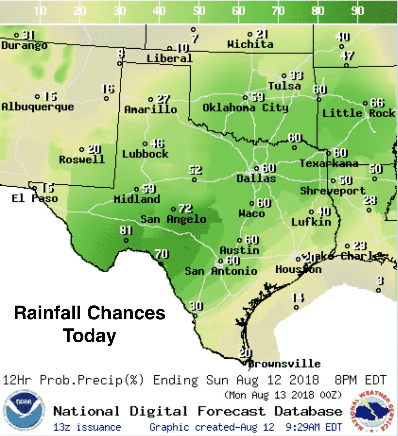
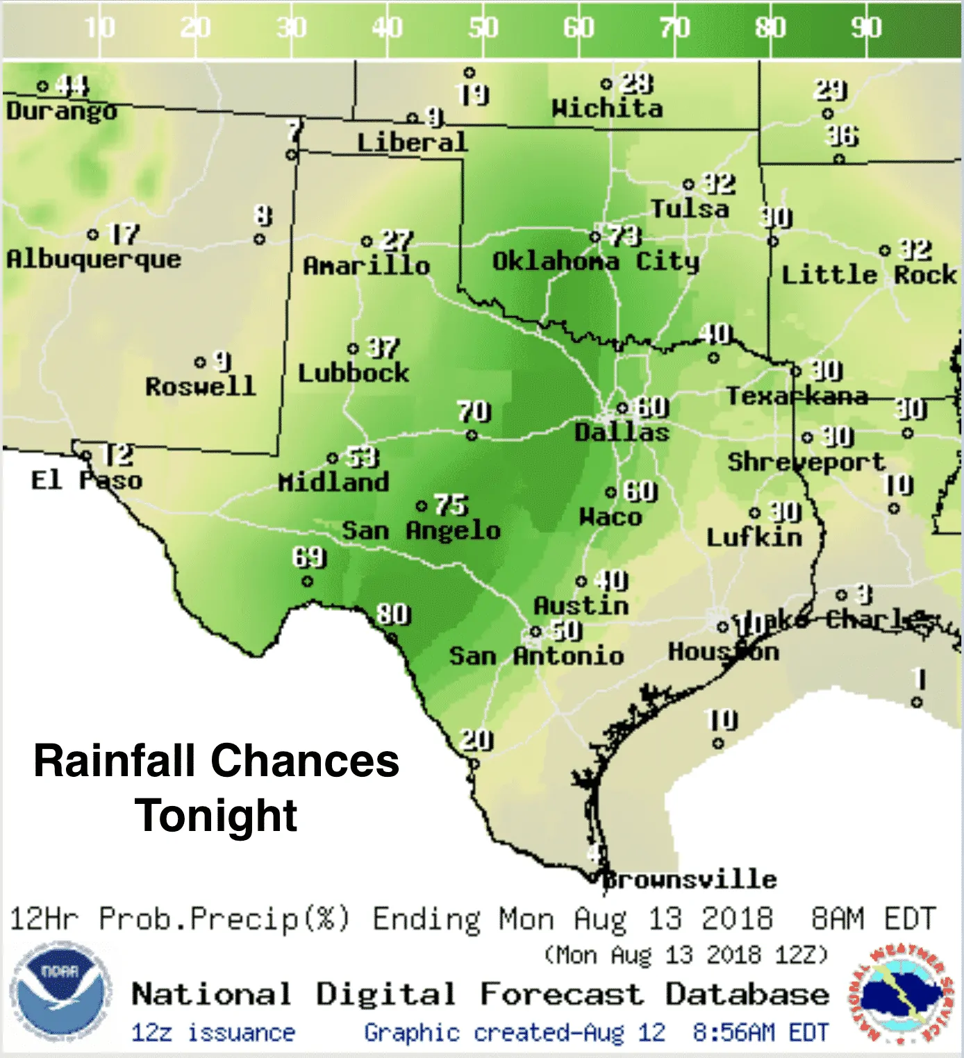
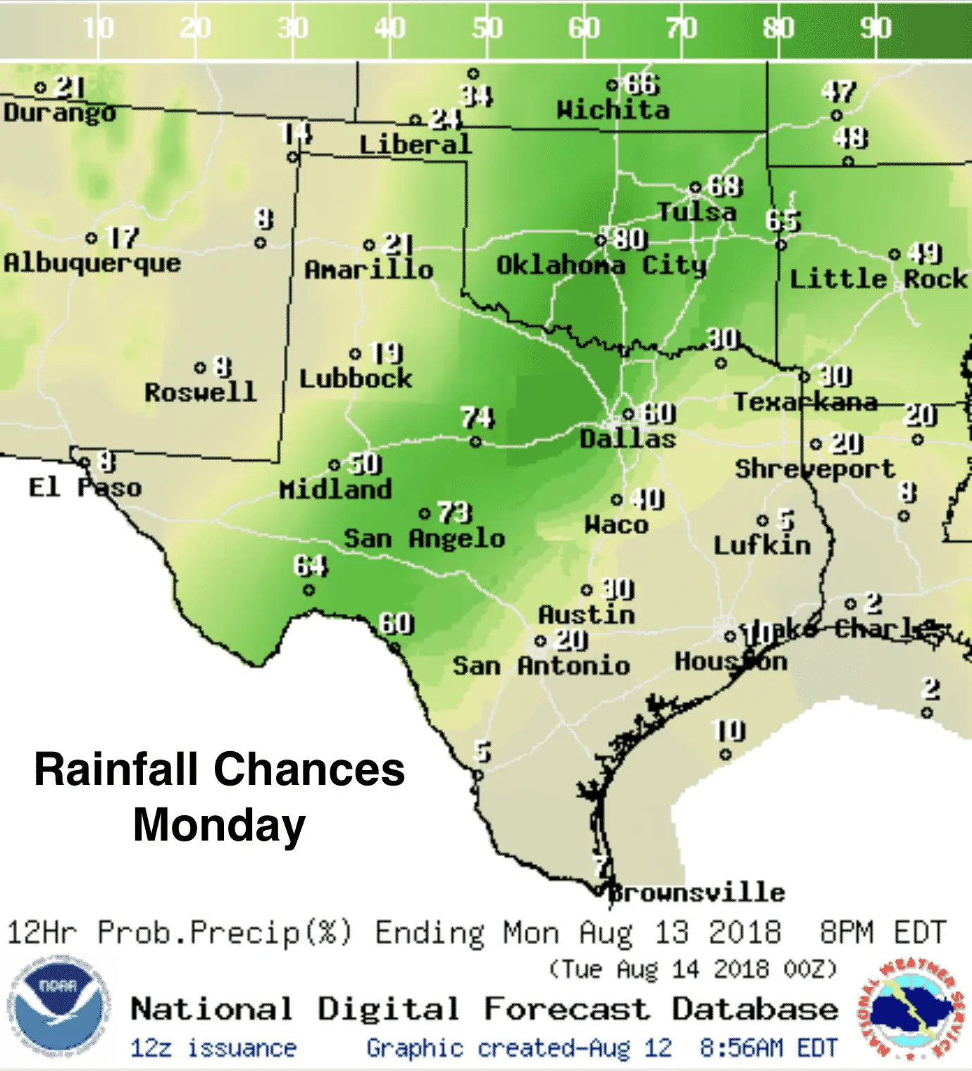
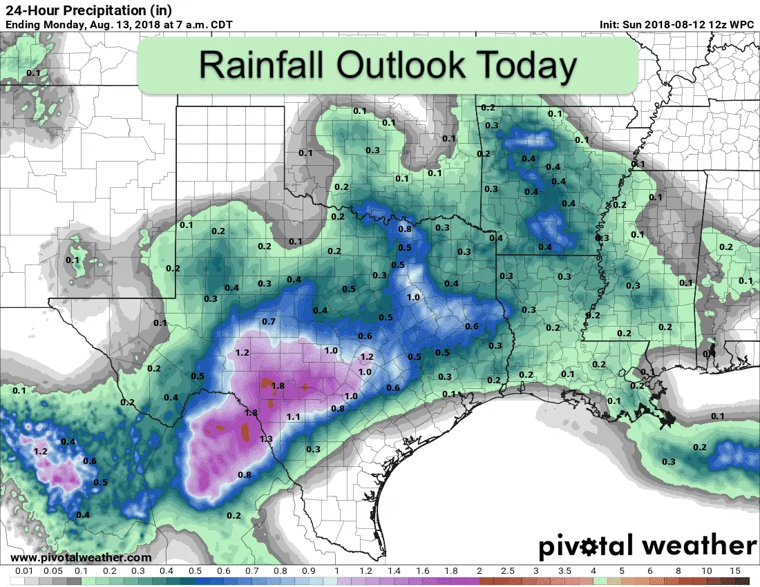
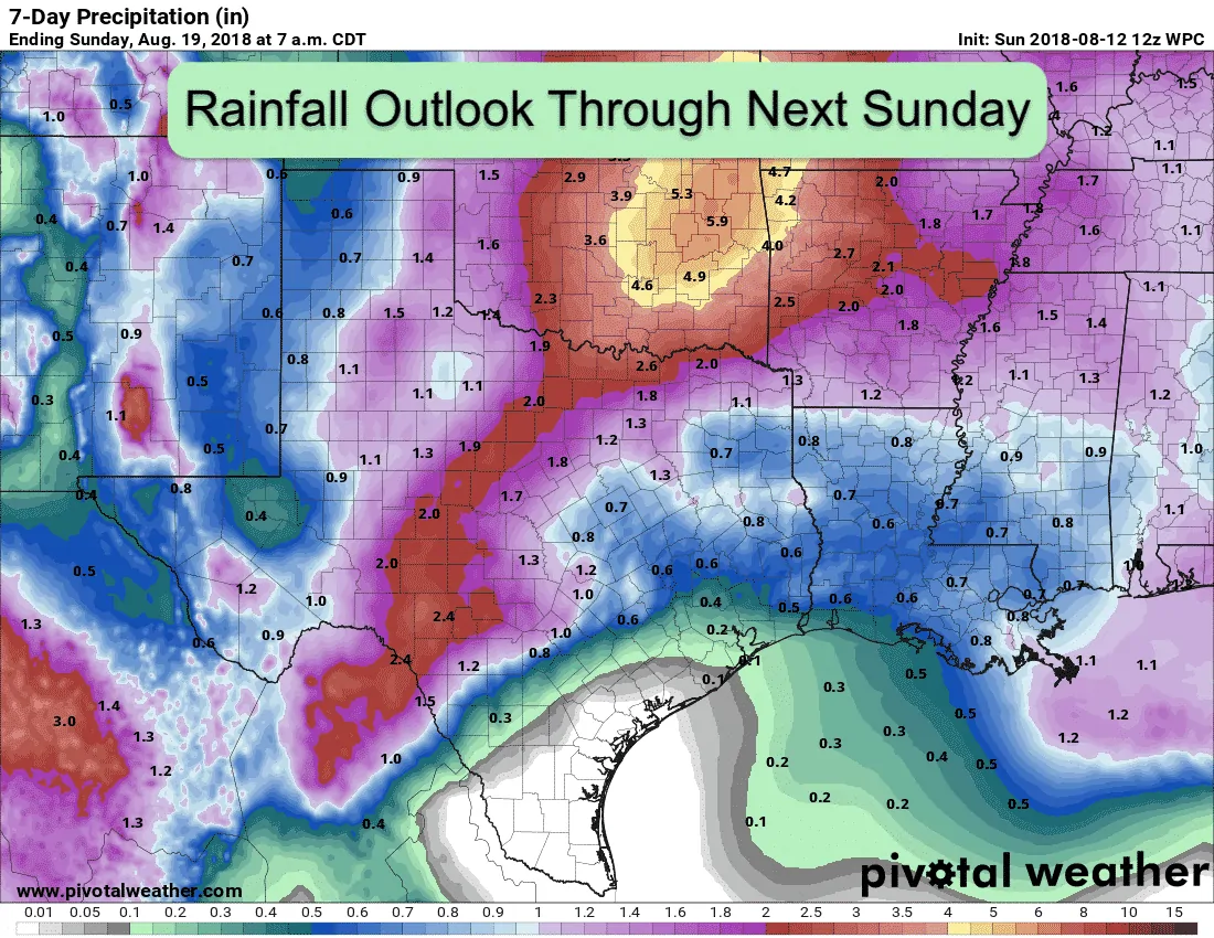
An upper level low situated across the Texas/New Mexico border will continue to draw moisture northward and keep rain chances in the forecast through Tuesday of this week. For today, best rainfall chances will reside across nearly the entire state with the heaviest rainfall expected for areas south and east of Dallas/Ft. Worth and down to our southwest between Ozona, San Angelo, Brownwood and parts of the western Hill Country region. Showers and storms that develop will be hit or miss for some but they will carry some impressive rainfall rates which may lead to localized flash flooding issues. Severe weather is not likely, but we can’t rule out a few storms reaching severe limits today with gusty winds, small hail and frequent lightning being the main threats along with torrential rainfall. Periods of heavy rainfall are expected to continue into the overnight hours for areas mainly west of the I-35 corridor across western north Texas, down to San Angelo and the western Hill Country region. These same areas will be favored for periods of heavy rainfall again on Monday and Tuesday before the upper level low across western Texas begins to move out. Our daily highs are expected to remain well below normal for the next couple of days as rainfall and continuous cloud cover remains in place. This is not a bad trend at all for the middle of August, so we’ll take it!
Simulated Radar for Today through 1am


0 Comments