
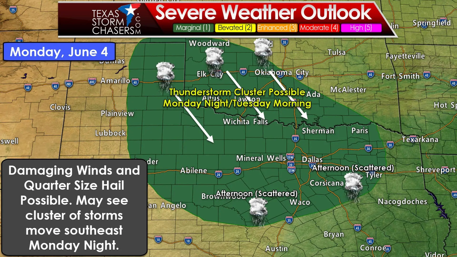
We have the potential for some interesting weather on Monday. There are a couple caveats that could throw a wrench into the forecast. With the disclaimer out of the way let’s dive into it. The Storm Prediction Center has placed a level one (marginal) severe weather risk for Monday across the eastern half of the Texas Panhandle, West-Central Texas, Northwest Texas, the Big Country, Texoma, a sliver of Central Texas, and a majority of North Texas. This broad low probability risk zone could see smaller areas of higher probabilities introduced in later outlook issuances as the forecast becomes more clear. A level one risk means a 5% chance of severe weather occurring within 25 miles of any given point (like your house).
There may be a couple rounds of thunderstorms on Monday, with a potential cluster of thunderstorms continuing into the morning hours on Tuesday. We’ll talk about each chance in detail.
Monday Afternoon Storms in North/Central Texas
The first chance of thunderstorms will be during the afternoon hours across North Texas, Central Texas, extending southeast through the Brazos Valley and into Southeast Texas. This chance for scattered thunderstorms will be highest during the afternoon hours. These storms will tend to be more of the ‘popcorn’ variety – meaning the go up in a hurry, but tend to rain themselves out within an hour or so. The outflow from that dying storm goes on to produce new storms nearby. That process can continue for a couple of hours until we get into the early evening hours. A couple of the stronger storms tomorrow afternoon may produce hail up to the size of quarters and very localized wind gusts up to 70 MPH. Most storms will tend to produce 35 to 55 MPH winds as they collapse. Dangerous cloud to ground lightning will occur with any storm. If thunder roars go indoors!
Monday Evening through Tuesday Morning Potential Storm Cluster
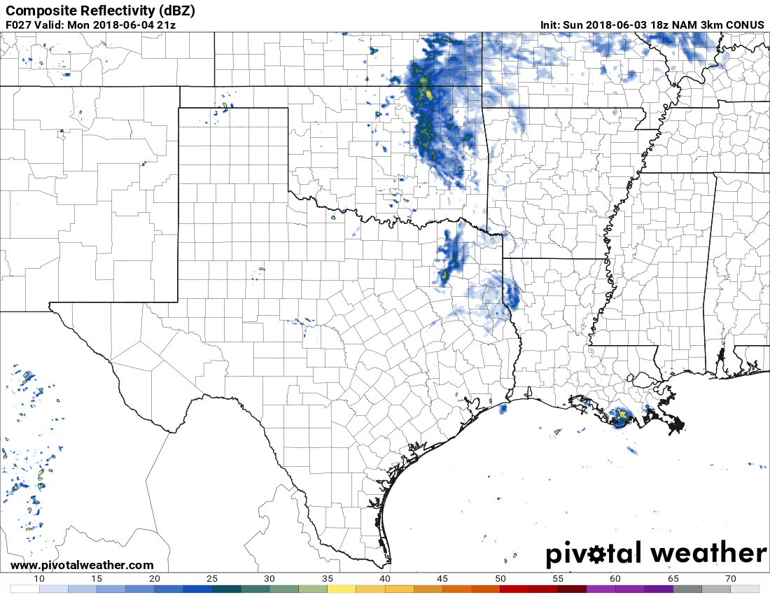
Simulated radar from the North American Model (NAM). Tomorrow’s storm coverage/location will depend on residual outflow boundaries – a factor this model cannot determine or depict. Thus don’t expect the radar to look like this tomorrow. This graphic is shown to depict the general expectation in terms of storm coverage and storm mode.
During the late afternoon hours, the same time the storms across North/Central Texas are ongoing, we’ll also see isolated to scattered storms fire up in the north/eastern Texas Panhandle, perhaps up into the Oklahoma Panhandle. These storms will likely grow upscale into a cluster or small squall line. This cluster of storms would move southeast during the evening hours and probably continue well into the overnight. Damaging straight-line winds and large hail could occur with the thunderstorm cluster.
Exactly where the cluster of storms ends up tracking tomorrow night will depend on how things play out during the afternoon. Residual outflow boundaries could help dictate the eventual path. If storms fire up farther east toward Oklahoma City that would cause the cluster of storms to move/impact Texoma and Northeast Texas versus Northwest Texas, the Big Country, and North Texas. We’ll just have to wait and see.
Regardless of the uncertainties mentioned above, we’ll likely see a cluster of storms impact some portion(s) of the state tomorrow night. Damaging straight-line winds up to 70 MPH and quarter size hail may occur. Depending on how organized the thunderstorm cluster becomes we may see it continue well into the morning hours on Tuesday as it moves southeast. In fact, someone may end up getting a soaking rain. Check back tomorrow morning for the latest forecast. We should be able to narrow down a corridor of highest storm potential for the Monday evening/Tuesday morning storm cluster.


0 Comments