
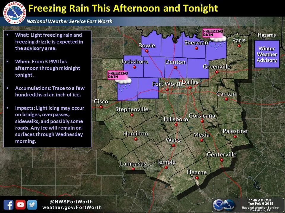
A brief episode of light winter weather is possible this evening across parts of North Texas. At this time the highest potential for freezing drizzle or very light freezing rain looks to remain just north of the immediate D/FW Metroplex. However, the freezing line will be precariously close. A glaze of ice is possible beginning late this afternoon through late tonight north of a Weatherford to Bonham line. We do note that this does include Parker, Wise, Denton, and Collin counties. Those in the northern ‘burbs’ of the metroplex may see a glaze of ice form on elevated surfaces. Primary surface roads should not be impacted, but icy spots may develop on bridges, overpasses, and lesser-used secondary roads. Temperatures will not rise above freezing until late Wednesday morning. Any travel issues that develop today may continue through the Wednesday morning commute. This is not expected to be a high-impact winter weather event, but it only takes a trace of ice to turn a bridge into a skating rink. 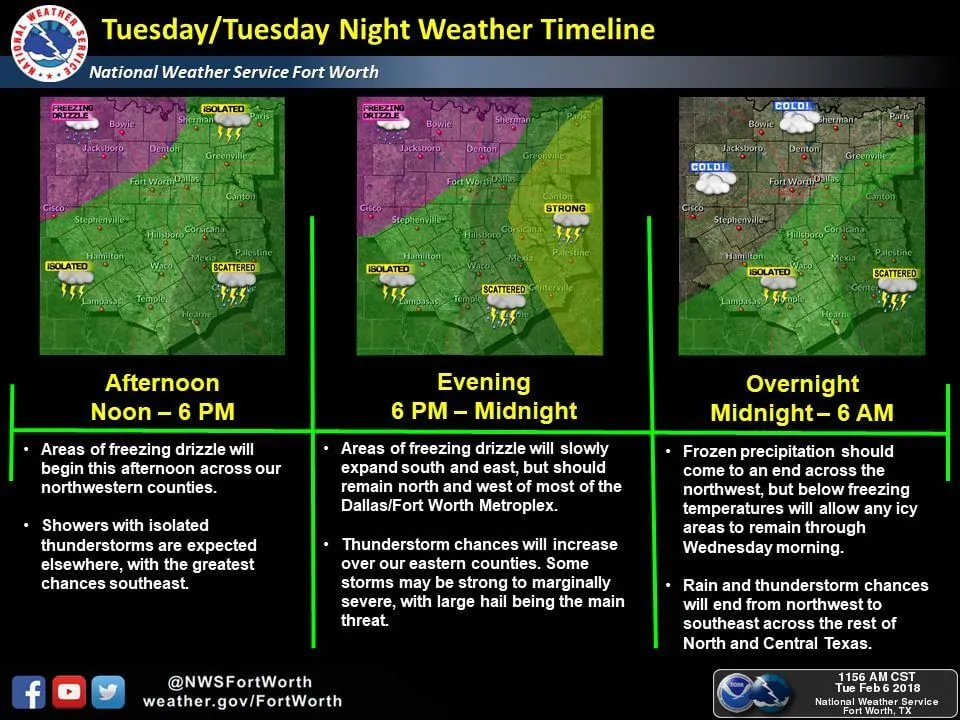
National Weather Service Fort Worth TX
1131 AM CST Tue Feb 6 2018

...FREEZING DRIZZLE OR LIGHT FREEZING RAIN WILL BE POSSIBLE LATE
THIS AFTERNOON AND TONIGHT NORTHWEST OF LINE FROM WEATHERFORD TO
TO BONHAM...

.A shallow cold arctic airmass will continue to see into northern
parts of North Texas through tonight. Meanwhile, an approaching
upper level disturbance will be moving across the region and
should develop areas of light freezing rain or freezing drizzle
across those areas primarily along and northwest of line from
Weatherford to Bonham. Accumulations are expected to be mostly
below a tenth of an inch.

TXZ094-103-104-116-117-070200-
/O.EXA.KFWD.WW.Y.0004.180206T2100Z-180207T0600Z/
Fannin-Denton-Collin-Palo Pinto-Parker-
Including the cities of Bonham, Carrollton, Denton, Lewisville,
Flower Mound, Plano, McKinney, Allen, Frisco, Mineral Wells,
Weatherford, and Briar
1131 AM CST Tue Feb 6 2018

...WINTER WEATHER ADVISORY IN EFFECT FROM 3 PM THIS AFTERNOON TO
MIDNIGHT CST TONIGHT...

* WHAT...Light freezing rain and freezing drizzle expected. Total
  ice accumulations of a light glaze at or below one tenth of an
  inch are expected.

* WHERE...Fannin, Denton, Collin, Palo Pinto and Parker Counties.

* WHEN...From 3 PM this afternoon to midnight CST tonight.

* ADDITIONAL DETAILS...Biggest impacts will be on bridges and
  overpasses, and less used secondary roads.

PRECAUTIONARY/PREPAREDNESS ACTIONS...

A Winter Weather Advisory means that periods of freezing rain
will cause travel difficulties. Be prepared for slippery roads.
Slow down and use caution while driving. The latest road
conditions for Texas can be found at drivetexas.org.


0 Comments