
Multiple accidents have been reported in Travis County due to icy bridges. Freezing drizzle has increased over the last two hours across the eastern half of South-Central Texas. Surface temperatures in the upper 20s mean any drizzle will stick to elevated objects. The good news is this drizzle should be moving out of South-Central Texas by 7-8 PM, but until then we’re going to see bridges ice up in a hurry. Take them slow!
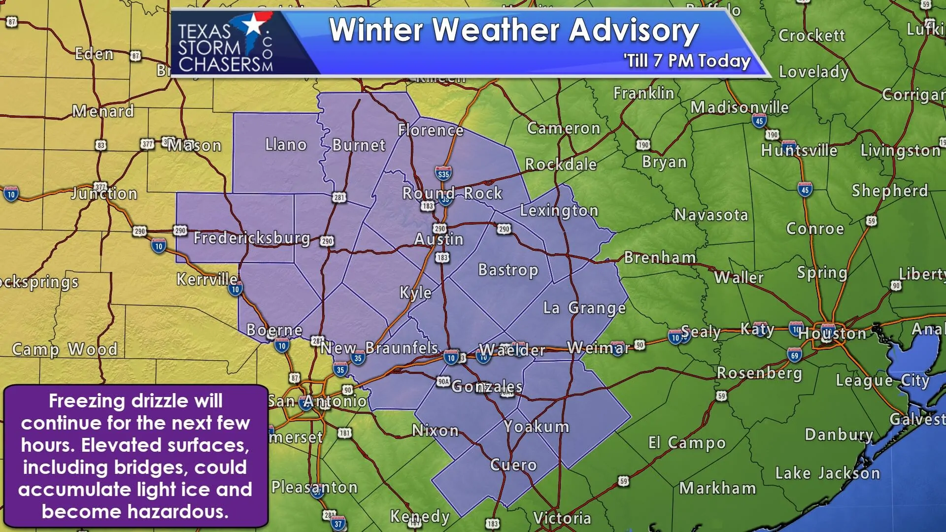
National Weather Service Austin/San Antonio TX
506 PM CST Tue Jan 2 2018

...lIGHT WINTRY MIX PRECIPITATION AFFECTING MUCH OF THE EASTERN
HALF OF SOUTH CENTRAL TEXAS THROUGH EARLY THIS EVENING...

.A mix of light freezing drizzle, light snow and sleet will
continue to affect the eastern half of South Central Texas through
early this evening. Police and EMS officials in the Austin metro
area are reporting multiple collisions due to icy conditions on
the road. Other areas across the Hill Country reporting light
accumulations as well. Light ice accumulations are expected
mainly on exposed surfaces, bridges and overpasses. Also, a light
dusting of snow is possible on grassy surfaces and vehicles. This
activity should come to an end early this evening as the forcing
behind this wintry mix moves to the east.

TXZ171>173-188>194-206>209-223>225-030100-
/O.NEW.KEWX.WW.Y.0004.180102T2306Z-180103T0100Z/
Llano-Burnet-Williamson-Gillespie-Kendall-Blanco-Hays-Travis-
Bastrop-Lee-Comal-Guadalupe-Caldwell-Fayette-Gonzales-De Witt-
Lavaca-
Including the cities of Llano, Burnet, Georgetown,
Fredericksburg, Boerne, Blanco, San Marcos, Austin, Bastrop,
Giddings, New Braunfels, Seguin, Lockhart, La Grange, Gonzales,
Cuero, and Halletsville
506 PM CST Tue Jan 2 2018

...WINTER WEATHER ADVISORY IN EFFECT UNTIL 7 PM CST THIS
EVENING...

* WHAT... Light ice accumulations.

* WHERE...Eastern half of South Central Texas.

* WHEN...Until 7 PM.


0 Comments