
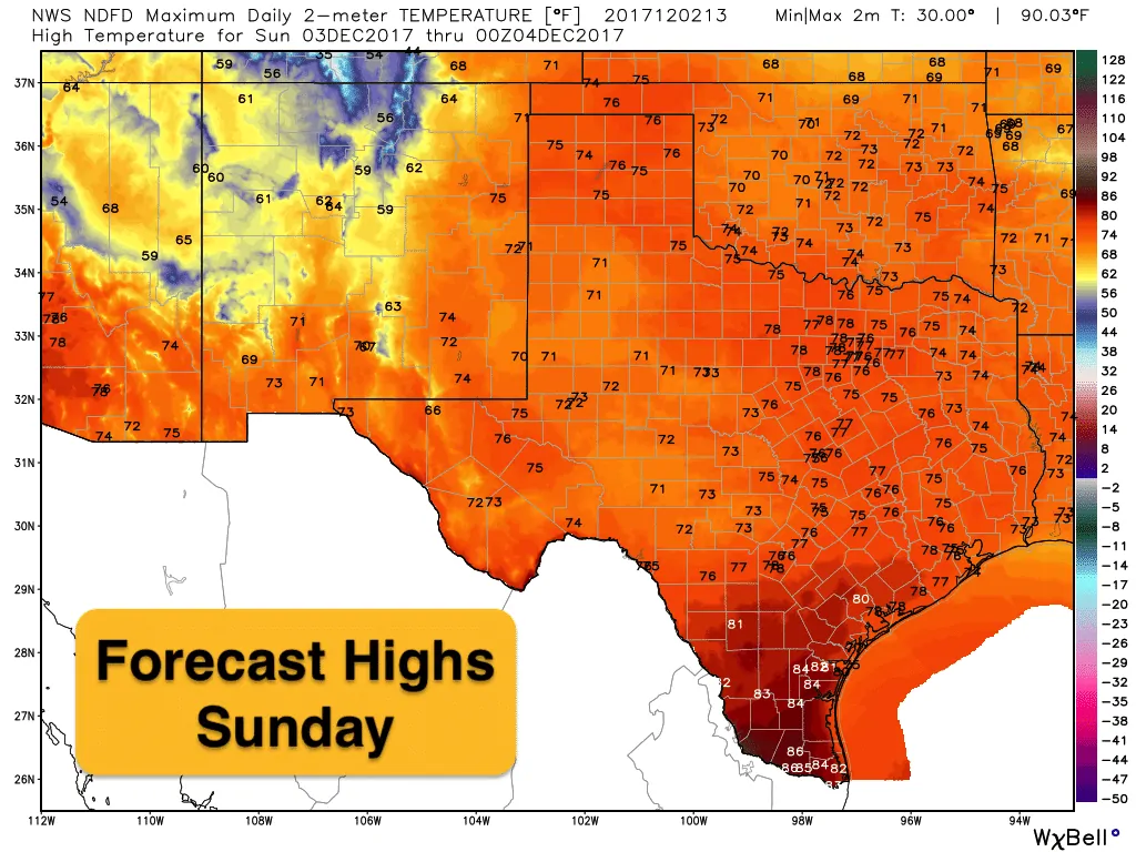
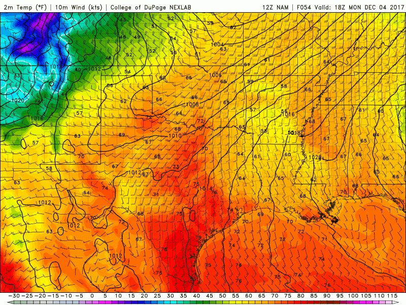
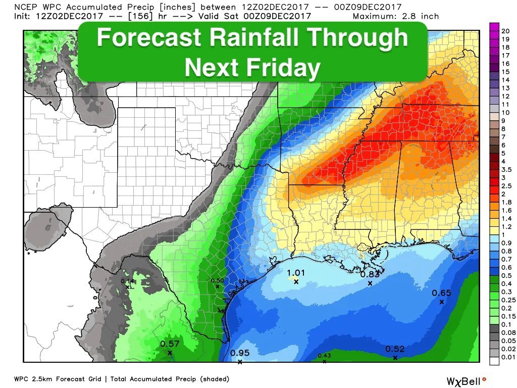
This weekend will mark the beginning of a large scale shift in our weather pattern which will bring about the return of more widespread rain chances and a strong cold front which will knock temps back down below normal for most of the week ahead. For today…we’ll see increasing cloud cover from west to east across the state as an upper level disturbance approaches from the west and temps will average a good 10-15 degrees above normal. Overnight, we’ll see an increase in rain and shower activity across central and south Texas as the upper level disturbance draws closer. On Sunday, moisture will begin to surge northward and we’ll likely end up with a day feeling more like late spring than late Fall. Light showers and sprinkles will continue across parts of central and southTexas, but for the most part, we’ll be rain-free. Our best chances for rain won’t arrive until we head into Monday ahead of the front. Rainfall during the day on Monday is expected to be scattered and light, but once the front beings to push through, we’ll see an uptick in rain and storm activity Monday night into early Tuesday…mainly for areas along and east of the I-35 corridor. Severe weather is not expected as instability levels look to remain on the low side. We’ll still keep an eye on that anyway. The front itself will hit the panhandle region by Monday afternoon and blast through the remainder of the state overnight into early Tuesday sweeping much of our moisture back out into the gulf leaving much cooler and drier air in its wake. Temperatures for the remainder of the work week will stay about 5-10 degrees below normal…but nothing too extreme as a majority of the coldest air will be east of us.
Strong Cold Front Arrives late Monday into Tuesday


0 Comments