
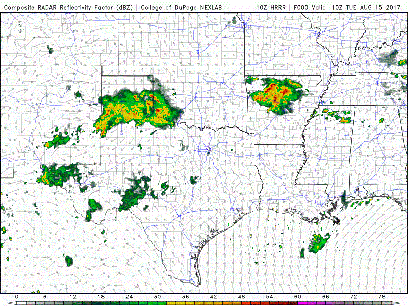
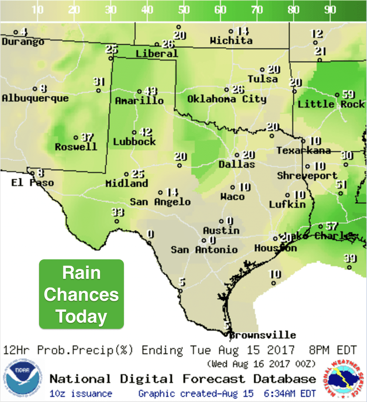
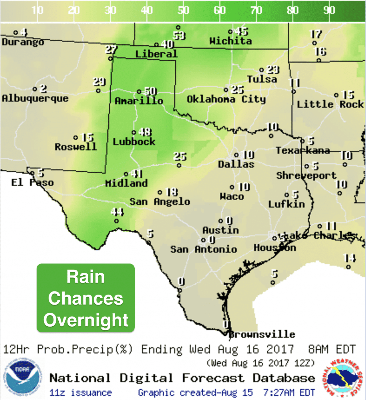
Rain and thunderstorms across the southern panhandle region are expected to continue for several more hours this morning before dissipating. We’ll see a little lull in activity during the early afternoon before storms begin to form once again across eastern New Mexico. Similar to yesterday, we’ll have a chance for strong to severe storms moving into the western panhandle as we get into the evening hours and overnight. A few of the storms could become severe with mainly a damaging wind threat. The Storm Prediction Center has placed much of the region under a Marginal Risk (Level 1) of severe weather for later this afternoon and evening. Elsewhere, just chances for scattered showers and storms mainly north of the I-20 corridor across north Texas, coastal southeast Texas and far western Texas as well. Here’s a look at how the radar may shape up today. As always, keep in mind this is a model forecast and not live radar.
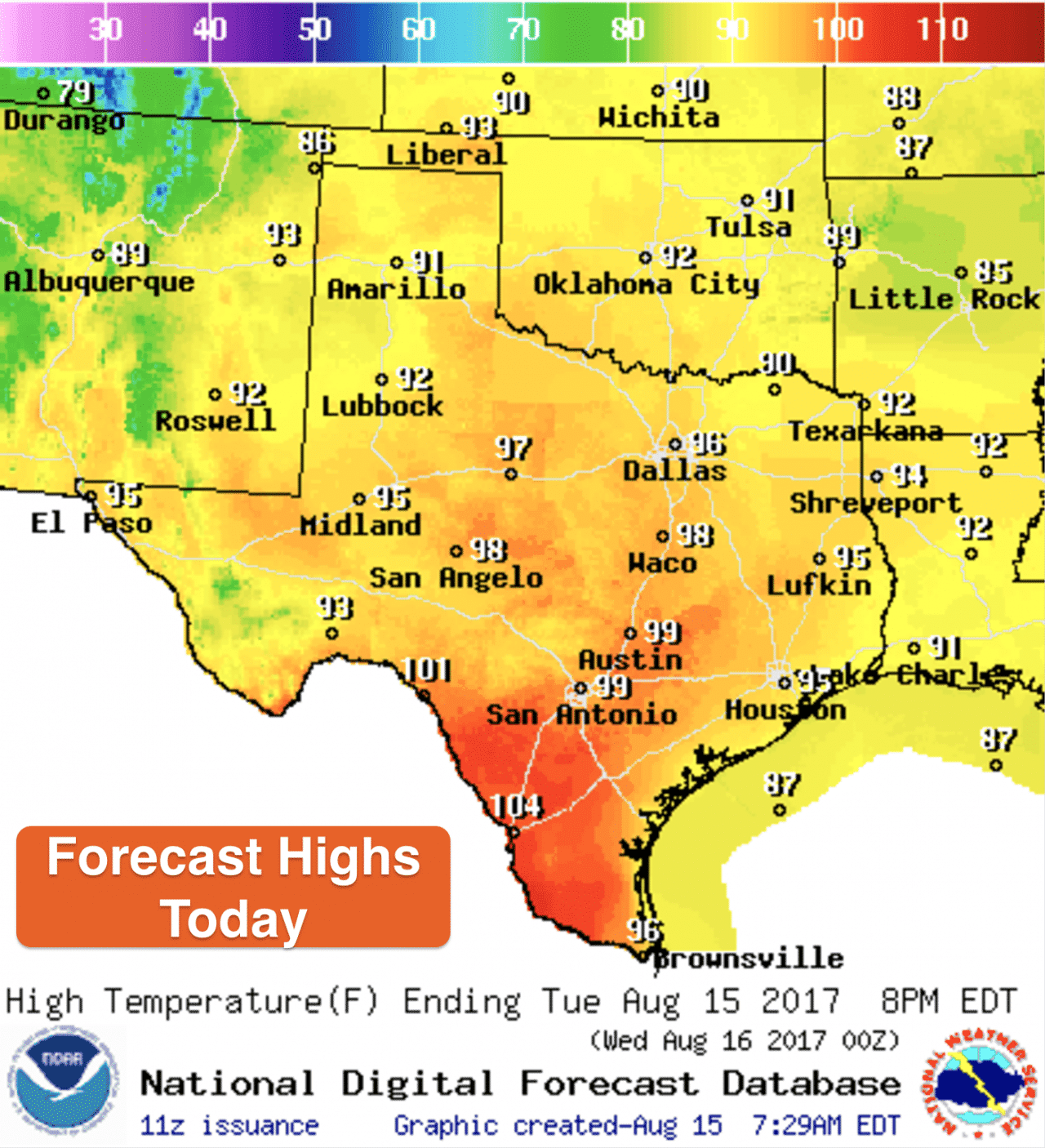
Highs today…seasonal with very warm and sticky conditions remaining in place across the southern and eastern portions of the state where humidity levels will be the greatest. Heat Index values will climb to 110 this afternoon for much of deep south Texas. Areas along and east of I-35 will see Heat Index values climb to around 100-104 later this afternoon. Temps will continue to rise this week and we’ll likely see the introduction of some of Heat Advisories for areas along and east of the I-35 corridor by Thursday as a bit of an August heatwave begins to take hold for the weekend…and likely into next week as well.


0 Comments