
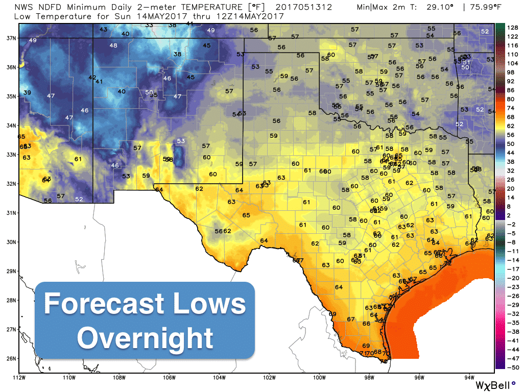
Quiet weather is expected today with high pressure settling in for a few days. Temps will be about where they should be for this time of the year with highs in the 80s across most of the state, with a few 90s sprinkled in across west Texas and along the south Texas borderlands. Rain chances today will be confined to the higher elevations of western Texas and the Big Bend region with pretty much zero chances anywhere else. There will be plenty of sunshine and blue skies, so be sure to get outdoors and enjoy! Lows tonight will be mild and seasonal ranging from the 50s to 60s, so not too bad at all.
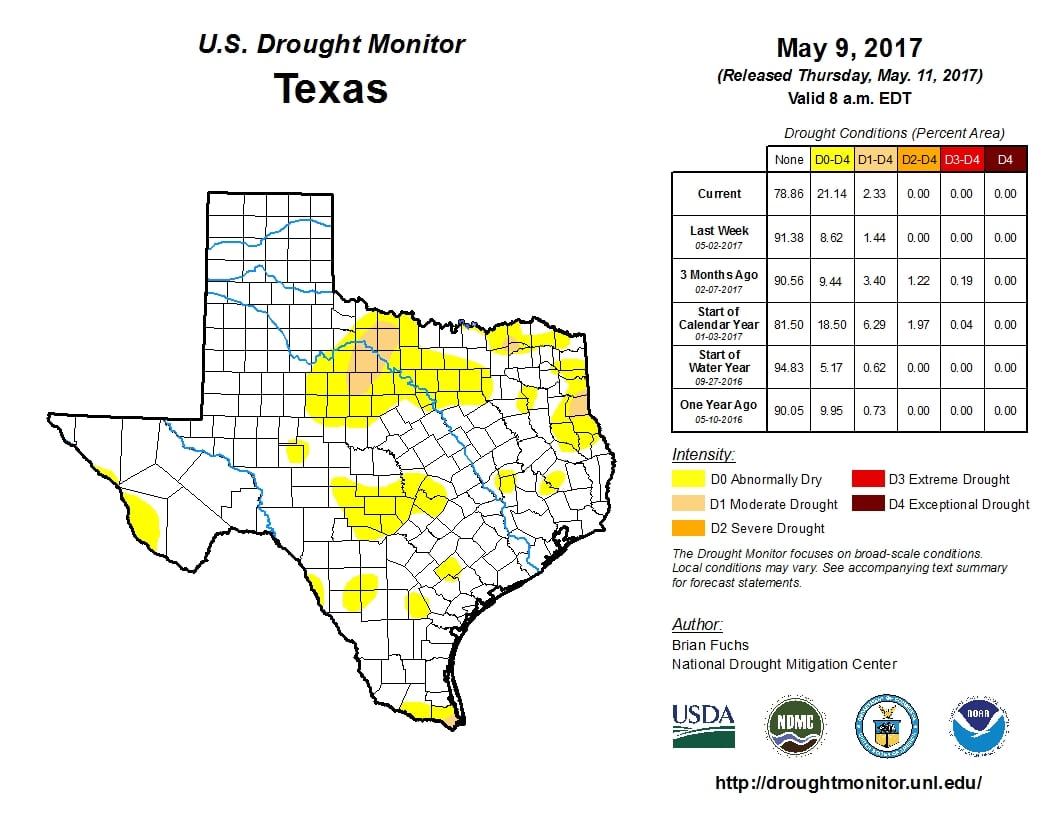
Rain and storm chances don’t return to the forecast until next week as a series of upper level disturbances arrives and the dryline across western Texas becomes active each afternoon. At this time, it looks like the highest chances for severe weather will be on Tuesday and again on Thursday across parts of western north Texas and the panhandle region, but it’s still too soon to discuss the particulars of those threats just yet. It does look like we may be shifting into a bit of a rainy pattern for the next 7 to 10 days which will likely begin to take shape by the middle of next week. We do need the rain though, with drought conditions returning many regions across north Texas.


0 Comments