
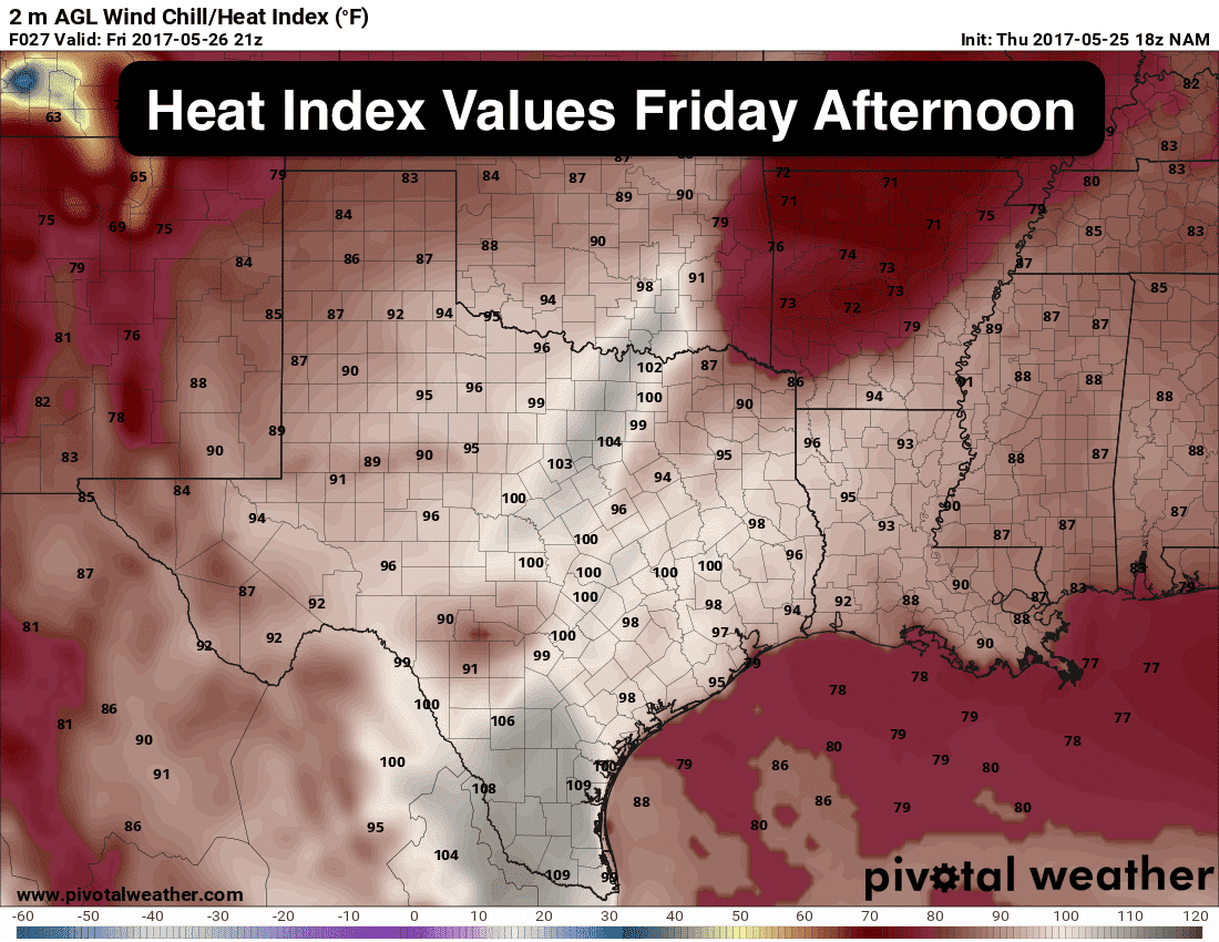
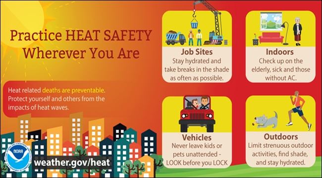
We will be quite “HAWT” across the state for the next couple of days! Highs tomorrow will be the warmest that many areas have seen since last September, and the fact that we’ve had a rather mild run of temps lately, it will come as quite a shock. Friday will be humid and oppressive ahead of the dryline where we’ll see dewpoints climb into the low 70s. That combined with highs forecasted to be in the low to mid 90s will result in heat index values between 100 and 103 across a large swath of north central Texas, especially within our metro areas. Behind the dryline, conditions will be hot and dry with breezy conditions expected through most of the day. Needless to say, anyone working outdoors tomorrow will need to make sure to drink plenty of water and take frequent breaks as our bodies have not had a chance to acclimate yet. You’ll also want to be sure that pets and livestock have access to adequate water and shade as well…and please don’t forget to check the back seat for infants and children!!!
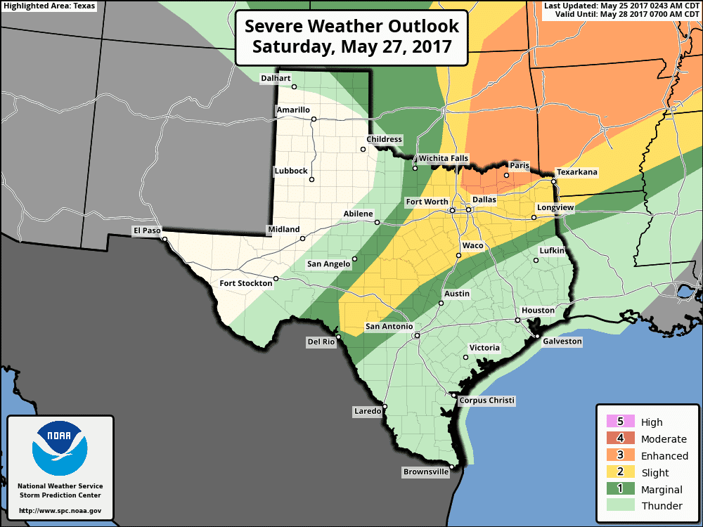
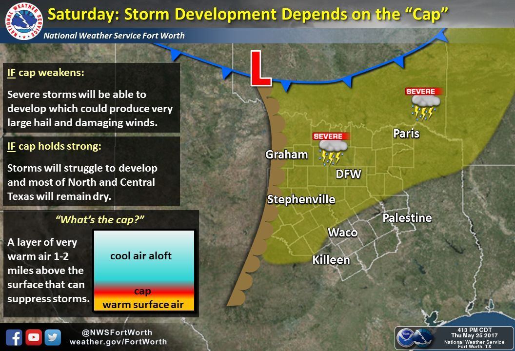
While we’ll remain rain-free on Friday and for most of Saturday, we do have a chance of seeing isolated severe storm development across parts of north central and west central Texas Saturday evening along the dryline. By Saturday afternoon, the dryline should be positioned across western north Texas down into the western Hill Country region. Dewpoints are forecast to be in the low to mid 70s and instability levels will be very high. Normally this would be quite a cause for concern; however, we will have a very strong cap in place which is expected to hold through most of the day. It will weaken as we get into the evening hours, and with enough forcing from a cold front pushing into the region, we may see the cap break in a few places along the dryline. If this happens, we could see a few isolated storms develop which will quickly become severe with a very large hail threat…possibly up to the size of grapefruit…damaging winds and the chance for a tornado or two. Overall chances are not high that we’ll see much in the way of storms, and not everyone will be impacted, but the conditions present by Saturday afternoon across the region will certainly be favorable for explosive development IF the cap can break. Better chances for storms will arrive after dark Saturday evening and during the early overnight hours as the cold front arrives across north Texas. The Storm Prediction Center has placed a Slight Risk (Level 2) across a large swath of northeast, north central and central Texas for Saturday afternoon. A small portion of northeast Texas along the Red River counties has been placed under an Enhanced Risk (Level 3). As additional forecast data arrives overnight, we may see the current risk areas adjusted slightly, but the takeaway is that anyone in these risk areas who are planning outdoor activities Saturday afternoon will need to pay attention to the weather and plan accordingly.


0 Comments