
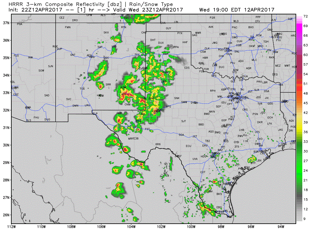
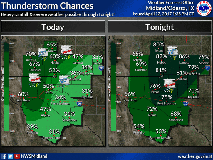
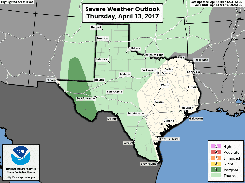
A slow moving upper level disturbance will continue to generate strong to severe storms with the threat of heavy rain across parts of west Texas, the southern Texas panhandle and South Plains for the remainder of this evening and overnight. Isolated strong to severe storms with a history of strong winds and 1 to 1.5 inch hail will continue to threaten parts of far west Texas/Trans Pecos region for several more hours. This activity is expected to congeal into a squall line and continue to slowly move east and further into the Permian Basin region as we get into the late evening and early overnight hours as the upper level disturbance shifts east. Flash Flood Watches are in place for much of far west Texas through 7am tomorrow. Rainfall amounts are expected to range between 1-2 inches with isolated higher amounts possible for areas where storms can line up and train over the same areas. By early tomorrow morning, much of the overnight activity will have decreased across the Permian Basin with mainly the eastern panhandle and portions of northwest Texas seeing the threat of heavy rain with embedded thunder. Additional storms are expected to develop tomorrow across these same areas, but intensity and coverage is expected to be less than what we saw today. We’ll have another blog update out tomorrow morning with the latest on Thursday’s storm chances, so be sure to check back!
Simulated Radar through 7am Thursday morning


0 Comments