
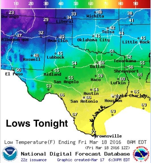
Conditions overnight are expected to remain relatively calm with only a few chances for spotty rain and thunder across parts of east and southeast Texas through the evening and overnight hours. Some of these storms could contain small hail, gusty winds and frequent lightning, but widespread severe weather is not expected. Lows tonight will drop into the 30s across the panhandle as a strong cold front begins to move south across the region tomorrow morning. Ahead of the front, a pretty sharp temperature gradient with lows only dropping into the mid 50s across across north, central and west central Texas…and even warmer as you get closer to the coast with lows only expected to drop into the upper 60s.
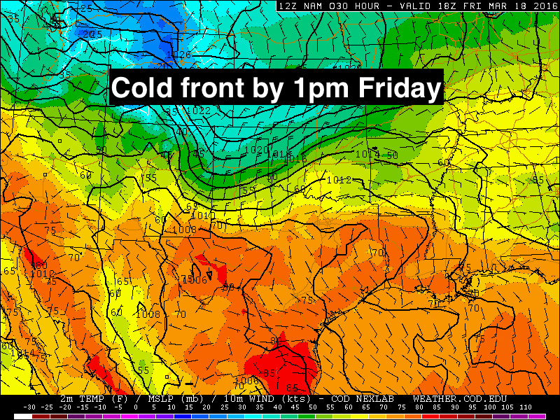
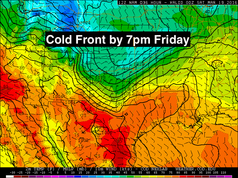
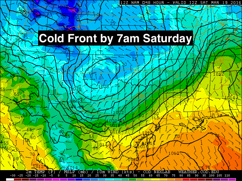
The strong cold front will move quickly through the state tomorrow morning arriving along the inland gulf coast counties by tomorrow night. Winds will be strong behind the front, gusting to around 30mph in its wake. Make sure you take a coat or jacket with you before you leave for work or school tomorrow morning, especially if you live in north or central Texas when frontal passage is expected during the day. The forecast graphics below will give you a rough idea on timing, although these fronts usually move faster than what the forecast models project.
 We also have a chance for storms to develop along the leading edge of the front as it moves south and begins to interact with moist and unstable air out ahead of it. It’s likely that we’ll see a line of scattered storms develop by early tomorrow across western north Texas, with additional development likely across central and southwest Texas by tomorrow afternoon during peak daytime heating. A few of these early storms could become strong with hail and gusty winds as the main threats.
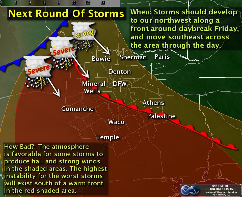
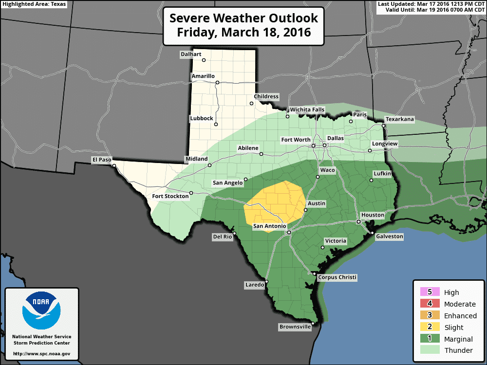
The area with the highest potential for seeing severe storms will be across the Hill Country region tomorrow afternoon as the front continues to push south across central Texas encountering moderately unstable air and a piece of upper level energy moving east out of northern Mexico. Storms that develop across this region are expected to be scattered to widespread, but a few of them have the potential to contain a large hail and damaging wind threat, especially within the Slight Risk area outlined below. At this time, widespread severe weather is not expected, but as we saw this morning, it only takes a few cells with large hail to do significant damage if they happen to move over a heavily populated area. We will be monitoring updates overnight and tomorrow in case this forecast changes once additional model data rolls in later tonight.
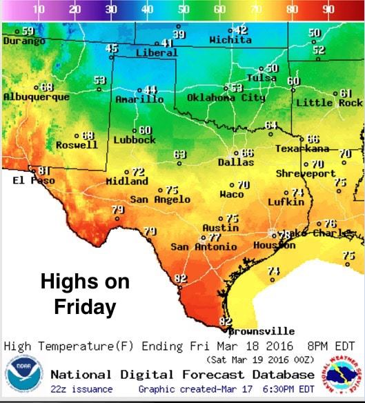
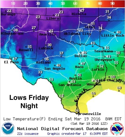
Obviously, highs tomorrow will be highly impacted by when the front arrives, and the northern half of the state will reach its peak heating early on, while the southern half of the state will cook a little longer. Lows Friday night will be a reminder that we’re still technically in the Winter season with lows in the mid 20s across the panhandle and 30s to low 40s across north and west Texas. Closer to the coast, lows will only drop down into the 50s and 60s as it will take a bit longer for the colder air behind the front to push that far south.


0 Comments