
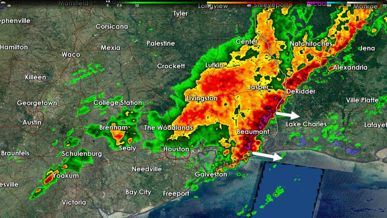
A line of strong thunderstorms was pushing east across far Southeast Texas. At the time of this writing the line was just entering Beaumont. The line itself is moving east at a good clip and may produce gusty winds up to 40 MPH. It should be pushing east of the state by 9 AM. Stratiform rain is falling from Shreveport southwest through Lufkin, Livingston, to the north side of Houston in the Woodlands. Isolated showers extend back to the Coastal Plains. That line dropped one half inch to one inch of rain in the Houston metro as it moved through. Those totals are not high enough to cause new flash flooding. I don’t anticipate renewed river flooding since totals should remain at or under an inch across far Southeast Texas. All precipitation should be moving out by lunch as a cool front pushes in.
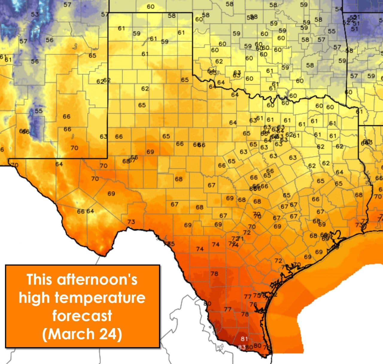
High temperatures will be noticeably cooler as a cool front ushers in northerly/northwesterly winds. Skies will quickly clear from west to east later this morning with sunny skies this afternoon. Temperatures will range from the lower 60s in the Texas Panhandle, Red River Valley, and Northeast Texas up into the 70s across South Texas and the Permian Basin. Fire danger will be noticeably lower than yesterday, but we could see a few elevated risk zones.

Low temperatures tonight will be on the chillier side of the spectrum for late March with 30s to lower 40s along and northwest of the Hill Country, Brazos Valley, to East Texas. We’ll see middle 40s in Southeast Texas through the Coastal Plains with lower 50s across South Texas. It would be a good idea to have a light jacket ready if you’re heading out Friday morning. Rain and storm chances begin to return Saturday Night and especially on Sunday.


0 Comments