
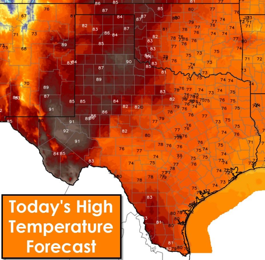
There will be several weather concerns over the next two days. Temperatures will be very warm to downright hot this afternoon and will be even warmer on Wednesday. Winds are already gusting up to 30 MPH this morning and will likely stay that way into Wednesday evening. Wind directions will vary depending on time of day and one’s specific location. Since we’re talking about a large area I’m not going to dive into the wind direction. Those who need specific wind information (aviation interests, fire-weather interests) should check their local forecast with the National Weather Service. Wind speeds are not expected to diminish tonight.
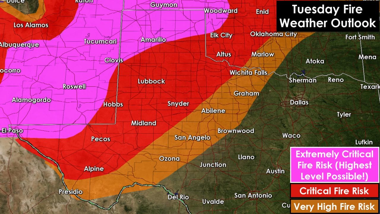
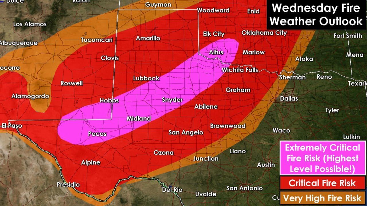
The biggest concern for the next two days will be extreme fire danger across the western half of Texas. Temperatures will be very warm to downright hot. Wind speeds will be gusting up to 45-50 MPH. Relative humidity values will drop below 25 percent. Some locations will see relative humidity values drop to 5-10 percent this afternoon and again on Wednesday afternoon. A complicating factor is that relative humidity values are not expected to rise above 40 percent tonight. Typically we see RH values recover nicely overnight. That will not be the case tonight. As such fire danger will remain very high all night as winds continue to gust over 30 MPH. Energy Release Component (ERC) values have continued to rise over the past few days due to the warm weather and dry winds. Conditions are ripe for significant wildfires. Any fire that develops over the next two days in the highest risk zones could become major incidents. If you see fire or smoke please notify your local fire department immediately. Trust me when I say they would rather be called out on a good-intent call then not get notification of a new fire. Ground and air resources are being staged and will be ready to respond to fires over the next two days. Both today and Wednesday have been designated extremely critical fire weather days. We don’t see those often. The most critical fire weather conditions will spread east on Wednesday as a dryline surges towards I-35. The risk of thunderstorms will increase across Wednesday evening along and east of Interstate 35. Some severe thunderstorms will be possible with large hail and damaging winds. We’ll address the thunderstorm-aspect of this system in a separate post later this morning.


0 Comments