
I just got back in from a storm chase out in the Texas Panhandle. I personally witnessed three tornadoes but there were likely over a dozen. Some of the tornadoes were large/violent and produced damage. I’ll let the local news media handle the damage reports. Let me start off by saying the threat for large/violent tornadoes has dropped off considerably. We could still see some tornadoes overnight but they’ll likely be more brief.
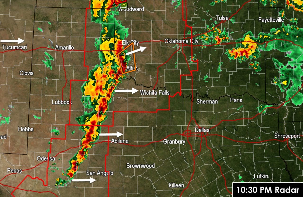
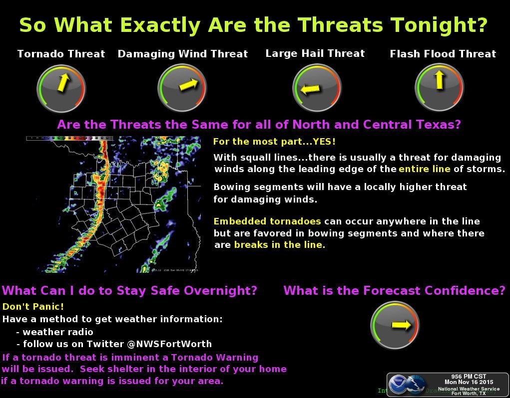
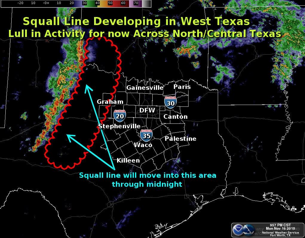
Shortly before 10:30 PM a line of strong thunderstorms was moving east into Northwest Texas, the Big Country, and Concho Valley. This line is moving east around 40 MPH. As the line continues to move east tonight it will have the potential to produce damaging straight-line winds over 60 MPH and brief tornadoes. As the line approaches North Texas and Interstate 35 we’ll likely see a severe weather watch issued. With a line of storms the tornado threat is reduced – but not eliminated – compared to discrete supercells. We’ll have to watch for any bookend vortices in the line that can cause localized enhanced wind gusts and brief tornadoes. Likewise if we get any discrete storms to fire up ahead of the line those could try and develop low-level rotation. The National Weather Service office in Fort Worth will launch a weather balloon at midnight. That special sounding will help determine the state of the atmosphere over North Texas.


0 Comments