
Good morning and happy Sunday everyone! All the gloomy rain from yesterday has moved out, the sky has mostly cleared out over the northern half of the state with the southern half of the state still under some cloudcover for today. Temps today will be seasonal and no rain is expected. A perfect day to run errands or just get outdoors and enjoy the season! Weak high pressure will be the dominant feature today through late Monday which means we’ll have several days of nice weather before our next system and cold front moves in through Wednesday. We’ll talk a little more about that at the end of the blog.

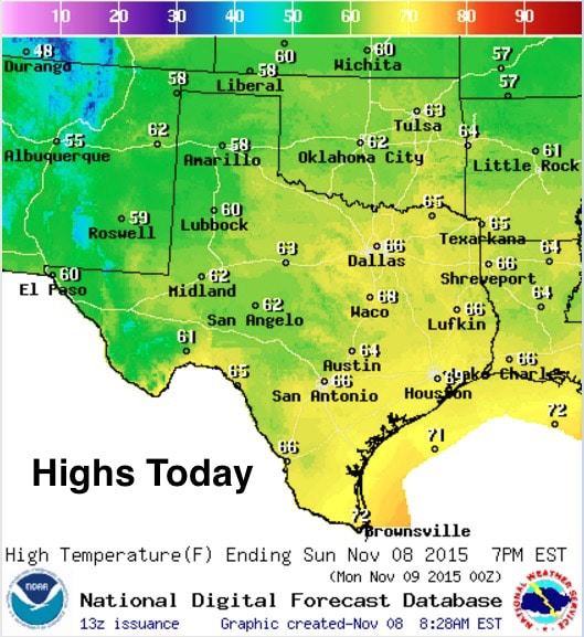
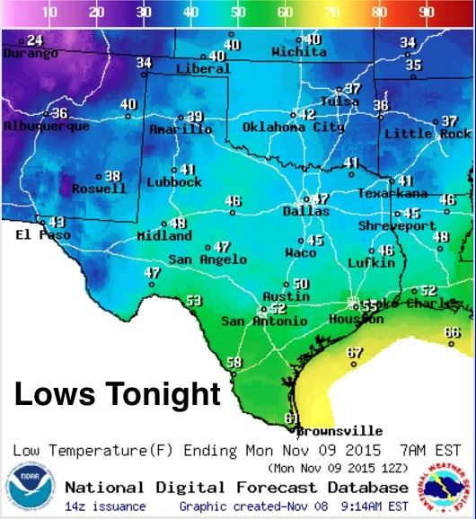
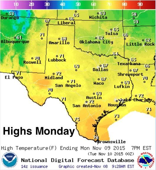
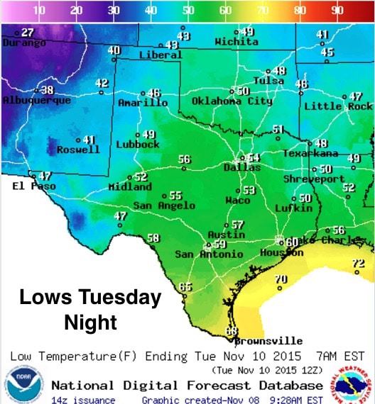
For today, highs will be seasonal in the upper 50s to upper 60s across much of the state. A few lingering low 70s will be found along the coast across deep south Texas. Lows tonight, nippy again across north and central Texas with 30s and 40s expected once again. Further south, pleasant low 50s to low 60s will be possible by early Monday morning. We’ll start to see a gradual warm-up for Monday with highs nudging up a few degrees. We’ll also begin to see surface winds begin to turn back from the south late Monday into Tuesday ahead of our next system. This will bring gulf moisture back into the state setting the stage for additional rain and storms from our next system.
Storm & Severe Weather Chances This Week~~~
First off, this next system will not impact a large portion of the state like our last several systems have. The long range models have been very consistent with sweeping this system through very quickly on Wednesday with impacts mainly along and east of the I-35 corridor. There will be a chance for a line of strong to severe storms to develop out ahead of the front on Wednesday, but that should quickly move across east and southeast Texas by Wednesday night. The biggest impacts from this system look to be across parts of northern Missouri and Illinois at this time where very strong storms, damaging winds and tornadoes are most likely on Wednesday afternoon and evening. While moisture return across that region remains questionable at this time, this is a very dynamic system with an impressive surface low developing, along with 100+knots of upper level wind speeds, to support the development of severe storms if sufficient moisture and some instability can be attained. I’d recommend that if you have any friends or family in the northern Missouri, southern and central Illinois area (basically west of the Mississippi there in that region) give them a heads up that Wednesday could be a bit of a bumpy ride. Again, not expecting that level of severe across Texas at this time, but we’ll certainly keep an eye on it and provide further info as we get into the work week.


0 Comments