
The main weather concerns today will be the record heat and near-critical fire conditions expected this afternoon. Temperatures are actually pretty nice across Texas this morning as the dry air allows things to cool off quickly after sunset. Humidity values are up in the 70-80 percent range across the southern half of Texas as temperatures have fallen closer to the dewpoint. Temperatures will quickly begin to warm after sunrise and humidity values will tank as the temperature/dewpoint spread increases.

Record high temperatures are forecast this afternoon across the eastern two-thirds of Texas. Mid to upper 90s are forecast in the Concho Valley, Big Country, Northwest Texas, North Texas, Northeast Texas, East Texas, Southeast Texas, Central Texas, South Texas, and the Rio Grande Valley. The Texas Panhandle will see temperatures in the low to upper 80s as a cool front pushes south and helps keep temperatures cooler. This same front will bring temperature relief to more of Texas on Friday and into the weekend.
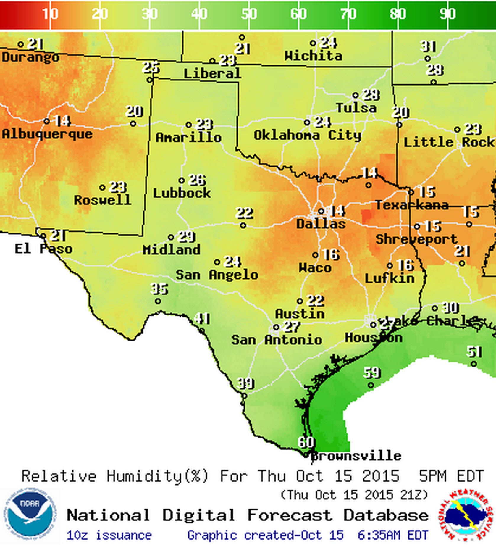
Relative humidity values this afternoon will be very low across much of Texas.
Relative humidity values will tank this afternoon as temperatures heat up into the 90s. Relative humidity values across North Texas, Central Texas, Northeast Texas, East Texas, and Southeast Texas are forecast to drop below 30 percent. Locations which have had fires ongoing will likely see humidity values drop towards 15 percent this afternoon. South to southeast winds will be sustained at 10 to 15 MPH gusting up to 20 MPH. Locally higher gusts are possible around well-established fires (such as the one in Bastrop County) as fires locally influence atmospheric conditions. Overall conditions will be very favorable for wildfire growth this afternoon. Long-range spotting and crowning is expected resulting in the potential for significant growth of existing and any new fires. Long-range spotting is what allowed the Hidden Pines fire to spread so quickly yesterday afternoon. The same type of fire behavior is expected today.
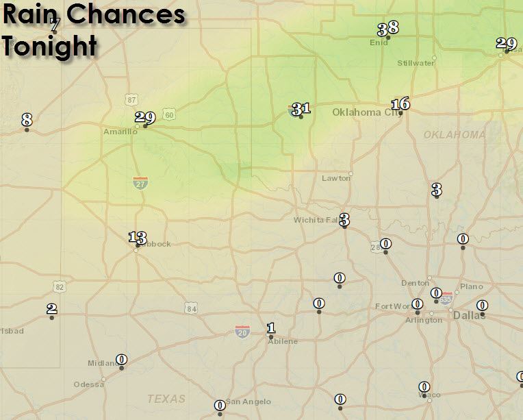
Isolated showers and thunderstorms are possible this evening and overnight across the Texas Panhandle as a cool front pushes south. North winds gusting up to 30 MPH will impact the Texas Panhandle and West Texas tonight.
High temperatures on Friday will only make it to around 60 degrees in the Texas Panhandle. Upper 60s to around 70 degrees can be expected across Northwest Texas and West Texas. Another day of very warm conditions and fire danger can be expected across the rest of Texas. Here are a few temperature graphics from an ensemble run of the Global Forecast System (GFS) weather model to show that temperatures will moderate across Texas by the weekend.
Rain chances continue to look good by the middle of next week across Texas. I won’t go into detail on that now but next week should feature seasonal temperatures with the potential a good soaker across parts of Texas, including areas that really need it.


0 Comments