
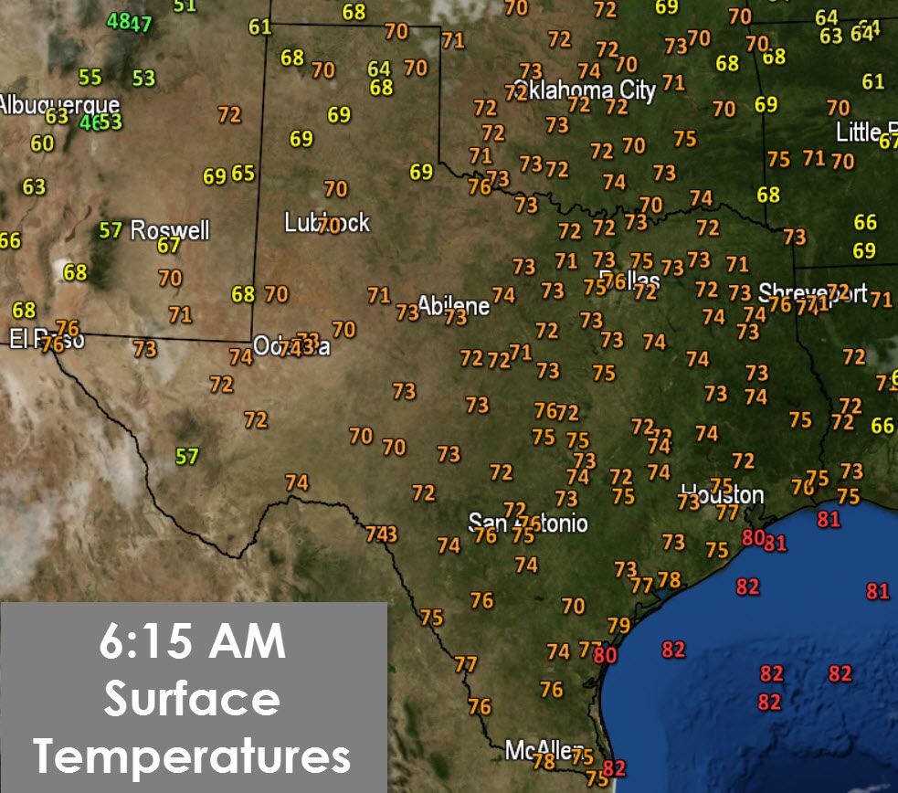
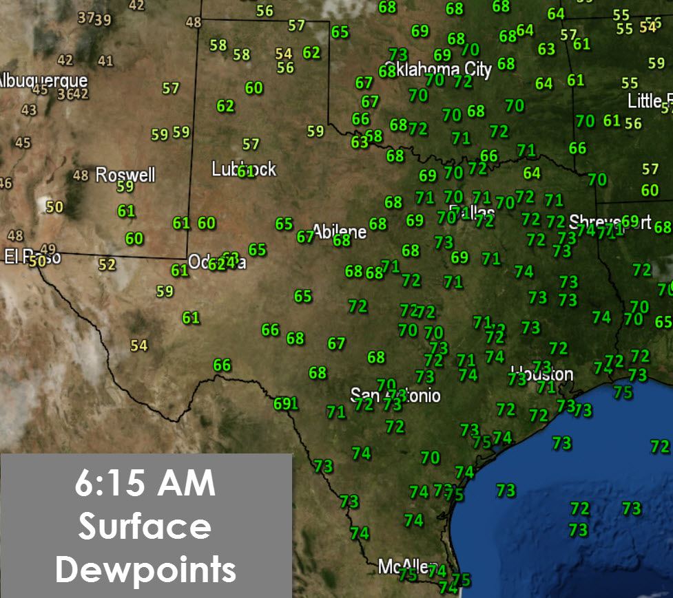
Southeast winds over the past two days have allowed tropical humidity to infiltrate all of Texas. At the time of this writing most of South Texas and parts of East Texas were socked in with low level overcast. Temperatures are noticeably warmer than this past weekend thanks to the return of 60 and 70 degree dewpoints. These conditions will continue through the end of the work week. A cold front will bring relief to the northern parts of Texas over the weekend. Sadly the front will stall out not too far south of the Red River based on the latest weather model data. As usual cold fronts tend to push a little faster and farther south than anticipated so we can hope for that. Welcome to the last official week of Summer where its going to feel like July and August.

Its no surprise we’re experiencing warm weather based off the upper level chart this morning. The jetstream has pushed back into the northwestern United States. Texas is under the influence of a high pressure aloft which is keeping our weather benign. There are signs the high will push off into the southwestern United States next week. Should that occur we may get a weak easterly flow which could allow a backdoor cold front push in from the east. Temperatures wouldn’t drop much if any but dewpoint values would drop into the 50s compared to the 70s we’ll see this week. Time will tell how that front possibility evolves and whether the upper level ridge will break down some.
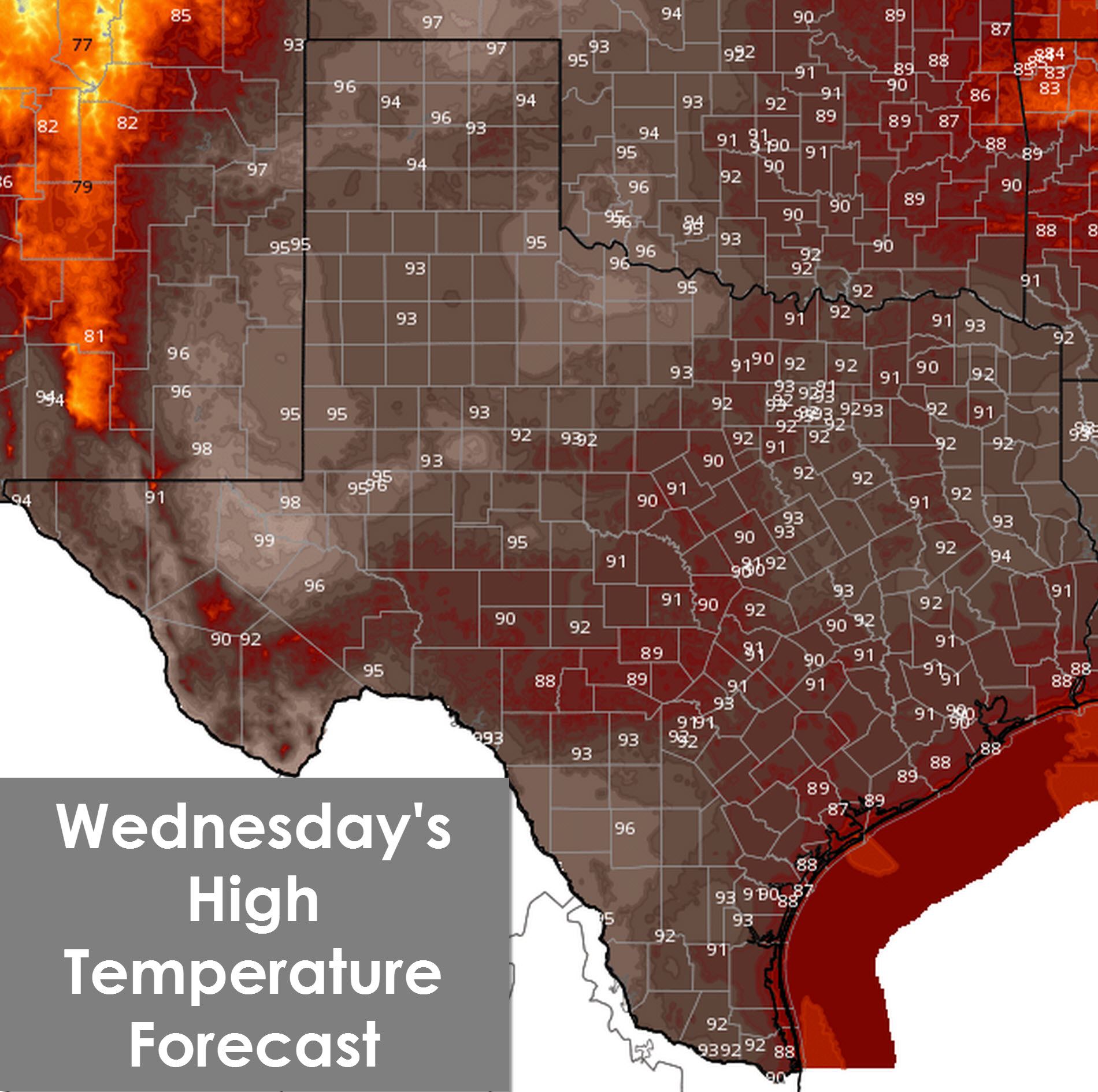
Today’s weather will leave no doubt that we’re still in summertime here in Texas. High temperatures will range from the upper 80s along the coast up into the 90s across the rest of Texas. The Texas Panhandle, Northwest Texas, and the Permian Basin will climb into the upper 90s and perilously close to 100 degrees. I was hopeful we were done with triple digit temperatures after last week but alas not just yet. With dewpoints in the 60s and 70s the heat index will be about five degrees above the air temperature this afternoon – probably even higher along the coast and in Southeast/East Texas. Gusty south winds will occur again this afternoon across the Panhandle, West Texas, and Northwest Texas. Elevated wildfire danger does exist.
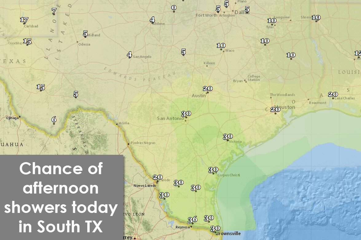
Some lucky folks did get an afternoon cool off on Tuesday with a shower or storm. Today will be drier across Texas now that the warm front has lifted north out of the area. Those in the Rio Grande Valley up into South-Central Texas (including SAT) will have a 30% chance of an afternoon shower/storm. Only 20% of folks in Southeast Texas will get wet this afternoon. A rouge storm cannot be ruled out in the Texas Panhandle or far West Texas this afternoon. Everyone else in the state has a ten percent or less chance of rain today.
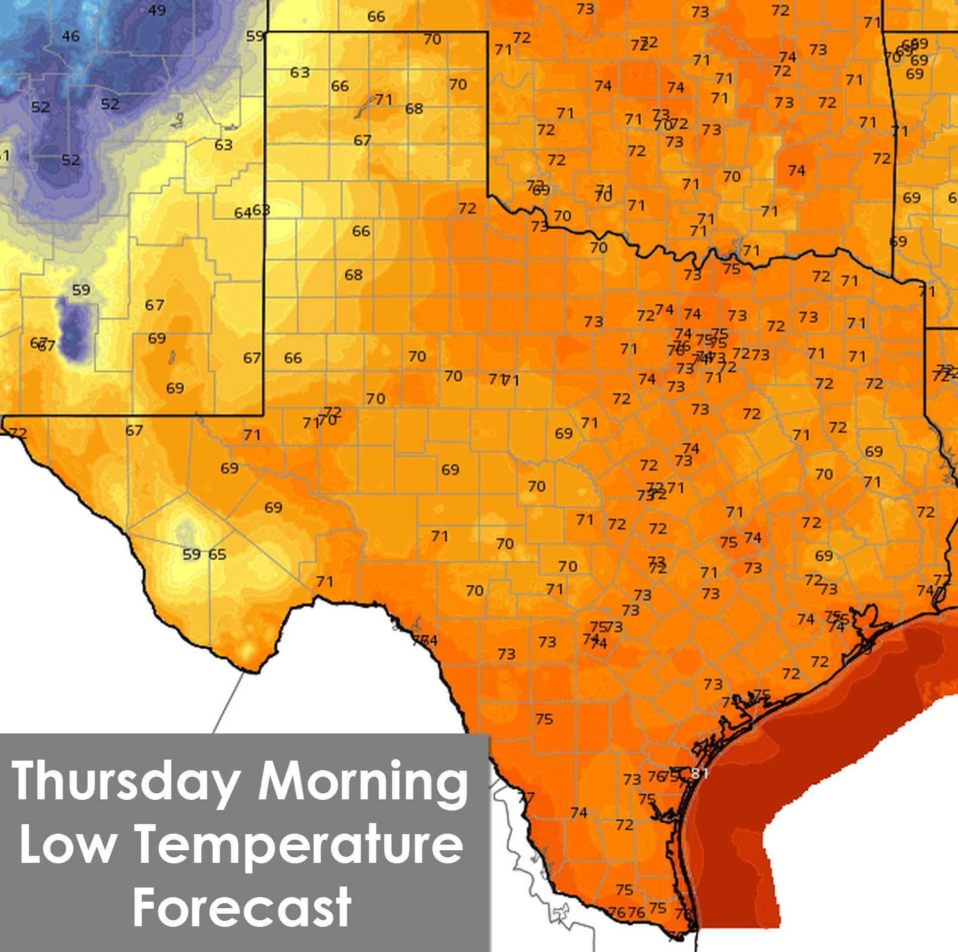
Tonight will be warm and balmy with low temperatures in the upper 60s to upper 70s across Texas. Any showers that fire up this afternoon will dissipate by or just after sunset. A dry night is expected with south/southeast winds.


0 Comments