
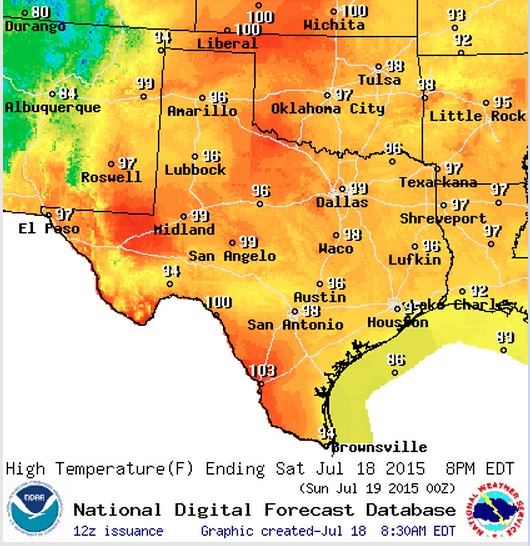
Another wash, rinse, repeat type of forecast featuring very warm temps and just a few chances of rain today. Looks like we stay this way through much of next week has high pressure continues to park itself over the state. Highs today, mainly in the mid to upper 90’s with a few 100 degree readings likely along the Rio Grande. North and west central Texas will be flirting with 100s…which hasn’t happened so far this season…but will likely see that happen tomorrow or by Monday at the latest. Heat index values will rise to between 100 to 107 today across much of the central, eastern and southern parts of the state where humidity levels are still quite high. This will certainly make it a bit miserable to be out during the afternoon hours, so get your chores done early! Heat is hard on everyone….stay hydrated, make sure your outdoor pets have fresh water and some shade, and check on your elderly neighbors to be sure they’re staying cool as well.


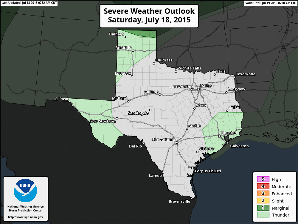
Again, chances for rain will be slim, but we do have a few chances across parts of the panhandle and around the mountains of far west Texas later this afternoon, and southeast Texas by early afternoon. Southeast Texas shouldn’t see much more than just scattered pop-up showers with some gusty winds and lightning as the main threats this afternoon. Panhandle and western Texas may see a few isolated strong to severe storms develop with downburst winds, lightning and some hail being the main threats. Overall, it doesn’t look like there will be much to ruin any plans folks may have for outdoors this afternoon and evening!


0 Comments