
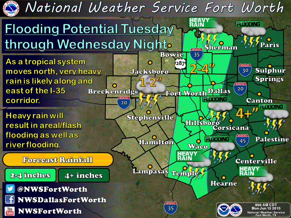
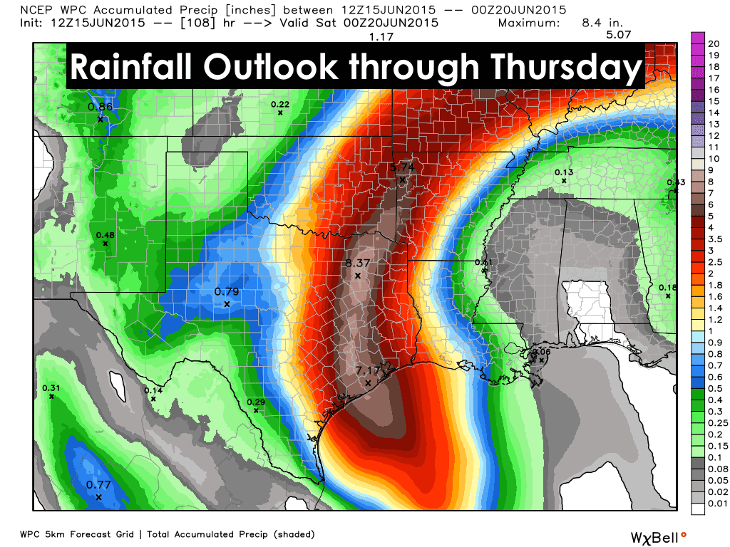
Air Force Reserve hurricane hunters have been flying over, around, under and through our Invest 91 in the Gulf of Mexico for most of the morning. They have determined that…for now…there is no well-defined center of circulation, and the system as a whole is still fairly disorganized. As such, it cannot be given tropical storm classification just yet. Conditions are still quite favorable for additional development today or overnight with probabilities bumped to a 90% chance of formation within the next 48 hours, so we still could see the formation of Tropical Storm “Bill” by tomorrow. Regardless of whether this system moves onshore as a tropical depression or tropical storm, it will be capable of producing major flooding as it makes landfall along the central Texas coast somewhere between Corpus and Houston…most likely sometime tomorrow (Tuesday). The exact track of the system remains uncertain due to its disorganization, so any projections for rainfall amounts could shift a bit east or west depending on how the system shapes up over the next 24 hours. As of right now, southeast Texas and the Houston area are the most concerning with upwards of 5 to 10+ inches possible by late Wednesday. We urge anyone living in this area to not delay making their flood safety plans…especially if you live in an already flood-prone area. Even if this isn’t a major system, it will still pack quite a punch with significant, possibly historical, flooding likely. We’ll continue to monitor and bring you the latest!
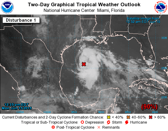


SPECIAL TROPICAL WEATHER OUTLOOK
NWS NATIONAL HURRICANE CENTER MIAMI FL
1235 PM EDT MON JUN 15 2015

For the North Atlantic...Caribbean Sea and the Gulf of Mexico:

Special tropical weather outlook issued to report on results of the
aircraft reconnaissance mission.

An Air Force Reserve Unit Hurricane Hunter aircraft has been
investigating the area of low pressure in the Gulf of Mexico all
morning.  Data from the mission indicate that the circulation
is highly elongated and lacks a well-defined center.  Therefore the
system is not a tropical cyclone and advisories are not being
initiated at this time.  However, the low still has the potential to
become a tropical storm at any time before it reaches the Texas
coast sometime tomorrow.

The aircraft data do indicate that the system is producing winds of
45 mph or so to the east of the elongated trough axis, and interests
in and along the northwestern Gulf of Mexico should continue to
monitor the progress of this system.  Regardless of tropical cyclone
formation, tropical storm conditions are likely along portions of
the middle and upper Texas coast, and possible in extreme
southwestern Louisiana, Monday night and Tuesday. The system is also
likely to bring heavy rainfall with possible flooding across
portions of eastern Texas and western Louisiana.  For additional
information, please see High Seas Forecasts and products issued by
your local National Weather Service forecast office.
* Formation chance through 48 hours...high...90 percent
* Formation chance through 5 days...high...90 percent


0 Comments