
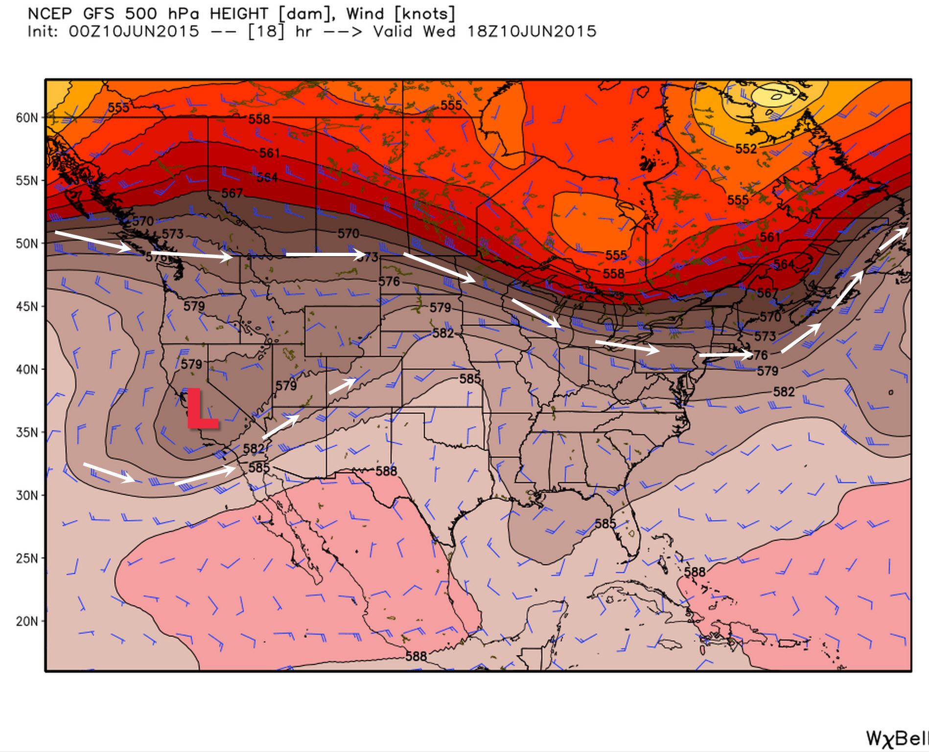
500 millibar heights and winds. Located around 18,500 feet on average.
Compared to Monday and Tuesday we’re starting to see changes in the mid-level of the atmosphere across the United States. The trough that was digging south across the Northeast United States has moved into the Atlantic. One thing that hasn’t changed is the main jet stream’s location. It continues to be strongest in southern Canada into the northern plains. Meanwhile an upper level low pressure is located over central California with a weak jetmax of its own. An upper level ridge continues in Mexico into the eastern Pacific ocean which actually sets up a favorable environment for tropical cyclone development off Baja California. We’ll likely see the third storm of the Pacific season develop by the end of the week way down there. The chance for rain will increase this weekend across parts of Texas as we see more moisture stream in along with some upper level energy. At this time severe weather is not expected to become widespread nor will widespread flooding be an issue. We’ll continue to refine that forecast as we get closer to the weekend.

Wednesday, June 10, high temperature forecast
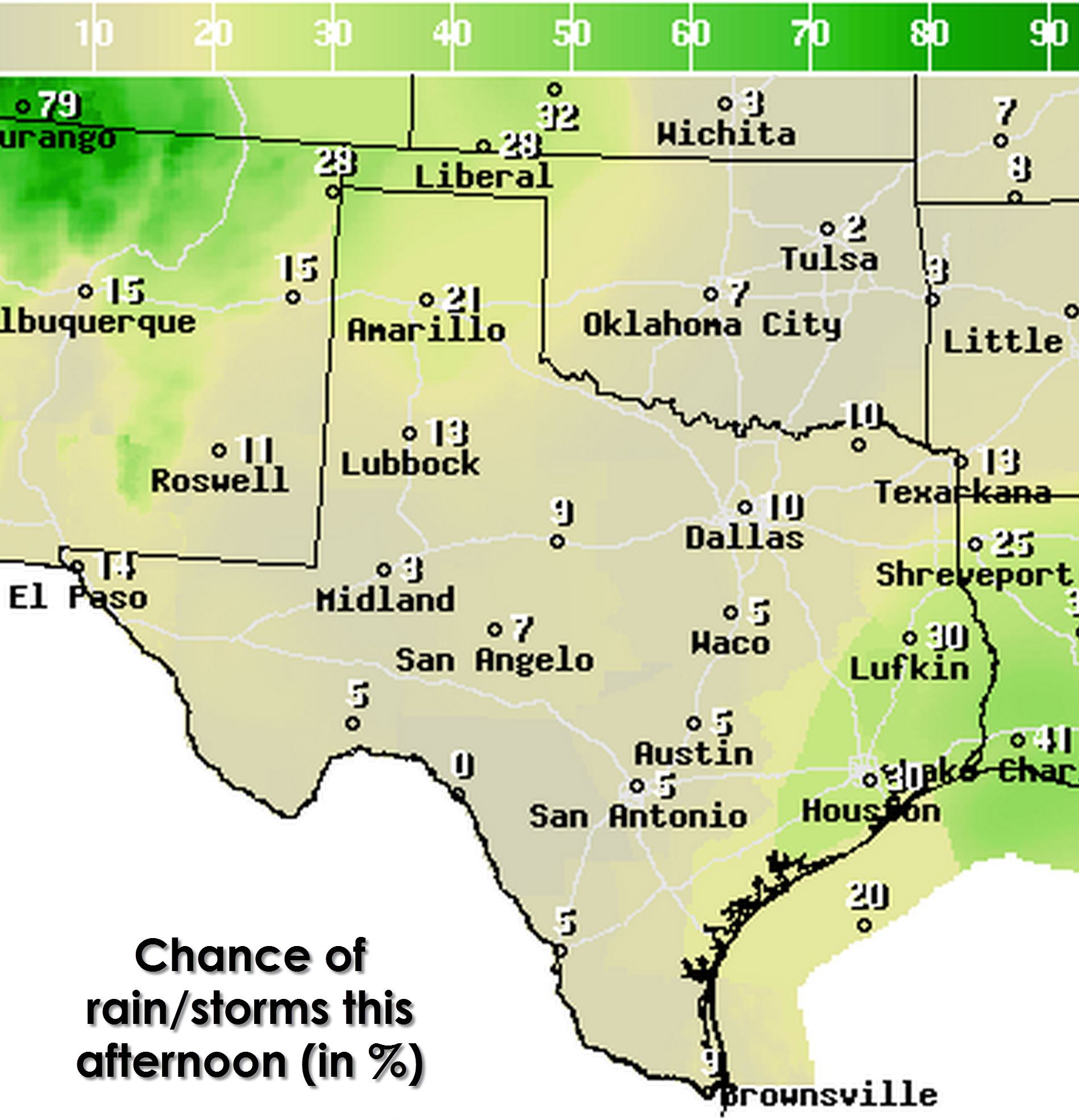
Chance of rain today (June 10)
Meanwhile today is going to feature the same story as the past few days. Temperatures will quickly warm this afternoon into the 90s for most of Texas. Heat index temperatures, or what it will feel like, will be a few degrees warmer than the air temperature. Some locations may approach 100 degrees today. As peak heating occurs this afternoon a few showers and thunderstorms are expected to develop across Southeast Texas thanks to the seabreeze. Additional more isolated storms will be possible in East Texas along with an isolated storm also possible in the Texas Panhandle. Each individual storm won’t last more than 30-45 minutes but the strongest updrafts could produce 50-65 MPH winds as they collapse. Otherwise frequent cloud to ground lightning and heavy rain is expected in proximity to the isolated storms this afternoon. Nothing unusual for the summertime ‘popcorn’ storms we deal with in the state.


0 Comments