
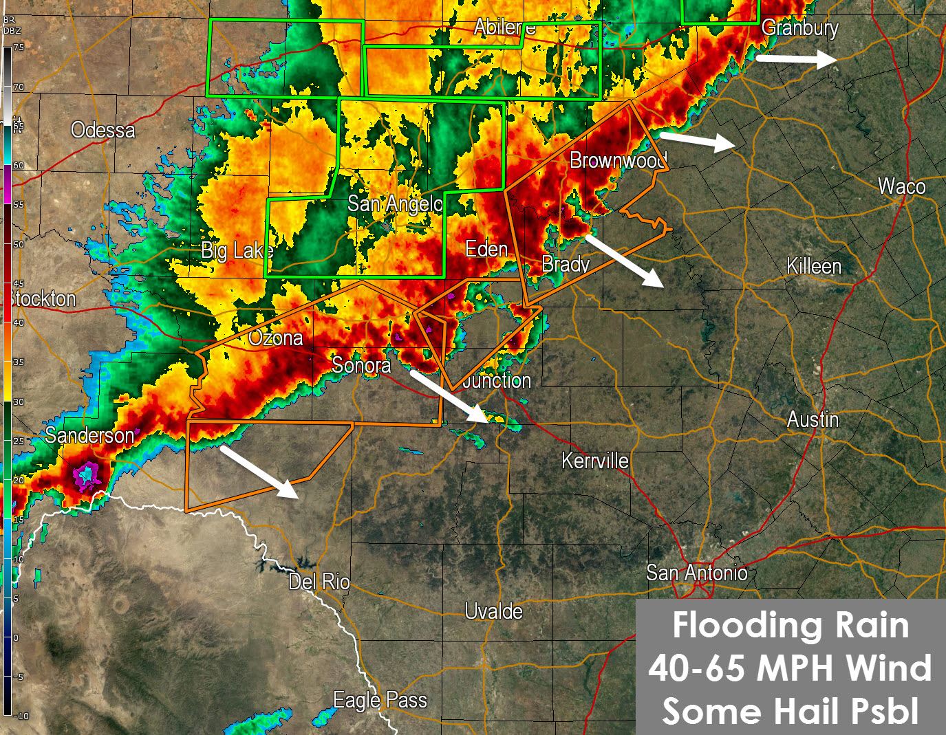
This update will be for Central and South-Central Texas. We posted a North Texas update a few minutes ago here. A line of severe thunderstorms extends along a Brownwood-Brady-Sonora line southwest into the Big Bend Plateau. These storms are moving southeast at 45 MPH. We should see the severe weather threat slowly diminish through midnight as the storms move into a less favorable environment for severe thunderstorms. While the environment over South-Central Texas may not be as favorable for severe thunderstorms it has plenty of moisture to support heavy rain. The High Resolution Rapid Refresh model run at 7 PM CDT indicates the potential for heavy rain to cause flooding tonight around the San Antonio Metro and points west/northwest. I wouldn’t take those locations to the bank but it wouldn’t surprise me based on the current radar. Obviously it won’t take much rain to cause more flash flooding tonight hence why a Flash Flood Watch is in effect. Storms are still a few hours away from Interstate 35 and the Austin/San Antonio metro. While not guaranteed for sure don’t be surprised to wake up to some thunder and heavy rain overnight. Those in low-lying areas and typical trouble spots should keep an eye on things just in case we see flooding set up in your area. 1 to 4 inches of rain will be possible tonight.


0 Comments