
If you don’t like the weather in Texas just give it a few days. Last week we were dealing with winter storms galore and now we’re dealing with almost the exact opposite. A low pressure system is expected to develop tonight across the Texas Hill Country into Central Texas. Once this low develops it will set the stage for a heavy rain event from South-Central Texas eastward across East-Central and Southeast Texas including the Brazos Valley. This process isn’t too dissimilar to events we’ve seen during the early summer months. With a El Nino-like pattern in place and an active sub-tropical jet our weather pattern continues to remain active.
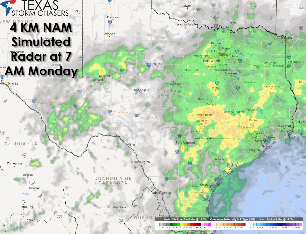
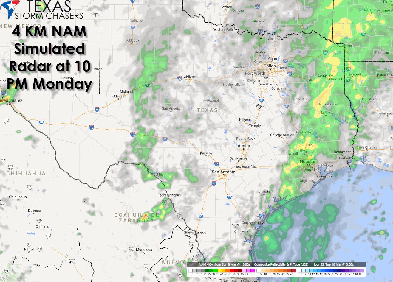
At the time of this posting we have widespread rain across East and Southeast Texas. Another round of rain is beginning to develop across the Permian Basin and Southwest Texas. This activity will continue to move east this evening. By Monday Morning the North American Model has widespread rain falling across North Texas, Central Texas, South-Central Texas, Southeast Texas, East Texas, and Northeast Texas. We note the model has the heaviest rains at 7 AM on Monday across Central Texas into the Brazos Valley and Southeast Texas. By Monday afternoon there has been a slight eastward shift in precipitation but otherwise the picture hasn’t changed much. One large area of rain continues across East and Southeast Texas with another batch of rain across the Permian Basin. By 10 PM Monday things are starting to wind down across the Permian Basin and along the I-35 corridor. Rain continues across Northeast, East, and Southeast Texas.

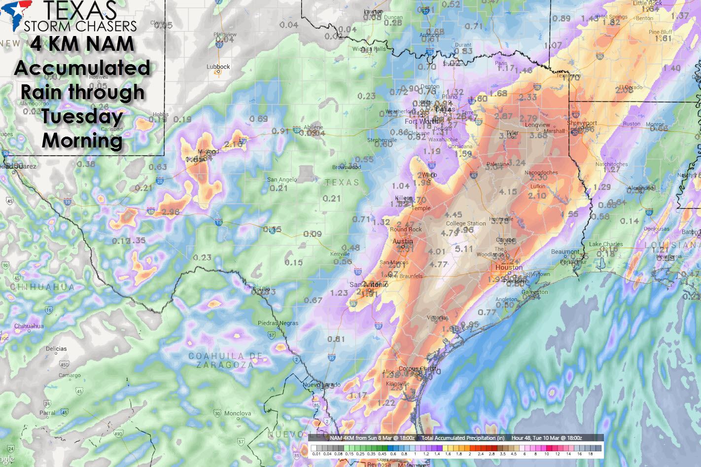
The setup tonight into Monday is supportive of heavy rains. The good news is we could really use the rain and definitely will welcome it with open arms. One small caveat is some of the rain tonight into Monday may fall heavy enough to trigger localized flooding issues. This is especially true in parts of South-Central, Central, Southeast, and East Texas where the heaviest rain is expected through Monday evening. While widespread flash flooding is not expected we could see issues in the typical troublespots or where we see very heavy rainfall in a short period of time.
Cold air is not an issue with this system and no winter weather is expected. On the other side of the spectrum widespread cloud cover will keep the atmosphere relatively stable and thus not supportive of severe thunderstorms. I know after last week its hard to believe but we’re actually entering our spring severe weather season in Texas.


0 Comments