
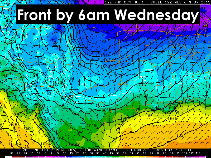
Today ended up being quite an enjoyable day with temperatures in the 50’s and 60’s for much of the state earlier this afternoon. A bit cooler up in the panhandle, but overall quite pleasant for the first week in January! That will all change by tomorrow as the 2nd Arctic front of the week arrives. By 6am tomorrow morning, the front will have pushed through the panhandle and into western north Texas. By noon, the front will be pushing through central Texas and by nightfall, it will have cleared the gulf coast counties. You’ll know when it arrives as gusty north winds, 20 to 30mph…with some gusts up to 40mph…will accompany the front’s arrival and will linger for several hours afterwards.

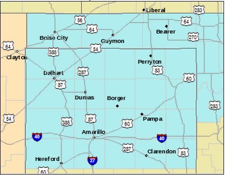
Wind Chill Advisories are in place for most of the Texas panhandle beginning at 3am tonight and continuing until 10am tomorrow morning. Chill values between -5 and -15 degrees and surface temperatures in the teens and low 20’s. Coats, hats, gloves, scarves and warm layers will be a must as you head out the door tomorrow morning.
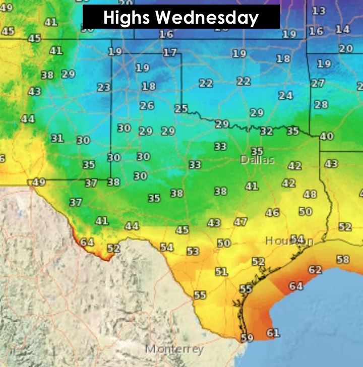
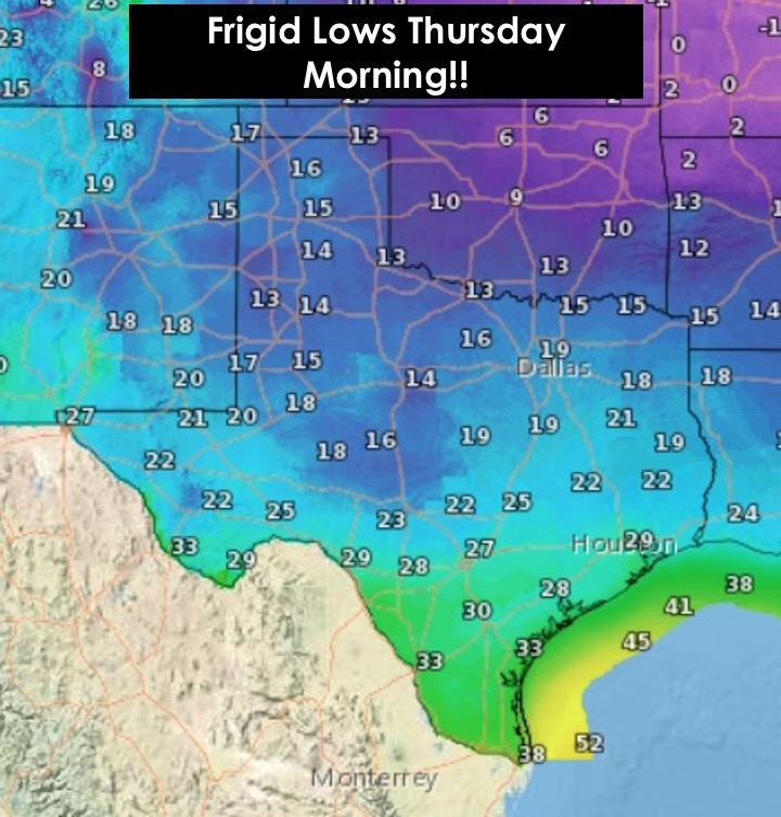
Highs tomorrow will be reached early on in the day across the northern half of the state as the front will steadily drop temperatures behind it. Ahead of the front across central and southern Texas, temps will climb into the 40’s and 50’s before crashing into the 20’s and low 30’s by early Thursday morning. Hard Freeze Watches will be in place across several counties (Brazos, Burleson, Grimes, Houston, Madison, Polk, San Jacinto, Trinity and Walker) in southeast Texas where temperatures will drop into the teens and low 20’s by Thursday morning. If you’ve not already done so, take care of the four P’s…People, Pets, Pipes and Plants! Be sure any exposed outdoor pipes are wrapped, bring in the pets or provide hay, blankets and shelter for them, bring in or cover sensitive tropical plants, and be sure to bundle up as you head out to work or school Thursday morning! Also, PLEASE remember to turn off your automatic sprinklers as this could cause hazardous conditions on urban sidewalks and streets!
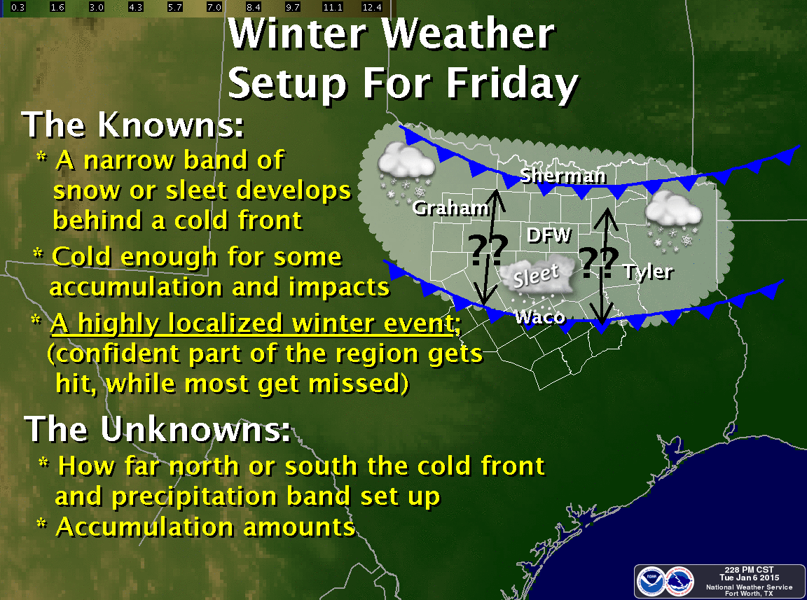
WINTER WEATHER UPDATE FOR FRIDAY: We’re still looking at a chance of at least a light mix of winter precip across parts of central and northern Texas beginning late Thursday night and lasting through early Saturday. There’s still some uncertainty in the timing of our next (3rd) cold front of the week and the precipitation chances. Right now, it looks like the front will push through northern Texas late Thursday and into Friday. Lift from an approaching upper level low will also be on the increase during this timeframe and through at least Saturday. The trick will be if this front is strong enough to push the cold air down fast enough to coincide with the best lift and rain chances which would bring the greatest chance for a snow, sleet and freezing rain mix. That is still a bit unclear at this point, but the forecast models continue to hint at some risk of seeing a mix of snow and sleet during the day Friday across the DFW area and surrounding parts of north and central Texas. It could cause some isolated travel impacts for residents mainly north of the I-20 corridor, so keep that in mind for your Friday commute. We’ll have additional updates and more precise graphics out as the forecast becomes more clear, so stay tuned!


0 Comments