
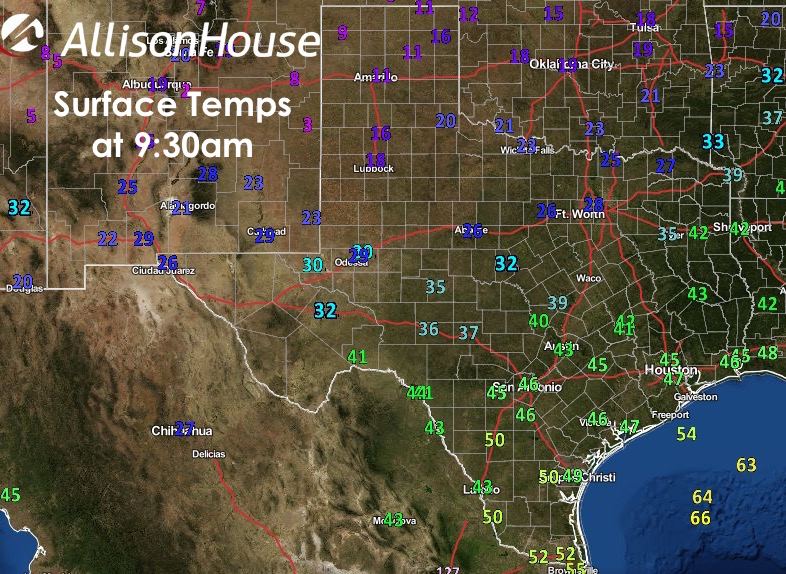
The first of two arctic fronts expected this week has arrived overnight and is quickly pushing south towards the Texas gulf coast this morning. Behind the front, winds have turned gusty from the north and temps are dropping off quickly. We currently have single digit readings in the panhandle, teens and 20’s across the south plains and north Texas. Wind Chill values have dropped to -5 in Amarillo and -8 in Lubbock. Some of the outlying towns have even lower wind chills…one city in particular, Dumas, is currently showing a wind chill of -12. Here’s a look at our current temps as of 9:30am.
Highs today will have been reached early on in the day before frontal passage. Lows tonight, chilly with teens and 20’s expected across much of the panhandle, west and northern Texas. Further south, 20’s and 30’s will prevail.


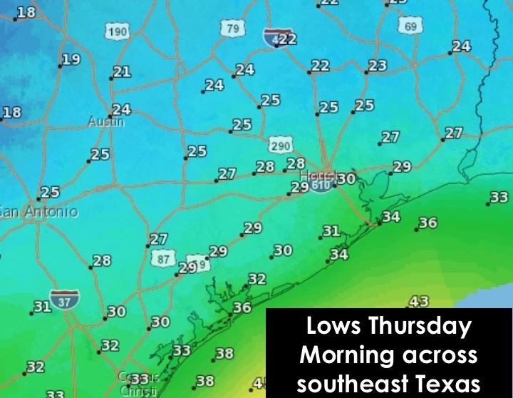
We’ll have a slight warm up on Tuesday, then our next arctic blast arrives late Tuesday into Wednesday. Thursday morning lows everywhere will be the chilliest of the week…even down into southeast Texas where temps are expected to drop down into the upper mid to upper 20’s. It’s not that often this region gets this cold so take precautions now to protect pipes, plants, pets and prepare to dress warmly as you head out to work or get the kids off to school Thursday morning!


0 Comments