
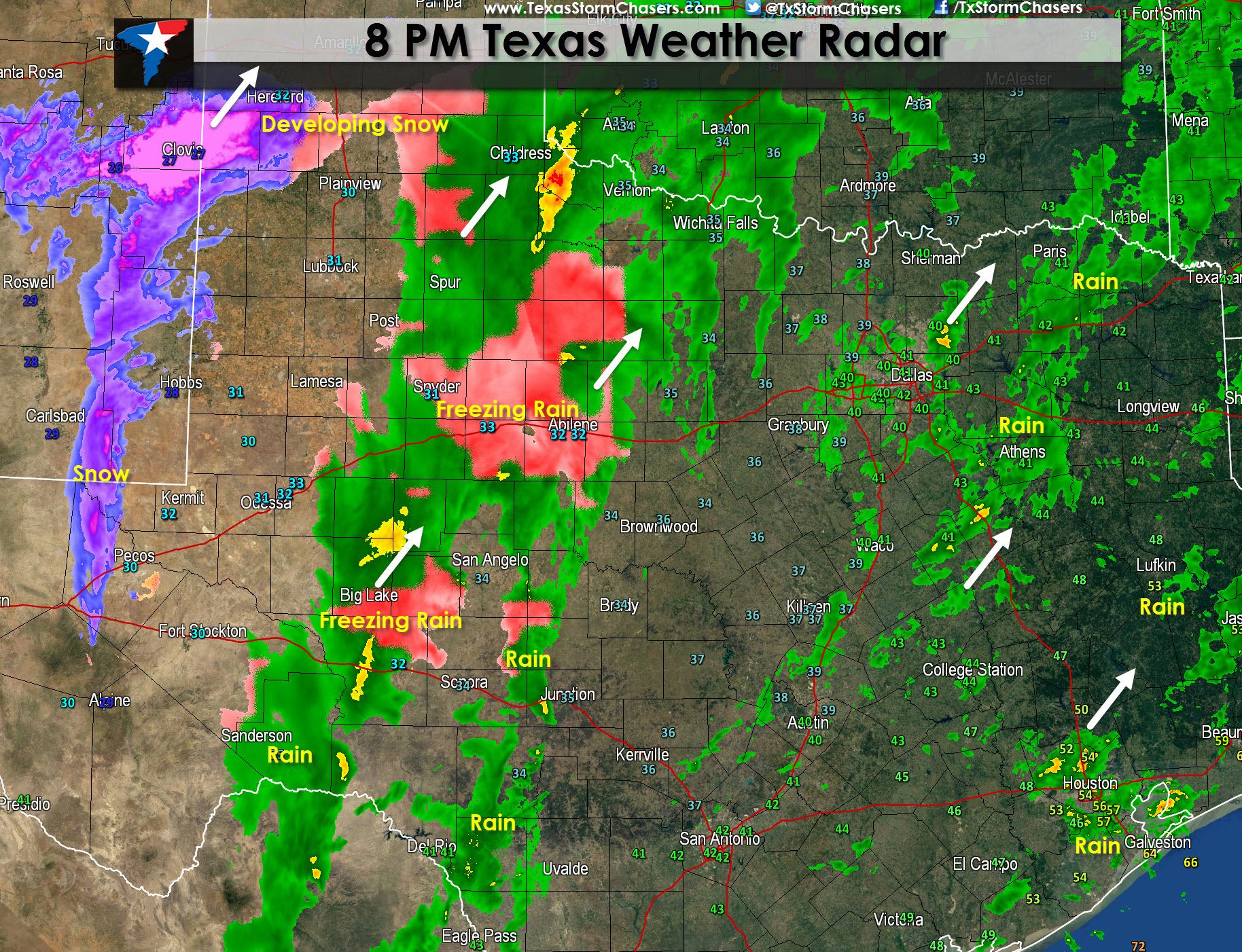
* Snow will increase in coverage over the next hour across parts of the Texas Panhandle and South Plains. The lower levels of the atmosphere in the Panhandle are quite dry so it will take some time for it to moisten up. That same process will cause evaporative cooling and surface temperatures in the Panhandle will likely fall into the upper 20s to around 30F. Snow accumulations of 3 to 5 inches are anticipated tonight across the Panhandle, South Plains, and Permian Basin where a Winter Storm Warning is in effect.
* Freezing rain or rain depending on surface temperatures continues across Northwest Texas, West-CEntral Texas, and the Concho Valley. Where temperatures are at 32F or below freezing rain is occuring and will accumulate on most surfaces. Most locations are sitting just above freezing but Abilene is reporting 32F so some icing may occur on elevated surfaces. With temperatures hovering near freezing localized icing is certainly possible over the next few hours.
* As the upper level forcing increases elevated thunderstorms have formed across parts of East and Southeast Texas in a layer of warm air a few thousand feet above the ground. These storms are capable of producing small hail and frequent cloud to ground lightning as they move north/northeast. Severe weather is not anticipated. Warm air is moving in in extreme Southeast Texas where surface temperatures have climbed into the 50s to lower 60s near the coast. This area does have unstable air and we may deal with a few strong storms after midnight in extreme Southeast Texas into Louisiana.


0 Comments