
The forecast for this afternoon and tonight continues to remain a tricky one due to warm air advection playing havoc with the temperature forecast. No one ever said forecasting winter weather in Texas was easy though.
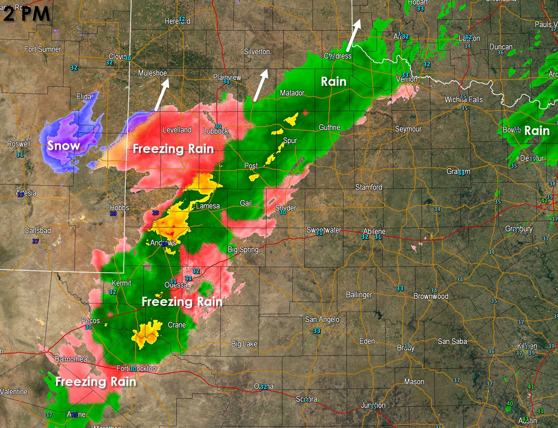
An area of moderate to heavy precipitation is falling form the Alpine Mountains northeast to Odessa to Lubbock and Quanha. This band has been training on nearly the same locations for a few hours now. This will continue through the afternoon before upper level forcing enters the region and expands precipitation. Temperatures across the northern Permian Basin and South Plains remain near or just below freezing. Warm air advection above the surface is helping push temperatures up in areas not seeing precipitation. As the heavier precipitation begins to push into an area the wet-bulb effect begins. Without going all nerdy I’ll just say that will usually help drop temperatures a few degrees in some cases (we’ve seen it a couple times today). That’s why keeping an eye on temperatures will be key today.
Here’s a few key temperatures for ice accumulation.
* Locations with temperatures above freezing (above 32F) will not have ice accumulate and any precipitation that falls will be in the form of rain.
* Locations with temperatures in the 31-32F range will likely see ice accumulate on elevated surfaces such as bridges/overpasses. Difficult to get accumulation on surface roads.
* Locations below 30F are much more likely to see accumulations on all surfaces including icy surface roads.
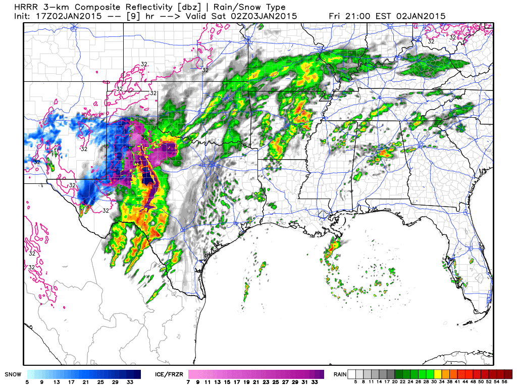
The band of precipitation across parts of the Permian Basin and South Plains will continue through the evening hours. As upper level forcing increases this evening precipitation will expand in coverage. Here is what the HRRR is showing around 9 PM this evening. The blues indicate snow as the primary precipitation type while the pinks/purples indicate freezing rain with rain in the typical color scheme. Notice how much more precipitation we expect to develop later this evening. We’ll have to watch the freezing line closely as those above freezing will be in good shape while those who fall below freezing will start dealing with additional accumulations.
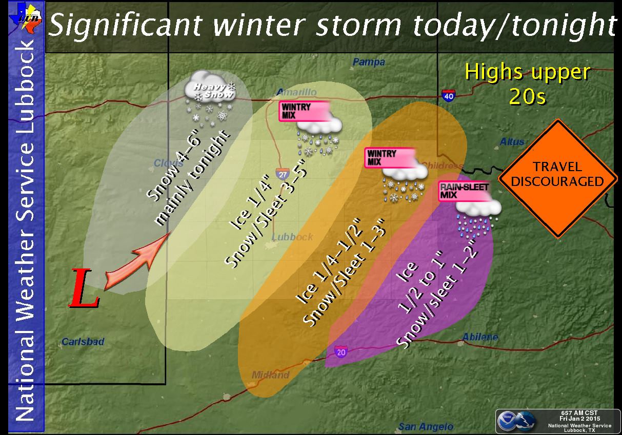
Here’s what the NWS Lubbock is forecasting for accumulations through tonight across their County Warning Area (CWA).


0 Comments