
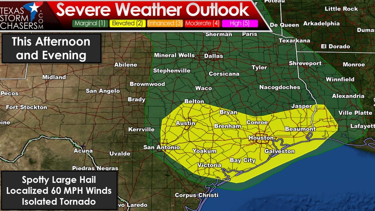
The Storm Prediction Center has upgraded Central Texas, the Brazos Valley, the Coastal Plains, and Southeast Texas to a category 2 risk of severe weather for this afternoon and evening. The latest short-term high resolution weather models are indicating we may see convective intensity increase as afternoon heating continues to destabilize the atmosphere. The primary concern today will continue to be flash flooding, but a couple severe storms are also possible. The strongest storms may produce large hail, localized damaging wind gusts, and even an isolated tornado. Its possible storms may congeal into a cluster or lien this evening and slowly move south. Otherwise Jenny’s forecast from an hour ago remains valid and can be read here.


0 Comments