
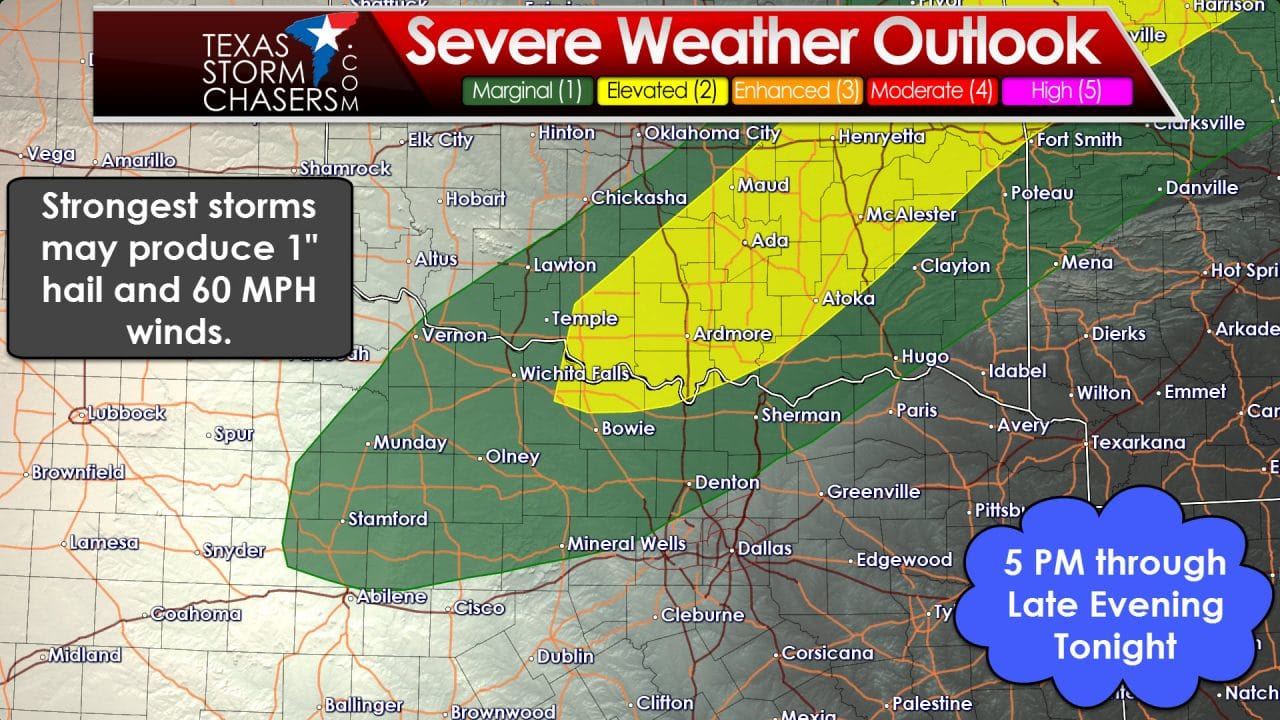
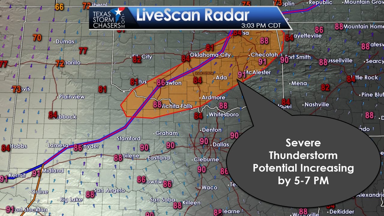
Compared with the forecast this morning there are little changes needed for the next few hours. The Storm Prediction Center has increased the severe weather risk up from level one to level two along the Red River in Texoma. This isn’t really a surprise as this is where thunderstorm coverage will be highest by the early to mid evening hours. I still am not anticipating widespread severe weather. A few storms will probably pulse up and produce quarter size hail and wind gusts over 60 MPH. The highest concentration of severe weather reports should be north of the Red River. As storms build to near and south of the Red River in Northwest Texas by 6 PM we should see a few become strong. The primary threat with the strongest storms would be quarter size hail and wind gusts over 60 MPH. Locally heavy rain will also be an issue, but flooding issues should remain localized and minor.
The cool front responsible for this afternoon’s storm chances will move south of the Red River late this evening. Scattered storms will accompany the front as it moves south. Some of these storms may be strong with gusty winds up to 55 MPH and small hail. A marginal severe weather risk will continue into the late evening across the Big Country and North Texas. I really don’t anticipate too many issues after 10 PM – although storms will certainly put on a light show. Activity will decrease in intensity as it approaches Interstate 20 late this evening with the severe weather threat quickly coming down.


0 Comments