
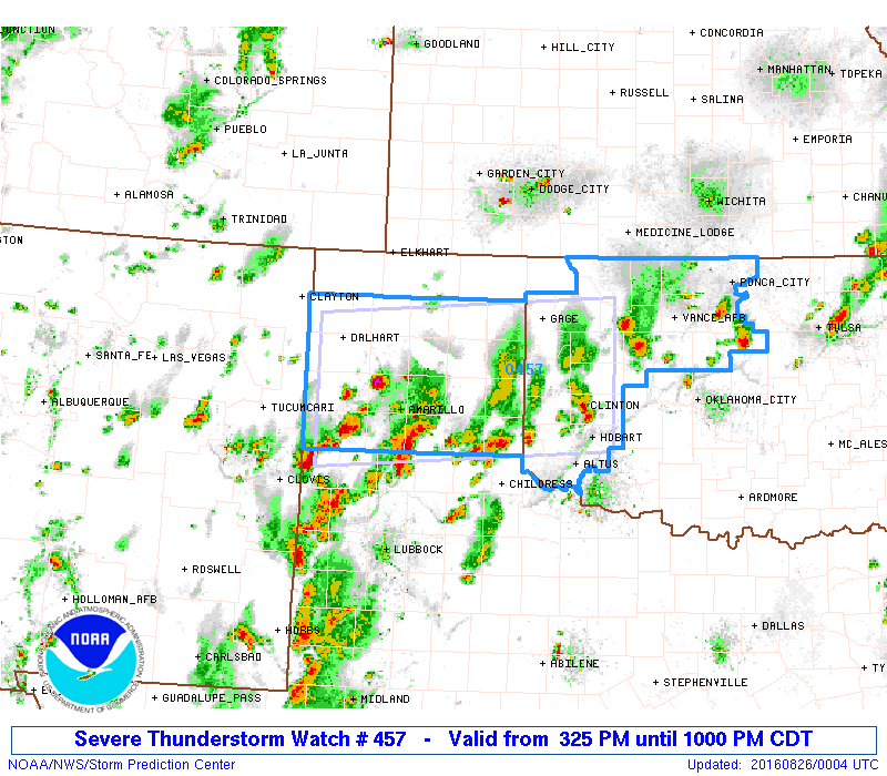
Widespread rain and thunderstorms will continue across much of the panhandle region as an upper level system lifts northeast out of New Mexico. Plenty of moisture will continue to flow across the region overnight, which combined with the lift from the upper level disturbance, will continue to generate rain and thunderstorm chances this tonight and into early tomorrow morning. A Severe Thunderstorm Watch remains in effect across the region through 10pm this evening, after which the threat of severe weather should be on the decrease through the overnight hours. Not everyone will see heavy rain tonight, but those that do could pick up a quick 1 to 3 inches of additional rainfall. Street and field flooding will be likely for those with the highest rainfall amounts through early tomorrow, so drive with caution as you head out on the roadways early tomorrow.

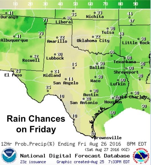
For tomorrow, the western half of the state will see rainfall chances decrease while the eastern half of the state will see rainfall chances increase. Scattered showers are expected to develop by late tomorrow morning across much of central and eastern Texas with northward expansion likely through the afternoon hours. Severe weather is not expected; however, a few cells could become strong with a threat of localized heavy downpours, downburst winds and frequent cloud to ground lightning. The chance for rain will be highest east of the I-35 corridor with accumulations averaging up to about 1/2 inch with some locally higher amounts. Not what you’d call a frog strangler, but a decent amount to keep the lawn watered.


0 Comments