
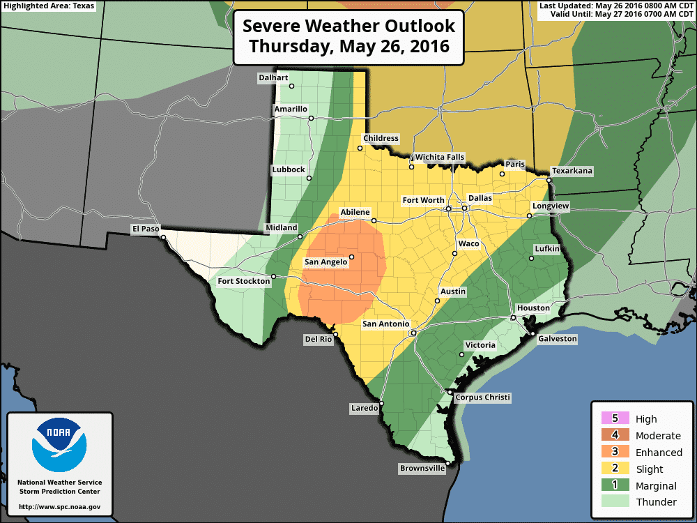
Showers and thunderstorms are underway this morning from Northwest Texas south through the Hill Country into Central Texas. All this activity is moving northeast. The ongoing showers and widespread cloudiness will result in a messy convective setup for this afternoon and evening. The Storm Prediction Center has placed the Concho Valley in a category 3 risk of severe weather for this afternoon and evening. A category 2 severe weather risk extends from Northwest Texas south to Southwest Texas – extending east to Central Texas, North Texas, and Northeast Texas. The strongest storms later today and tonight could produce large hail, damaging wind gusts, localized flash flooding, and isolated tornadoes. Storms may develop by the early to mid afternoon hours just east of the dryline in the western area of the risk zone. Some of these initial storms may be supercells. By the late afternoon hours storms may be congealing into a cluster or squall line. That line of storms will slowly march east with a threat of hail, damaging wind gusts, and very heavy rain capable of producing localized flooding. Numerous thunderstorms are expected by the early evening west of Interstate 35. Large hail and damaging wind gusts are the primary concern today but flooding will become a threat tonight.


0 Comments