
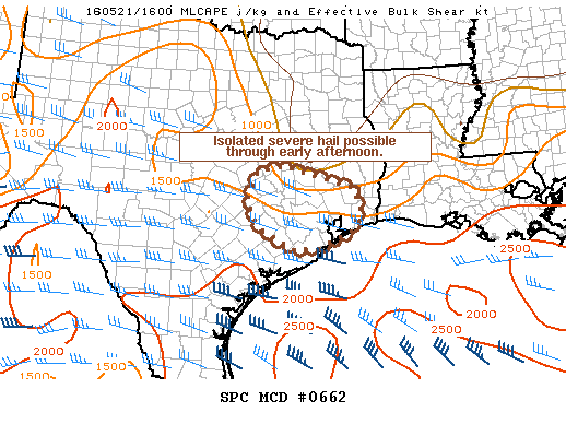
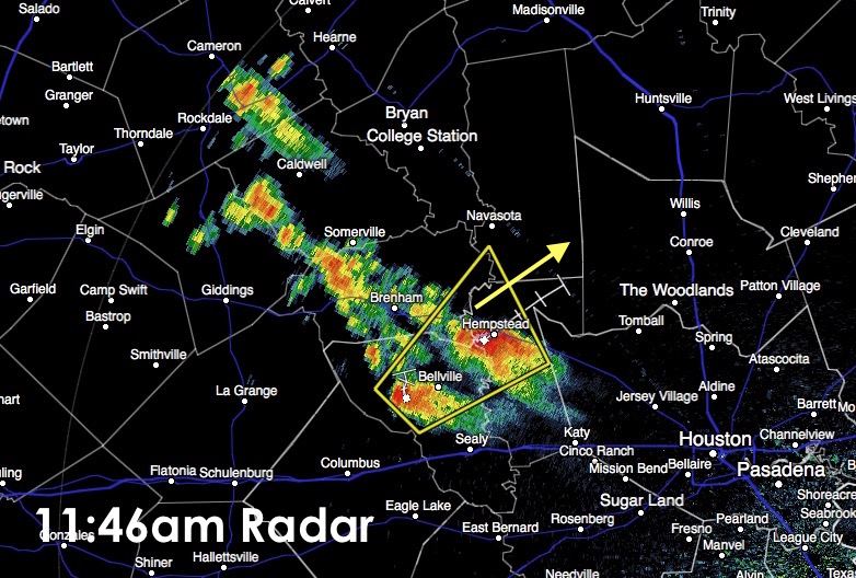
Isolated pop-up strong to severe storms with a threat of large hail is possible across portions of the central coast to southeast TX region this afternoon. Due to the very localized and scattered nature of storm development this afternoon, a severe weather watch is not likely; however folks in this region of the state could see at least some additional severe storm development through the late afternoon hours. Currently, we have one cell severe warned over Hempstead with 50+mph wind gusts and 1.5 inch hail possible. This group of cells is moving off to the northeast at 20mph. Lightning will also be a threat in and around any of the larger cells that develops, so if you’re outdoors and hear thunder, you need to head indoors. Lightning can sometimes strike over 10 miles away from the parent storm.


0 Comments