
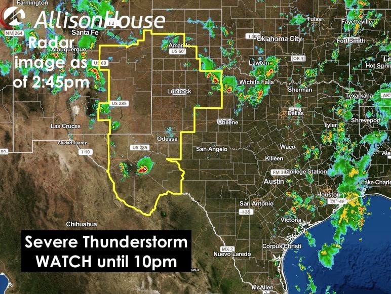
A severe thunderstorm WATCH has been issued for parts of the Texas panhandle and western Texas until 10pm this evening. A few storms are already ongoing across parts of northwest Texas and also in the trans-Pecos region east of Ft. Davis. Additional storms are likely to fire up across eastern New Mexico within the next couple of hours and slowly make their way east across the border into the southern panhandle and west Texas later this afternoon and evening. The storms that form this afternoon are expected to start out as isolated, then eventually congeal and merge into a large complex which will work its way east across this region into the early nighttime hours before dissipating after midnight. Large hail over 2 inches in diameter and damaging winds will be the primary threats, but an isolated tornado or two cannot be ruled out early on before the storms congeal. In addition to those threats, there will also be the chance of localized flash flooding under any of the stronger cells that develops. Residents across the area will need to keep an eye on the sky this evening if you have outdoor plans!
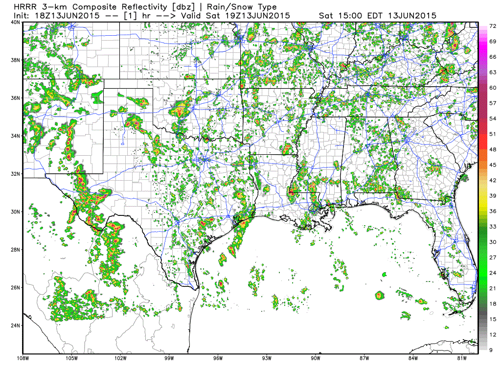
Simulated radar through 4am tomorrow morning.
SEVERE THUNDERSTORM WATCH NUMBER 297
   NWS STORM PREDICTION CENTER NORMAN OK
   200 PM CDT SAT JUN 13 2015

   THE NWS STORM PREDICTION CENTER HAS ISSUED A

   * SEVERE THUNDERSTORM WATCH FOR PORTIONS OF
     EASTERN NEW MEXICO
     WESTERN TEXAS

   * EFFECTIVE THIS SATURDAY AFTERNOON AND EVENING FROM 200 PM UNTIL
     1000 PM CDT.

   * PRIMARY THREATS INCLUDE...
     SCATTERED LARGE HAIL LIKELY WITH ISOLATED VERY LARGE HAIL EVENTS
       TO 2.5 INCHES IN DIAMETER POSSIBLE
     SCATTERED DAMAGING WIND GUSTS TO 70 MPH POSSIBLE
     A TORNADO OR TWO POSSIBLE

   SUMMARY...SCATTERED THUNDERSTORMS...INCLUDING A FEW
   SUPERCELLS...EXPECTED TO MOVE/DEVELOP EASTWARD FROM EASTERN NM INTO
   W TX THROUGH THIS EVENING.  OTHER STORMS MAY CONTINUE TO
   FORM/STRENGTHEN OVER EASTERN PARTS OF THE TX SOUTH PLAINS. SOME OF
   THE STORMS WILL BE CAPABLE OF VERY LARGE HAIL...LOCALLY DAMAGING
   WIND...AND POSSIBLY A TORNADO OR TWO.

   THE SEVERE THUNDERSTORM WATCH AREA IS APPROXIMATELY ALONG AND 95
   STATUTE MILES EAST AND WEST OF A LINE FROM 60 MILES NORTH
   NORTHEAST OF CANNON AFB NEW MEXICO TO 45 MILES EAST SOUTHEAST OF
   MARFA TEXAS.


0 Comments