
* As of 4 AM all tornado watches have expired.
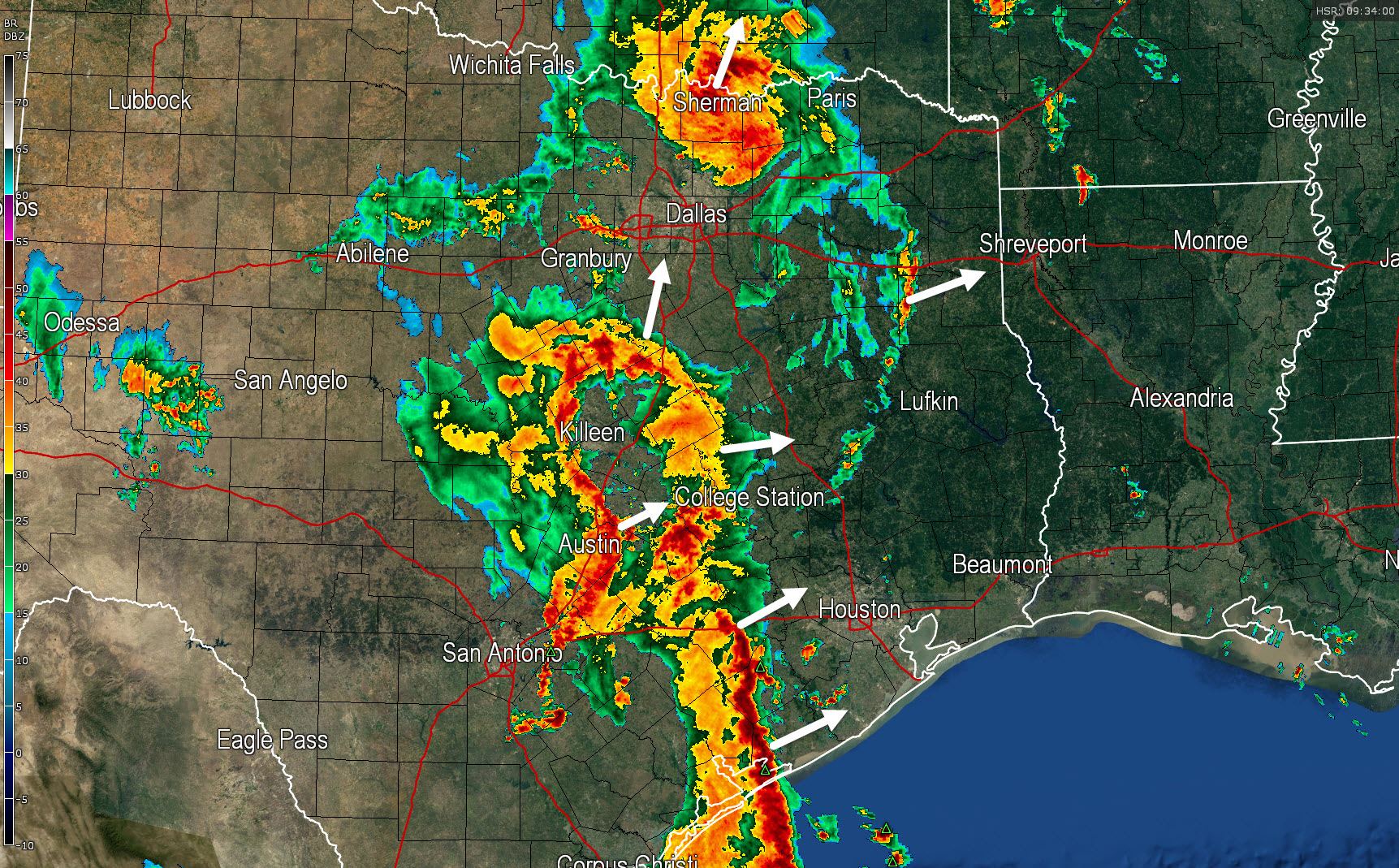
* A line of severe thunderstorms from the Gulf Coast near Palacios north to El Campo to Columbus is moving northeast. This line will impact the Houston Metro south to Galveston around 6 AM most likely.
* Heavy rain has moved north of D/FW but continues to rain heavily along the Red River. Flooding will continue to be a problem for a few more hours. Additional heavy rain will arrive later this morning from the south with a continued flood threat.
* Significant flooding has now reached San Marcos and Kyle along Interstate 35 (which is flooded).
* While a few severe storms remain possible this morning in Southeast TExas, the most problematic threat will be flooding.
* Widespread rain will continue through mid-morning before moving into Northeast and Extreme East Texas by 2 PM. Activity will be more isolated behind (west) of this line this afternoon.


0 Comments