
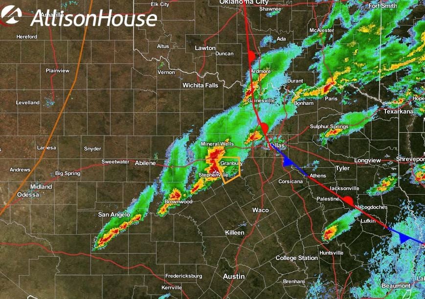
Still under the gun for a threat of additional tornadic development across west central Texas as a line of fast moving storms advances east. Most of the DFW metroplex is behind the stalled front; therefore, not anticipating tornadic development, but folks could see impacts as a line of storms currently approaching Ft. Worth from the southwest. Another smaller complex of storms in the northern Tarrant/Southern Denton county is currently being monitored, but no severe warning is expected at this time. Reports coming out of Stephenville indicate high winds with power line and tree damage, plus golf-ball size hail. These storms are fast moving. Glen Rose, Granbury, Pecan Plantation and surrounding communities need to prepare now for these potential impacts. Further southwest between San Angelo and Brownwood, additional severe storm development through the evening is anticipated. This line of storms stretched across west central Texas has a history of producing tornados. Folks in the path of these approaching storms will also need to take the necessary precautions to find shelter and stay safe. Track the storms live via our interactive radar at: https://texasstormchasers.com/radar


0 Comments