
Let’s hope this is Winter’s Last Stand, shall we? Numerous WINTER WEATHER ADVISORIES will be in effect tomorrow and into Thursday across the panhandle and northern Texas. I’ve broken them down by region below due to the timing of each.
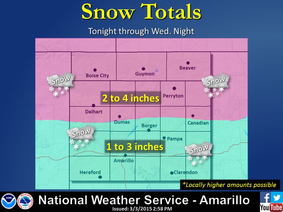
Panhandle: Advisories for the panhandle are in effect from Midnight tonight until Midnight Wednesday. Rain is already developing and is expected to change over to a mix of snow, sleet and freezing drizzle fairly quickly after midnight. Snow totals of 2 to 4 inches are possible across the northern panhandle, with 1 to 3 inches likely across the southern Panhandle including Amarillo. Main impacts will be accumulations on bridges and overpasses, especially for your Wednesday morning commute.
Southern Panhandle & Northern Rolling Plains: Advisories are in effect from 3am tomorrow morning until 12am Thursday morning. Accumulations of freezing rain, sleet and light snow is expected to develop after 3am tomorrow morning and spread south during the day. Snowfall accumulations between 1 and 2 inches is expected with hazardous travel conditions are expected for Lubbock and surrounding towns.

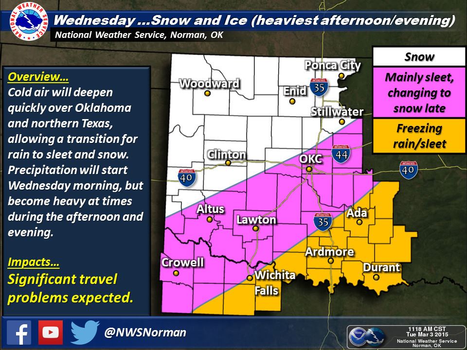
Western North Texas: Advisories are in effect from 6am Wednesday morning until Midnight Wednesday. A mix of sleet and freezing rain will be the primary threat between 6am tomorrow until noon. After that, a transition to sleet and snow is possible during the afternoon hours as deeper cold air advects across the area. The bulk of the winter precipitation is expected to fall between 3pm and 9pm which is expected to make the evening commute hazardous. This mainly affects the cities of Wichita Falls, Vernon, Archer City and surrounding towns.
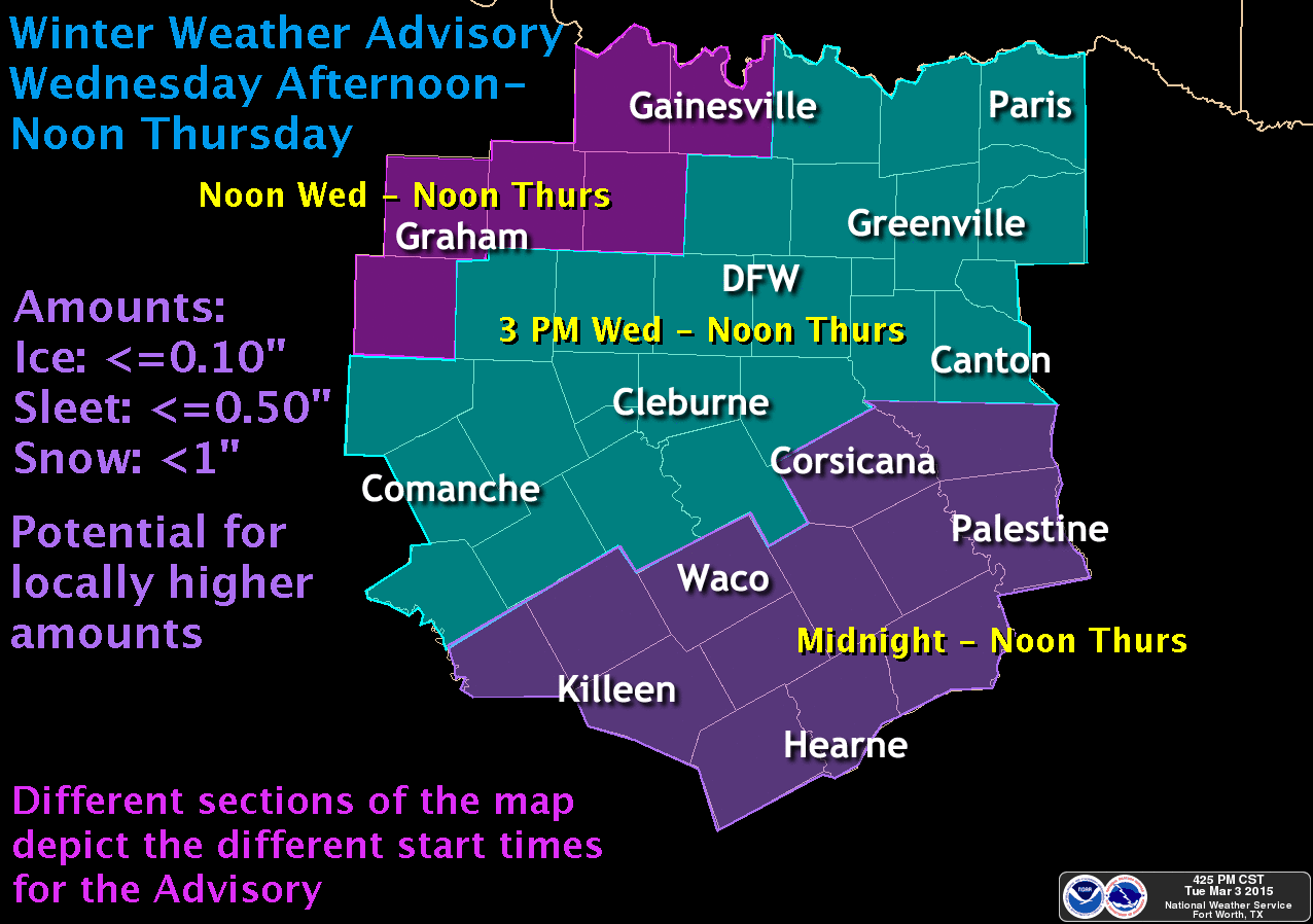
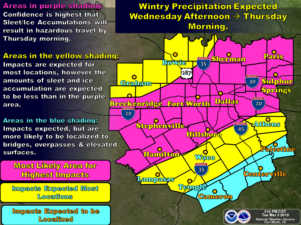
North and Central Texas…including the Dallas/Ft. Worth Metroplex, Waco and Killeen: Advisories here are broken down into three segments as indicated in the graphic below. For the northern portion of the Advisory, freezing rain is expected to begin around noon and transition to a mix of light sleet and light snow by the afternoon hours. Accumulations of 1/10th of an inch of ice is expected with snowfall accumulations at under an inch by the time the system has moved on. For the central portion of the Advisory area…and this includes DFW…winter precipitation is expected to begin around 3pm tomorrow afternoon starting with freezing rain which will transition over to a mix of sleet and snow later in the evening. Ice accumulations of 1/10th of an inch and snowfall accumulations up to an inch are expected by Thursday morning.
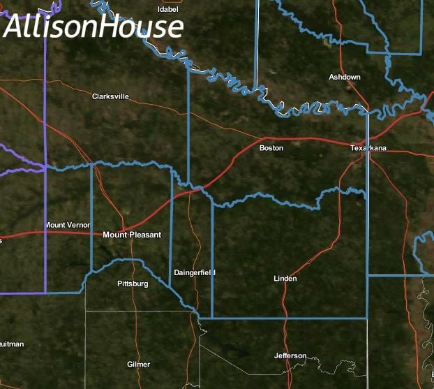
Northeast Texas…including Texarkana, Mt. Pleasant and surrounding towns: You folks are under a Winter Storm Watch beginning Wednesday evening and ending Thursday morning. Here, freezing rain is likely to develop Wednesday evening before transitioning to snow by early Thursday morning. Accumulations here will be light and generally under 1/4 inch.
While this is not expected to be a high-impact event overall with regard to snow or ice totals, wind chills behind the front will be brutal and, as mentioned above, there will be some slick roads and bridges across the region during this event…especially for those impacted during morning or evening commutes. Also, if the cold air comes in faster than currently projected, we could see increases in sleet and snowfall totals which will just add to the fun. The latest model data is starting to roll in. Look for additional updates and graphics out later this evening!


0 Comments