
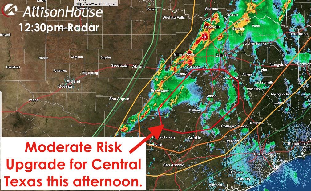
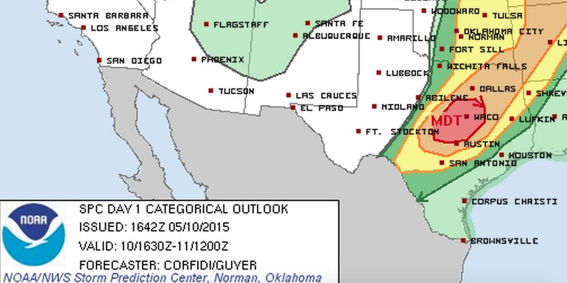
The latest Storm Prediction Center update has upgraded parts of central Texas to a Moderate Risk of severe weather this afternoon. This includes the cities of Hillsboro, Waco, Belton, Hamilton, Lampasas, Burnet, Georgetown, Marlin and Groesbeck and surrounding communities. An outflow boundary from this morning’s storms combined with the dryline and a strong upper level disturbance will set the stage for potentially severe storm development this afternoon within this region. Supercell thunderstorms with large hail, copious amounts of heavy rain, and a threat of tornadoes will exist well into the afternoon and evening hours as this system slowly works its way east today. Folks within this region will need to pay special attention to the weather throughout the day and heed warnings once they are issued.
0 Comments