
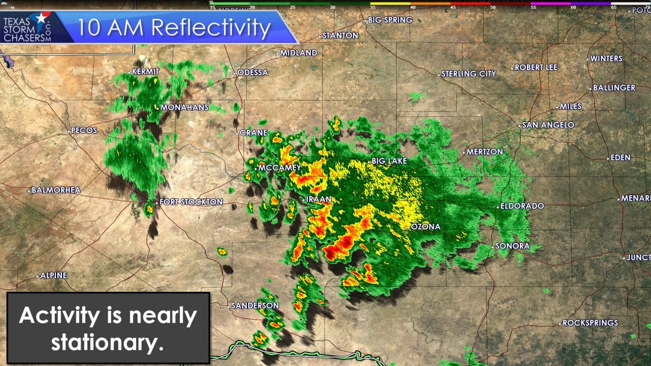
An area of moderate rain continues to fall across the southern Concho Valley and Southwest Texas this morning. This area of rain produced 3 to 5 inches of rain in San Angelo this morning resulting in some flooding issues. Local lakes should show some decent gains in the coming days. We’re also watching a disorganized area of light showers across Central Oklahoma. Visible satellite shows an outflow boundary making slow progress near the Red River from Wichita Falls to Gainesville. This OFB may shift south towards I-20 by early afternoon. Meanwhile an isolated shower or two remains possible as far north as Lubbock in West Texas this morning.
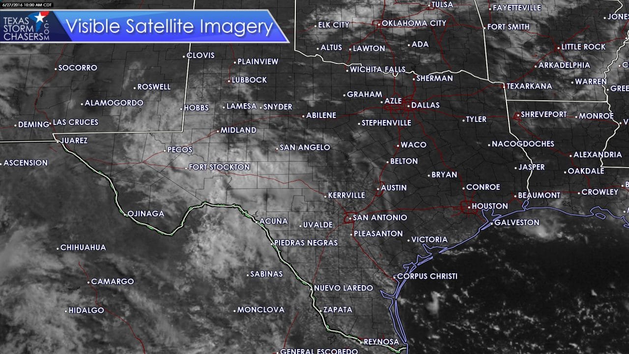
Visible satellite imagery is showing an increase in cumulus clouds from Austin south into the Rio Grande Valley. Cumulus is also developing in Southeast Texas. These areas of cumulus may lead to isolated to widely scattered shower and thunderstorm development this afternoon. The cap is weak and once temperatures warm this afternoon we should be able to pop a couple of storms. Wind shear values in the atmosphere are nonexsistant and widespread severe weather is not expected. With temperatures in the 90s today the atmosphere will certainly be unstable. Some storms may pop up quickly and become strong with small hail and strong, gusty winds. These storms will only last 45-60 minutes before they rain themselves out. As they weaken they’ll produce outflow boundaries that could help spark off additional storms nearby. That process will repeat itself several times until early evening. Overall we should see a 20 to 30 percent coverage of storms this afternoon.
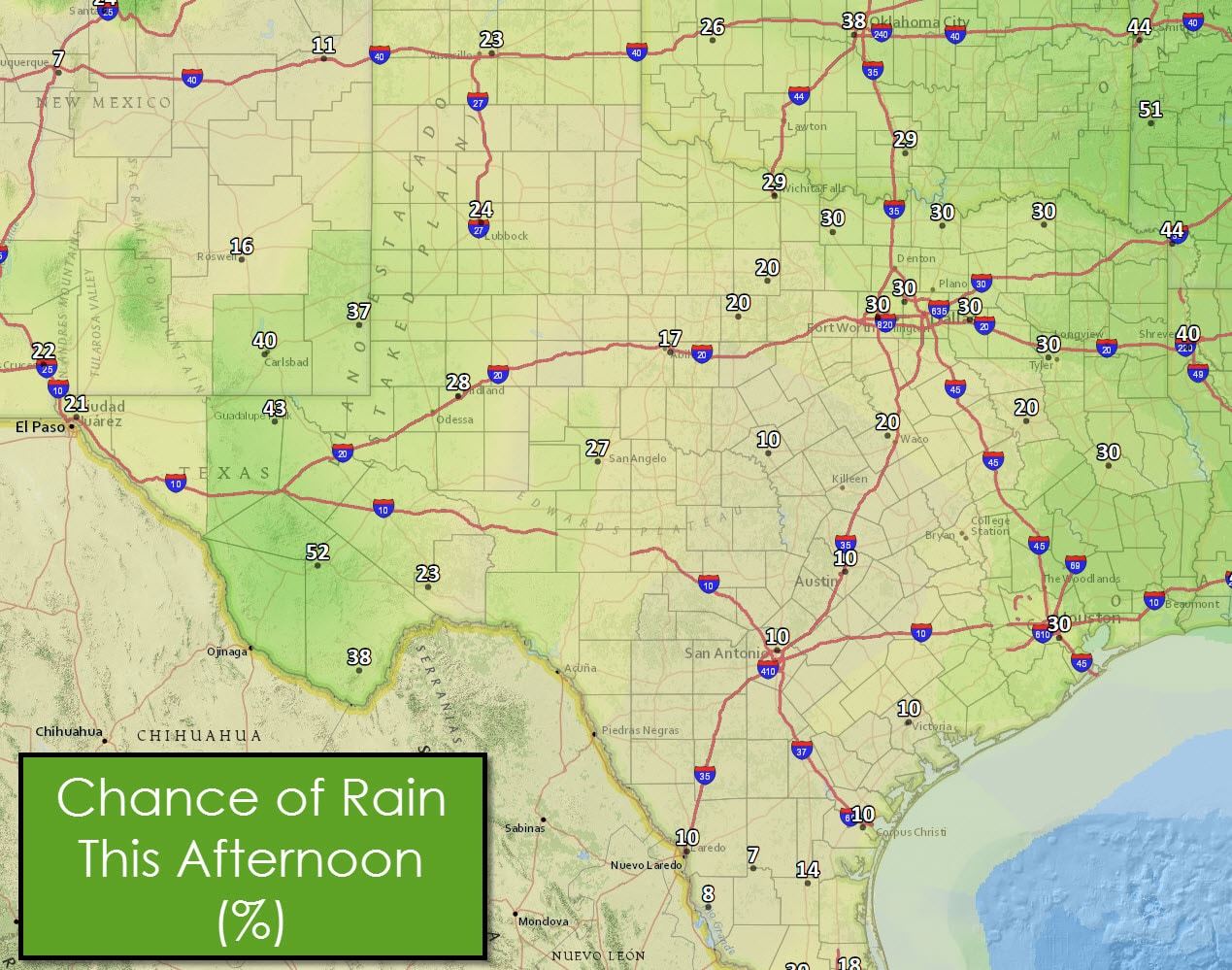
The outflow boundary pushing south of the Red River may also become a focal point for thunderstorm development this afternoon. The best chance for isolated storms will be from Wichita Falls to Dallas to Tyler and points north in Northeast Texas this afternoon. Like South and Southeast Texas storms will be ‘popcorn’ in nature with the outflow boundary production process likely helping to spark off additional isolated storms through early evening. A few storms may become strong with gusty winds, small hail, and brief heavy rains.
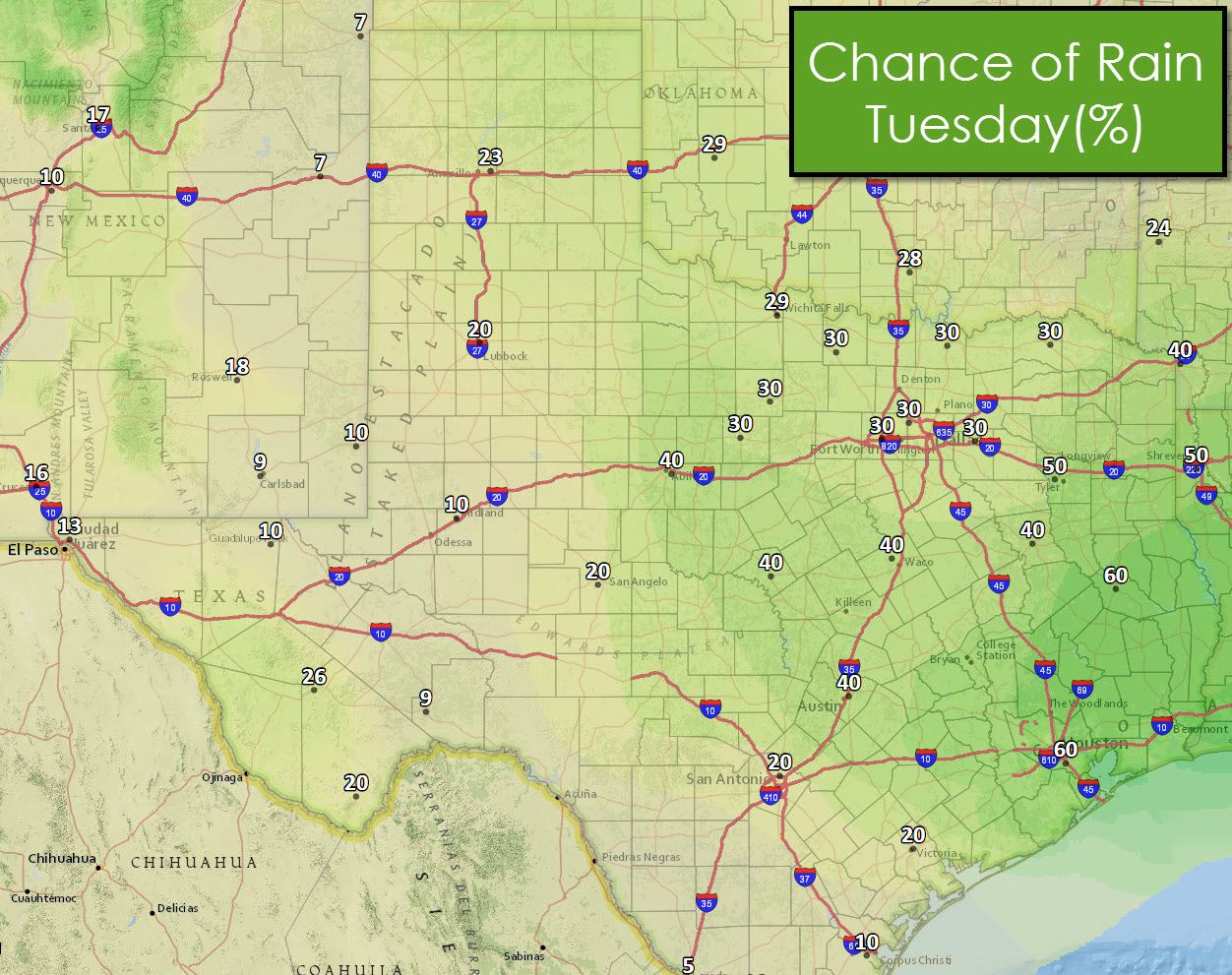
A weak upper level disturbance will move into Texas on Tuesday. A weak cap plus toasty temperatures will allow for scattered thunderstorms during the afternoon hours Tuesday. A few storms may be strong with small hail, gusty winds, and brief heavy rain. Showers and storms today will also leave a few outflow boundaries that could cause new storm development on Tuesday. We’ll chat this evening about the latest rain chances for tomorrow – but Tuesday does seem to be the best chance of rain this week.

0 Comments