
Starting out this morning we have a few blotches of green on the weather radar. Outside of a few sprinkles not much else in the way of precipitation is expected this morning. At most the sprinkles will be enough to partially wet the pavement and add to an already humid enviornment. Any shower activity should be out of the picture by 10 AM. After that the focus of the day will once again be on gusty south winds and seasonably hot temperatures. The Texas Panhandle, all of West Texas, the Permian Basin, Far West Texas, Northwest Texas, the Big Country, and the Concho Valley will end up near or over the triple digit mark this afternoon. Pecos is forecast to top out at 111°F today with Palo Duro Canyon possibly approaching 112-115° during the next two afternoons. Those are not heat index values – those are the actual air temperature forecasts! Amarillo, Lubbock, El Paso, Midland, Del Rio, and Eagle Pass will all top out between 102 and 107 degrees today. Don’t expect any cooldowns for the next several days as overnight temperatures will remain in the 70s to near 80 degrees.
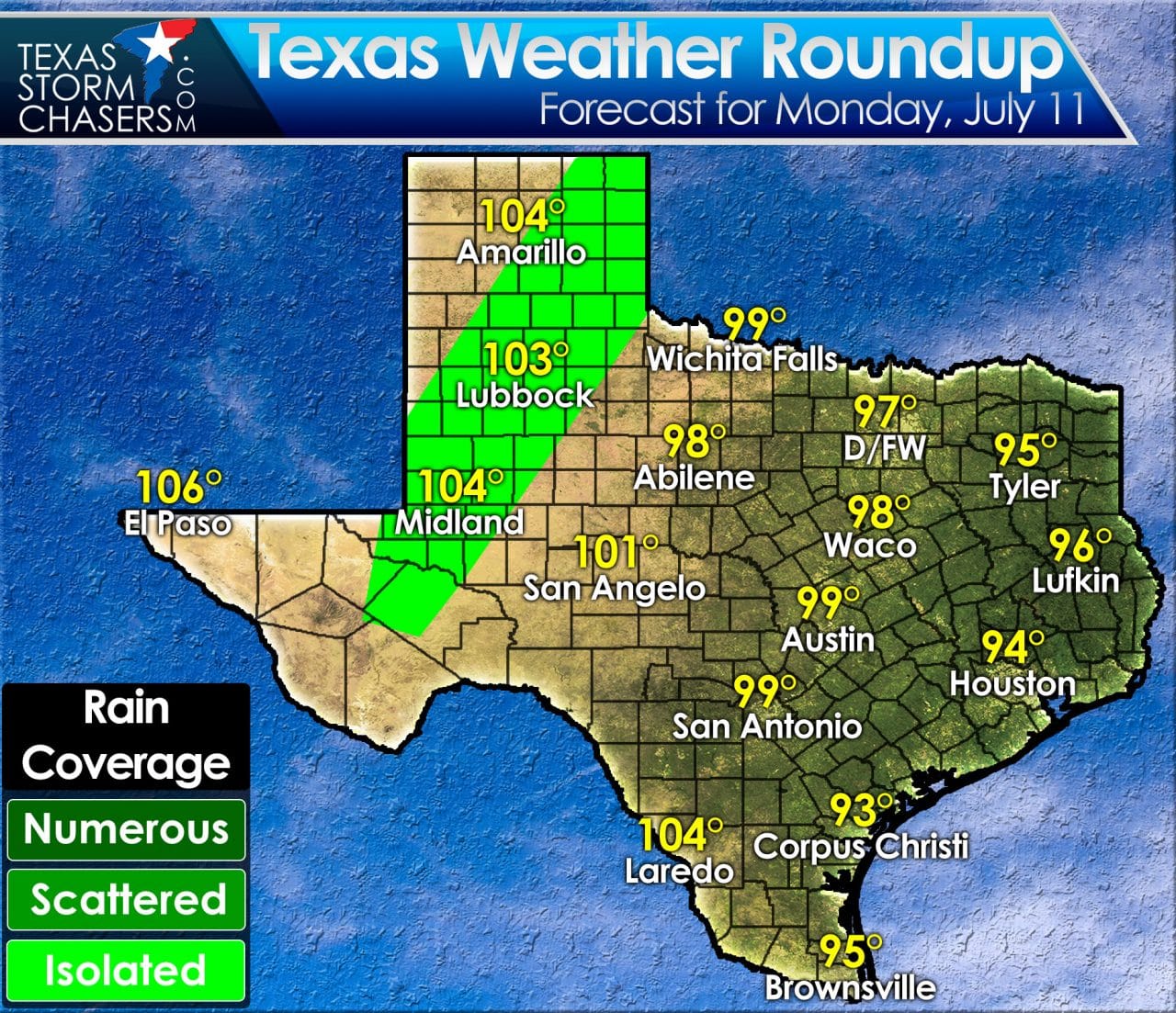
Heat index temperatures (what it’ll feel like) will be in the 102 to 108 degree range along and east of Interstate 35. One saving grace is that gusty south winds will at least provide a little relief. HUmidity will still be atrocious no matter how much wind we end up with today. One consequence of gusty winds and hot temperatures will be potential fast moving grass fires. Even with recent rains the hot temperatures and gusty winds will make for difficult firefighting. An isolated storm or two can’t be ruled out this afternoon in the eastern Texas Panhandle into West-Central Texas. The chance of being impacted by a storm is quite low, but not zero since the cap will be weakened with surface temperatures above 100 degrees. Much of the same weather is forecast on Wednesday.
0 Comments