
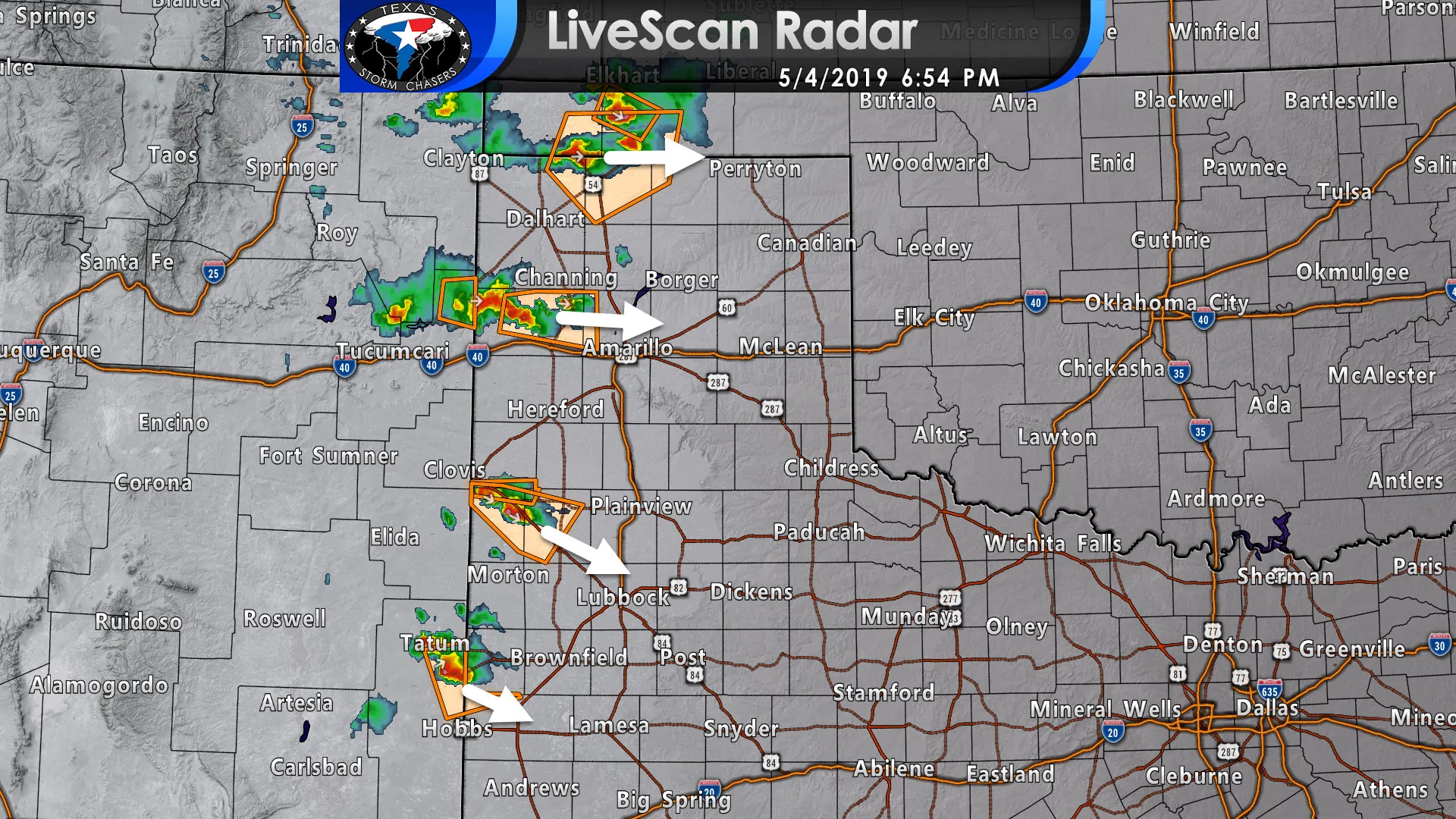
Scattered supercelluar thunderstorms have developed late this afternoon east of the dryline. Storms extend from the Oklahoma Panhandle southward into the western Texas Panhandle, Far West Texas, and into far Southwest Texas south of Marathon.
The exact movement of each storm is dependent on a variety of factors. Most storms are moving east or southeast at about 15 to 20 MPH.
Up until now, the primary concern has been very large hail out of the strongest storms. However, as cloud bases lower and we get an increase in low-level winds, we could see an isolated tornado threat materialize over the next one to two hours.
The overall number of storms should be on the decrease by 9 to 10 PM. We could see one or two storms continue through midnight across the Texas Panhandle southward into the Permian Basin. We are not expecting a large squall line or cluster to develop tonight. The strengthening cap (inversion) will help squash storms tonight.
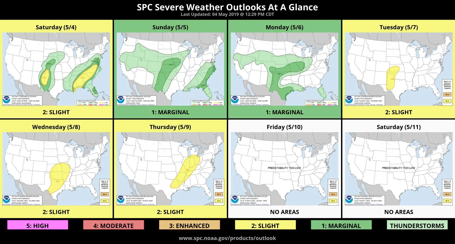
We’ll see the risk of severe storms move a tad farther east on Sunday with a similar storm mode anticipated. Very large hail and isolated tornadoes are possible with the few supercells that can fire up late tomorrow afternoon. A stronger cap and somewhat weaker shear should keep the number of storms lower.
We’re going to be quite busy this upcoming week. We’ll see a chance of severe thunderstorms on Sunday, Monday, Tuesday, Wednesday, and Thursday. One or more thunderstorm clusters in that time period will likely produce additional heavy rainfall and new concerns of flooding. We’ll chat about that in detail tomorrow.

0 Comments