
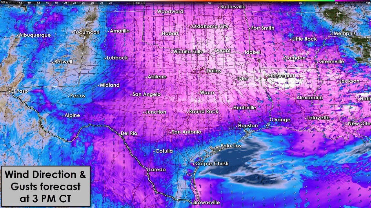
Winds will be out of the north today now that a weak cool front has pushed into South Texas. North winds will become a bit gusty this afternoon as a pressure gradient sets up. Luckily we’re not dealing with cold temperatures otherwise the north wind would be rather unpleasant.
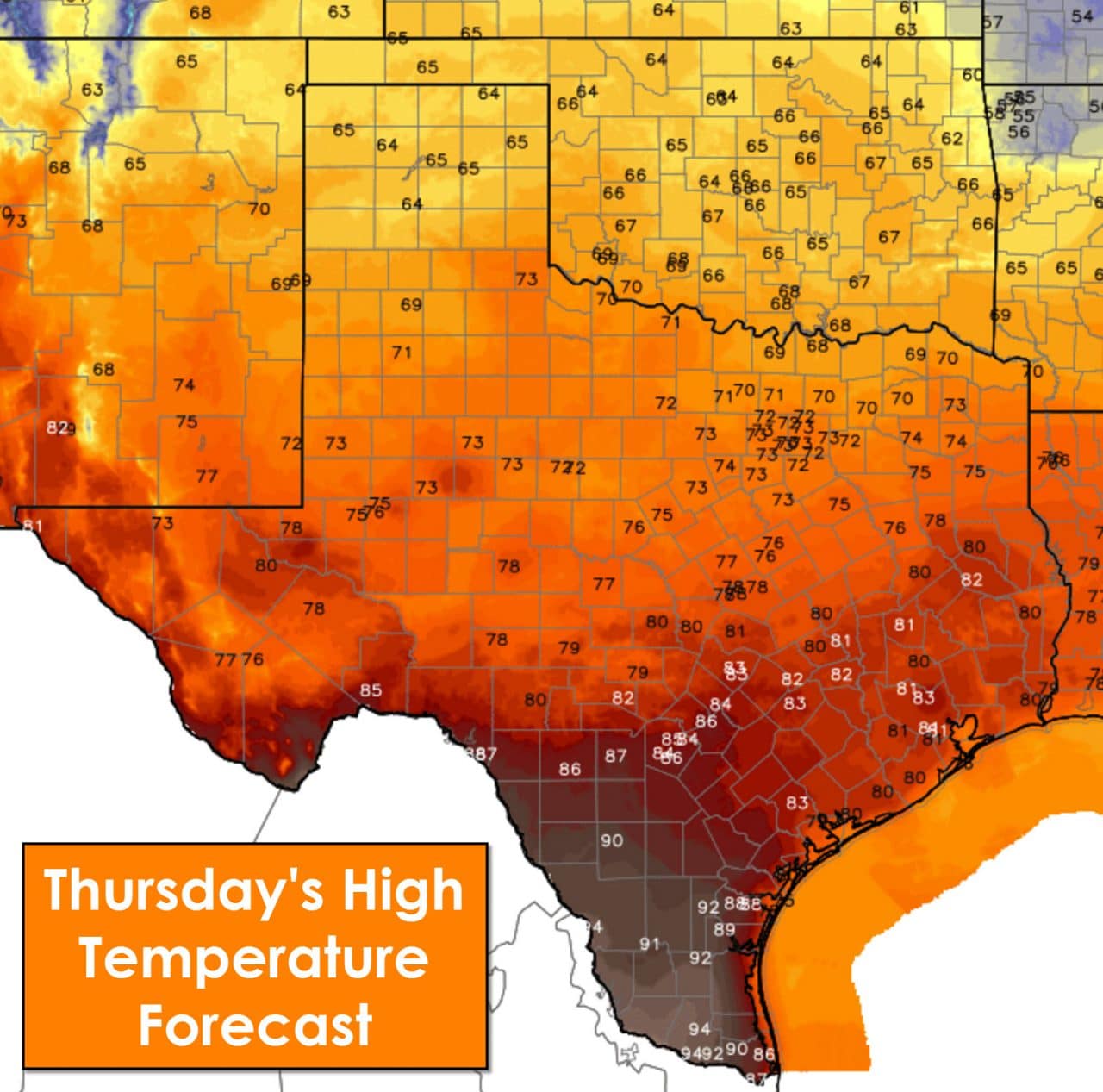
High temperatures this afternoon will range from the middle 60s in the Texas Panhandle all the way up to the middle 90s in Deep South Texas. 60s and 70s are expected in the northern half of Texas with 80s in the southern half of Texas. Lower to middle 90s are expected in South Texas, Deep South Texas, and the Rio Grande Valley this afternoon.
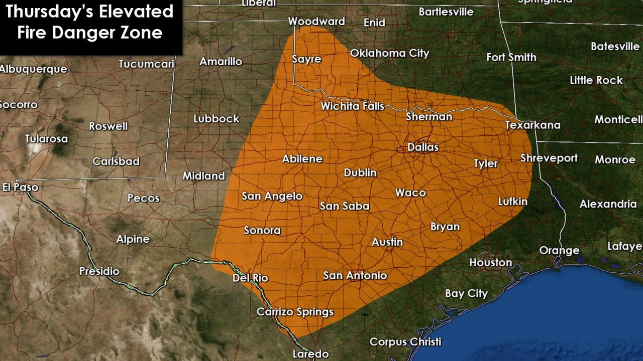
Elevated to very high fire danger will occur this afternoon across the Big Country, Concho Valley, Northwest Texas, North Texas, Northeast Texas, East Texas, Central Texas, the Brazos Valley, and South-Central Texas. North winds could gust over 30 MPH this afternoon. Relative humidity values will drop to 20-35 percent during peak heating this afternoon. Should relative humidity values end up being lower than forecast an area of critical fire danger may be introduced in later outlooks.

Clear skies will be prevalent across the state tonight. Temperatures north of the cool front, in a comparatively drier air mass, will fall back into the upper 30s to middle 40s tonight. That pretty much includes all locations north of South Texas and the immediate coastline. Folks along the coast, in South Texas, and the Rio Grande Valley will drop to around 50 degrees up into the lower 60s in the RGV.

Elevated fire danger will exist on Friday across western North Texas, Northwest Texas, the Texas Panhandle, all of West Texas, the Permian Basin, Big Country, and Concho Valley. Portions of that outlook may be upgraded to a critical designation in later updates.
Next week is looking much more active in the weather department across the state. The southern branch of the jetstream is about to become active. The ‘storm train’ will set up with the possibility of strong upper level storm systems every couple of days. Moisture return will begin in earnest this weekend and above-average temperatures will continue into the upcoming week. Several rain opportunities will begin with the first on Sunday. The best chance for more widespread rain and thunderstorms will be Monday through Wednesday. All these potential storms are still in the Pacific Ocean. Forecast confidence in any particular scenario will remain low until we get the storm systems on-shore and in the upper air balloon network. Some severe weather potential is evident on Monday and Tuesday – although I emphasis its just potential at this point. Storm system timing, quality of moisture return, cap strength, and other factors will all determine where each day’s potential sets up. Consider this a heads up that we’re heading back into an active weather pattern after mainly quiet weather since January. Pockets of heavy rain will be possible along with severe weather threats. The spring tornado season began on March 1 so the storm threat isn’t unusual. Take time while the weather is quiet to compile and review your severe weather safety plans.
0 Comments