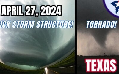
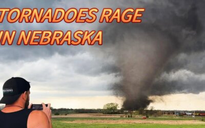
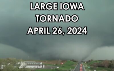
We intercepted several high-precipitation supercells this day. The first was in the late morning in South-Central Oklahoma. That storm had decent mid-level rotation but was undercut at the surface by a cold front. The wall cloud had decent motion but was broad and wasn’t able to produce a tornado. After dealing with that storm for about 30 minutes we bailed south to a storm near Huckabay, Texas. That storm was much more intense and was tornadic. It was so wrapped up in rain we only had a brief glimpse of a tornado. Outside the rain was impressive inflow and turbulent motion. We had to bail southeast on Highway 108 to Stephenville before heading north on Highway 281 to once again intercept the storm once again. Radar was showing very strong rotation but it was wrapped up in rain and in an area with no roads. As the circulation and probable rain-wrapped tornado approached 281 we bailed south into Stephenville. Sunset was approaching and we elected to head to Cleburne for lightning photography. That didn’t really turn out so after waiting nearly an hour we headed back home to Norman. Overall it wasn’t a bad chase day – but nothing too memorable came out of it either.
SUBSCRIBE to us for more at @texasstormchasers
Web: Texasstormchasers.com
Facebook: “TexasStormChasers.com”
Twitter: @TxStormChasers
Instagram & TikTok: @texasstormchasers
Patreon: https://www.patreon.com/texasstormchasers
** Support us on Patreon so we can continue and improve our live coverage from behind the desk and in the field chasing extreme storms! Exclusive benefits included!
0 Comments