February 2, 2024 Tornado-Cast from TSC Meteorologist Trey Greenwood (Meteorological Discussion), looped with one replay. @ConvectiveChronicles
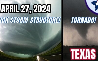
Basic Discussion: Spring-like weather this week will translate into spring-like thunderstorms tonight in Texas. A quick-hitting upper-level storm system will bring a sweeping line of thunderstorms. Those storms will move from west to east tonight across the eastern seventy-five percent of Texas. Cold air aloft will promote a risk of hail. The most intense storms may produce quarter to golfball size hail. Most of tonight’s activity will behave with hail sizes in the pocket-change size range (pea, dime, penny, nickel). There is a non-zero chance of a spinup #tornado, but conditions aren’t particularly favorable for tornadogenesis. That would be a different story if surface dewpoints were about five degrees higher. Localized strong to damaging wind gusts are also a secondary concern. Numerous showers and thunderstorms are possible ahead (east) of the squall line beginning this afternoon in the eastern two-thirds of Texas. The best plan is to have indoor plans this afternoon and tonight. One-half to two inches of rain is expected with activity today through Saturday afternoon across the eastern half of Texas. The fast-moving nature of the system should preclude widespread excessive rainfall concerns. Soils in the eastern third of Texas remain saturated after last week’s rain event. Localized flash flooding can’t be ruled out, and high water in the typical troublespots is a given. Another round of rises on creeks, streams, and rivers will continue next week. A weak cool front will push into the northern half of Texas behind tonight’s system. High temperatures this weekend into early next week will dip into the 50s and lower 60s – which is still warm for early February. The 70s and 80s will continue unabated in the southern third of Texas. Temperatures will begin climbing the temperature roller-coaster by Tuesday, with 60s and 70s returning to the entire state by mid-week. Dry weather is expected for several days beginning Sunday. Above-average (warm) temperatures will likely continue in Texas for the next two weeks. Long-range weather patterns, such as the North Atlantic Oscillation (NAO), indicate a return to colder weather will likely occur sometime in the second half of February across the United States. Considering it is winter, that’s not a surprise. Just how much cold air dips into our part of the country is indiscernible at this time range, but it is unlikely we’re done with winter. Until then, enjoy the warmer weather!
Get the FREE Texas Storm Chasers Mobile App for your local weather forecast, interactive weather radars, live Texas weather coverage, and more!
#rain #severe #texasweather #weatherchannel #txwx #winter #wind #windy #storm #dallas #houston #news #todaysweather #austin #sanantonio #elpaso #lubbock #amarillo

0 Comments