
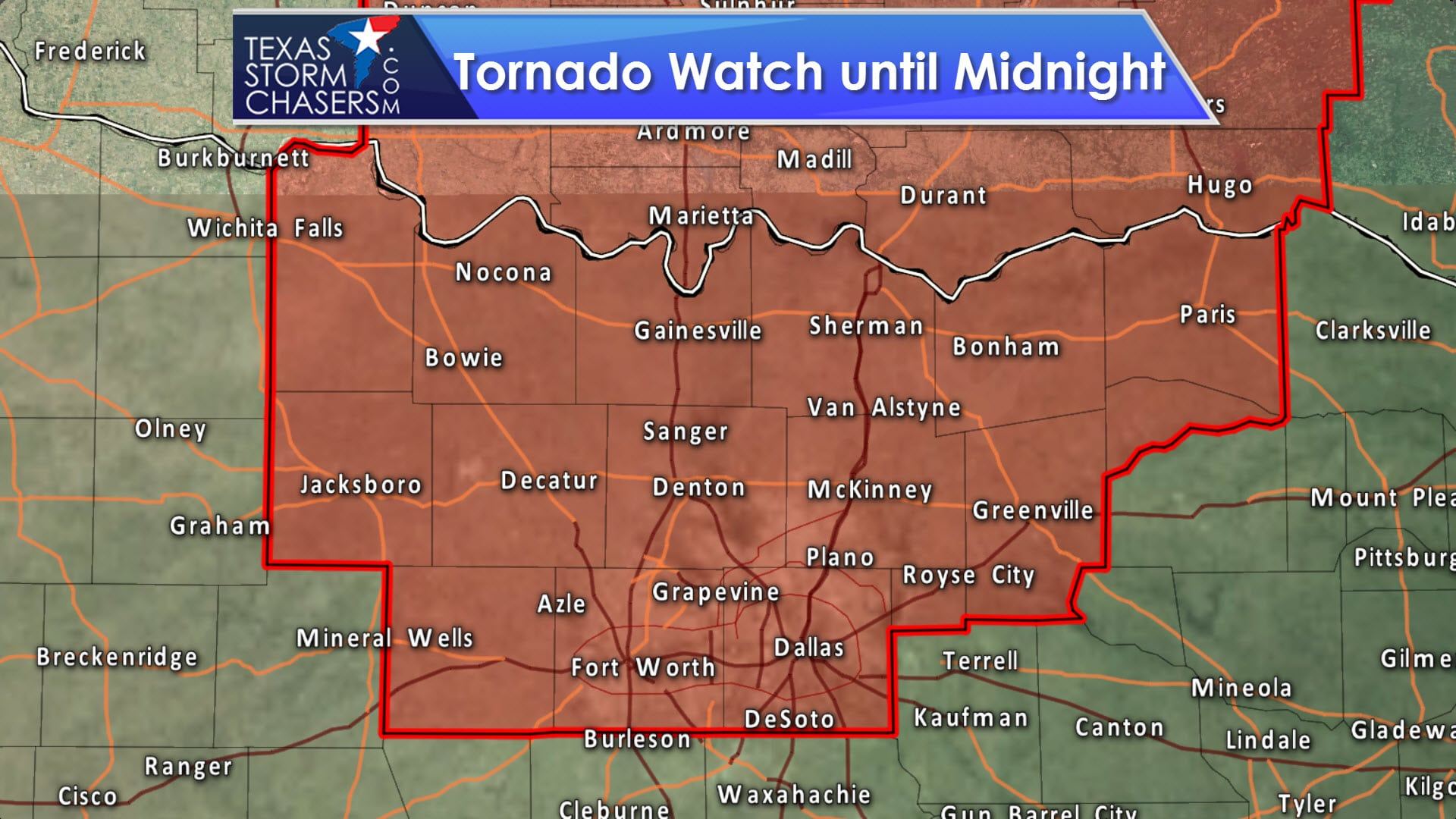
A tornado watch has been issued for Texoma and portions of North Texas. This watch does include all of the D/FW Metroplex, extending northeast to Greenville and Paris. Western edge of the watch is from Weatherford to Jacksboro to Henrietta. Storms should start to fire up within the next hour, and our first attempt may be going up in Palo Pinto County. Storms will generally move east/northeast. The strongest storms may produce very large hail exceeding the size of baseballs, localized damaging wind gusts over 70 MPH, and tornadoes. The threat for tornadoes may remain low through the early evening, but could increase somewhat after sunset as cloud bases lower.
Advertisements

0 Comments