
Ingredients are coming into place to support a severe weather event tomorrow across the eastern half of Texas. We don’t use such terminology to create anxiety but express our confidence and overall threat. Even widespread, high-impact severe weather does not impact everyone. Please use our forecasts to plan and prepare versus as a way to fear. I’m not going to devolve into unnecessary hype or hoopla.
Compared to my forecast this morning, we’ve seen the upcoming storm system trend slower – which means it will begin further west. We’re also seeing a southward expansion of thunderstorm chances tomorrow and tomorrow night.
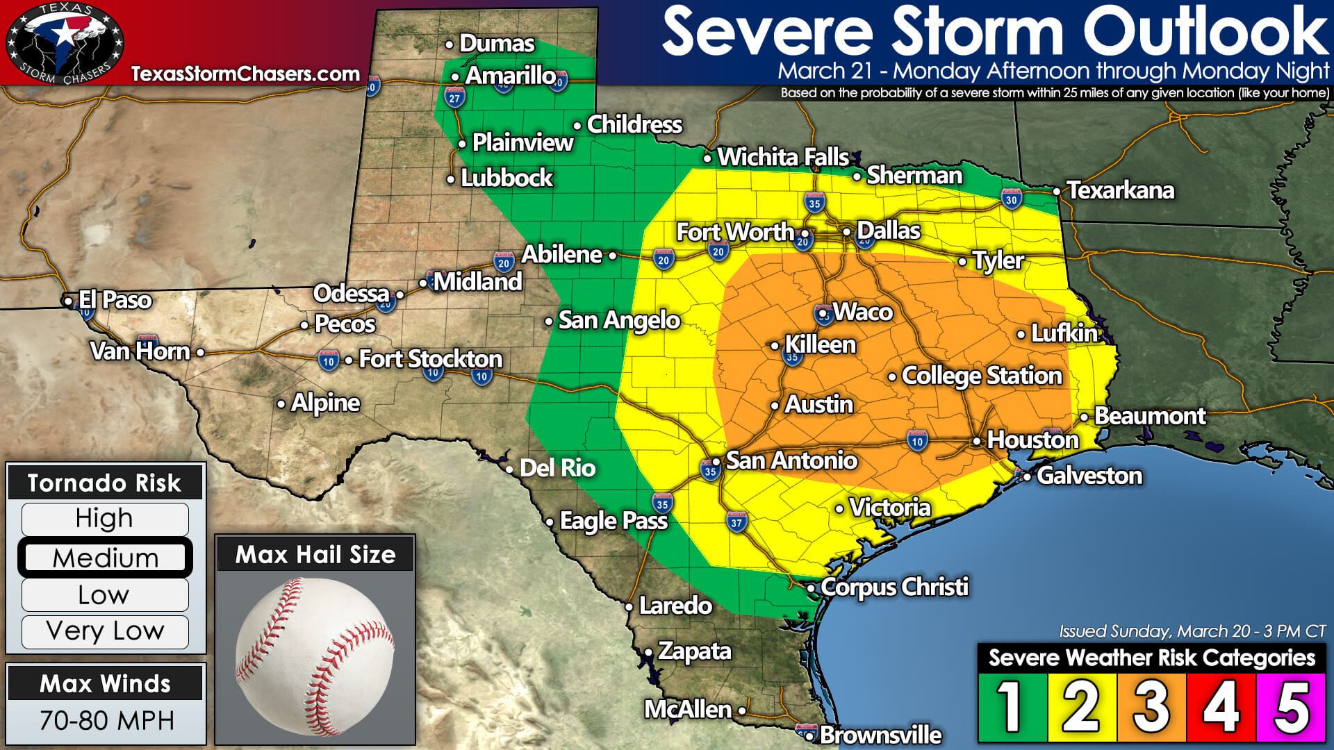
The Storm Prediction Center now highlights a risk of severe thunderstorms from Amarillo and Pampa south/east to San Angelo to Rocksprings to Kingsville in South Texas. Severe thunderstorms become more likely east of a surface dryline across North Texas, Central Texas, the Hill Country, and South-Central Texas – east to Louisiana and Mississippi on Tuesday.
We have an enhancement of the severe weather probabilities across southern North Texas, Central Texas, the Brazos Valley, Southeast Texas, and East Texas. The higher the risk level, the more likely severe storms are in your local area. We’ll talk about timing in detail below.
Threats
Tomorrow’s storm mode will be a mixed bag of line segments and discrete storms. Strong to extreme wind shear will support all modes of severe weather with both line segments and discrete storms. Stronger storms within the squall line may produce widespread damaging straight-line winds, embedded tornadoes, and pocket-change size hail.
While we typically see a lower risk for tornadoes with squall lines, we may see embedded supercelluar storm structures with our upcoming event. Any embedded supercell storm modes within the squall line will be capable of producing significant severe weather – including the threat for tornadoes and destructive hail. Not all storms will be severe tomorrow.
Discrete storms, or storms that are relatively by themselves tomorrow afternoon and tomorrow night, have the potential to be problematic. Ingredients across the eastern half of Texas will support significant severe weather – including the potential for several tornadoes and destructive hail. We may be dealing with multiple tornadic storms simultaneously at times tomorrow and especially tomorrow evening.
Given the higher-end wind shear and other favorable ingredients, there is the potential for a longer-lived, strong tornado. The highest relative threat for longer-lived, significant tornadoes will be in the level three risk from Central Texas through the Brazos Valley and East Texas. I am concerned we may have a few discrete storms in Southeast Texas tomorrow evening – which would also have higher-end severe weather potential.
Timing & Discussion
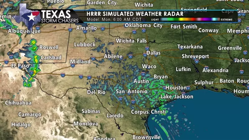
Showers and thunderstorms will increase coverage tomorrow morning across the eastern half of Texas. The morning activity will be related to warm-air advection and the moisture flying north ahead of our upcoming storm system. Severe weather isn’t likely with the morning activity.
Storms may gradually become more robust in the small hail department toward lunch-time in North Texas. Scattered thunderstorms, some of which may be severe, are expected to develop in the Texas Panhandle arching southeast into Northwest Texas by mid-afternoon. Storms will race off to the northeast.
Between 3 PM and 5 PM – scattered supercelluar thunderstorms are likely to develop just east of a surface dryline – which should be located from near Wichita Falls to Breckenridge to Lampasas to Borene. Showers and thunderstorms (mostly sub-severe) will also continue across North Texas, Northeast Texas, and perhaps south into the Brazos Valley.
Atmospheric ingredients will be in place to support significant severe weather with the ‘dryline storms’ – and I would expect rapid intensification once they develop. Most storms will be racing east/northeast at 45 to 55 miles per hour. By 7 PM, we may have a broken line of severe to intense thunderstorms from Bonham to Waco to Bastrop to Gonzales.
Storms will continue moving northeast rapidly into the early evening across Northeast Texas southwest into the Brazos Valley. We note that storms may try to become more cellular, resulting in a significant tornado threat. As the storms in Northeast Texas start moving into Arkansas and Lousiana late tomorrow evening, new storms are expected to develop in the Coastal Plains and Southeast Texas.
Atmospheric ingredients will continue to support all modes of severe weather with any storms in Southeast Texas, East Texas, and the Golden Triangle tomorrow evening, tomorrow night, and Tuesday morning. There may be multiple rounds of storms tomorrow. Once storms finally move east of Texas or off the Upper Coast by 8 AM Tuesday. Our severe weather threat will conclude once storms are east of Texas. A significant outbreak of tornadoes will likely impact Louisiana and Mississippi.


0 Comments